NomadTracks for skiing & winter sports
Every descent, drawn in the snow
Skiing, snowboarding, ski touring, snowshoeing — winter days are elevation stories, and NomadTracks tells them precisely: ascent and descent meters, speed charts that separate the climb from the run, and a recorded line through terrain where summer trails don't exist.
Ascent vs. descent, untangled
The elevation and speed charts make every lap readable: skin track up, run down, repeat. Gain and loss are tracked separately and honestly.
Gloves-friendly recording
Start and stop from the Apple Watch, glance at live stats on the Lock Screen — the phone stays warm in the inner pocket all day.
Terrain without trails
Off-piste there's no path network to follow — but your recorded line and the georeferenced ski-touring map overlay keep the route home unambiguous, fully offline.
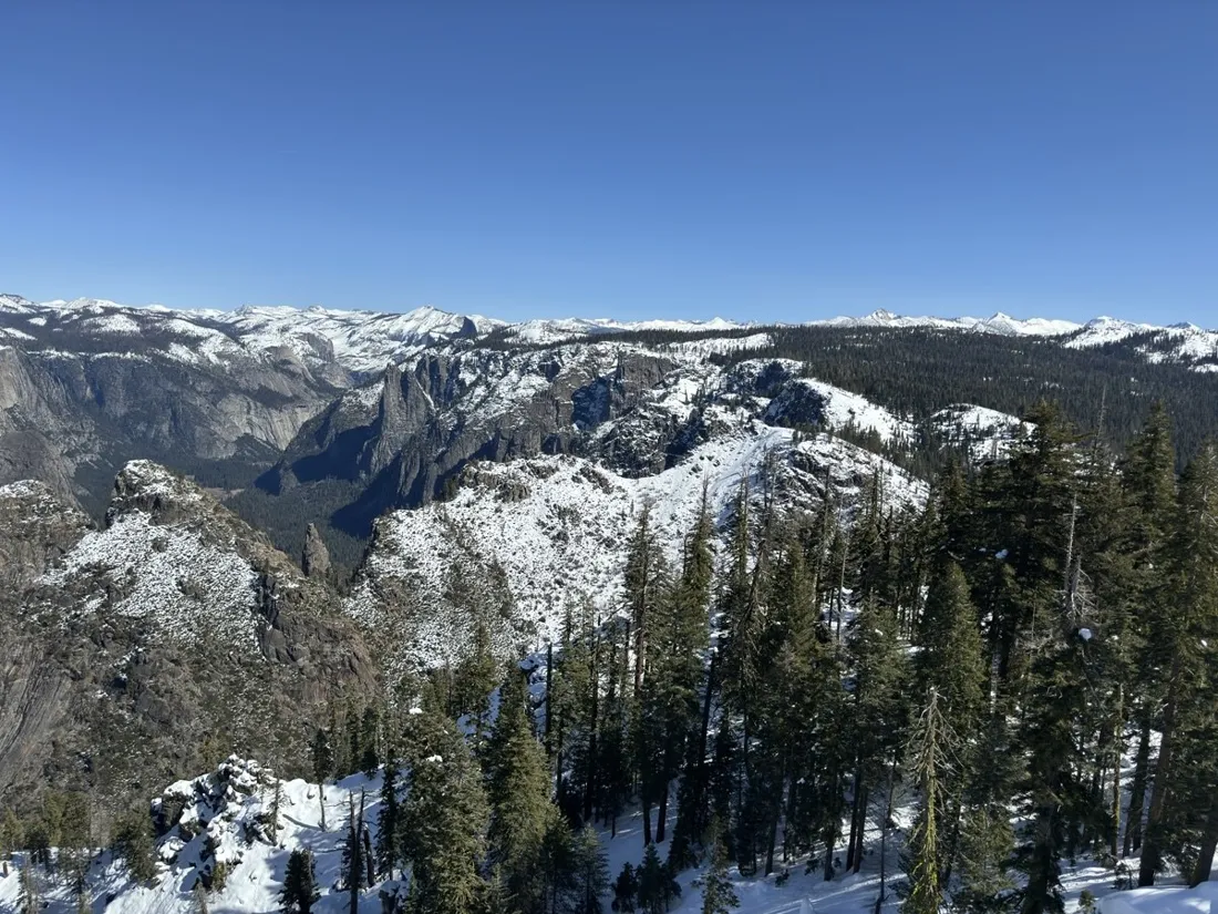
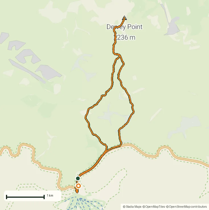
From the field
Real recordings, real places
Tap a photo or map to open the full track story — route, elevation profile and GPX download included.
Questions
FAQ
Does cold weather affect recording?
GPS itself is unaffected; cold mainly costs battery. Keeping the phone in an inner pocket and recording from the Watch is the proven winter setup.
Can I see how many vertical meters I skied?
Yes — elevation gain and loss are recorded separately, with full charts per recording. A lift-served day shows its laps clearly.
Can I use a ski-touring paper map?
Yes — photograph or import it and georeference it like any custom map; alpine-club ski-route sheets work beautifully as live overlays.
What is a good snowshoe GPS app?
A snowshoe GPS app has one special job: navigation where summer trails don't exist under the snow. NomadTracks records your line (so the way back is simply your own track), shows honest elevation gain, works fully offline, and records from the Apple Watch so the phone stays warm — free, with no account. The Dewey Point story below is a real 12 km snowshoe recording.
Free on the App Store
Record, map and keep every adventure — privately, on your own devices.
🤖 Also on Android — free on Google Play.