Snowshoeing · Yosemite National Park, California, USA · recorded with NomadTracks
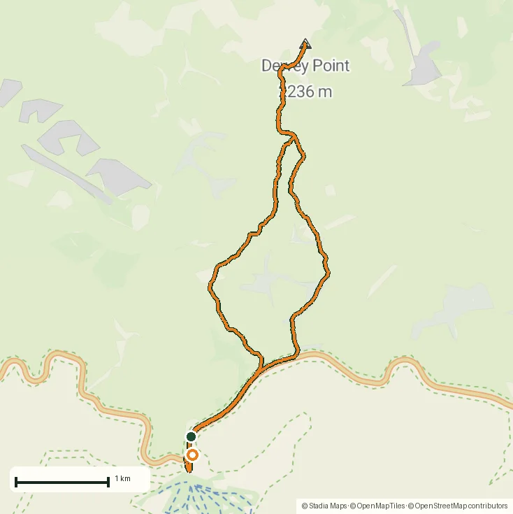
Dewey Point in winter: 12 km on snowshoes to Yosemite's quiet rim
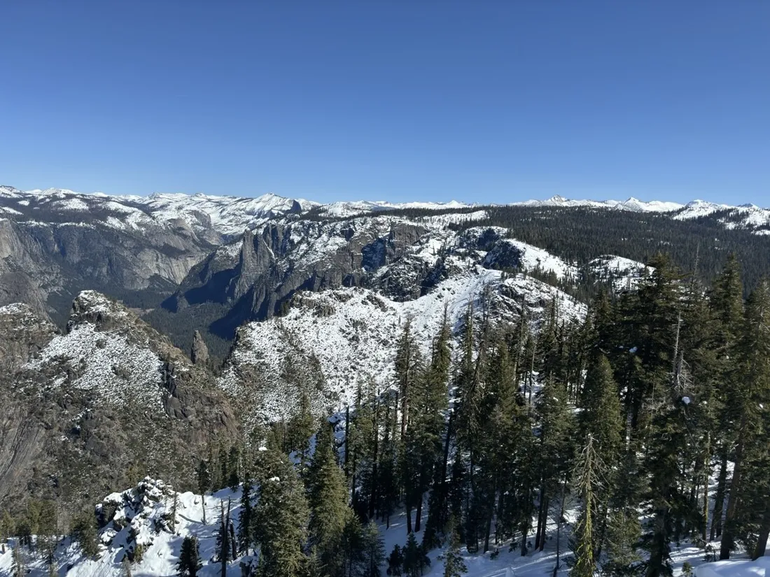
In summer, Yosemite's valley rim is a parade. In February, the Dewey Point trail is silence and untouched snow: 12.4 km from Badger Pass through the forest to a cornice with El Capitan dead ahead and the whole valley a kilometer below.
About this data: this track and its photos were personally shared with us as samples by a NomadTracks user. NomadTracks never uploads, collects or shares your tracks or photos — your recordings stay on your devices and in your own cloud.
Download GPX Coordinates, elevation and relative times — recording dates are normalized out, photos not included.

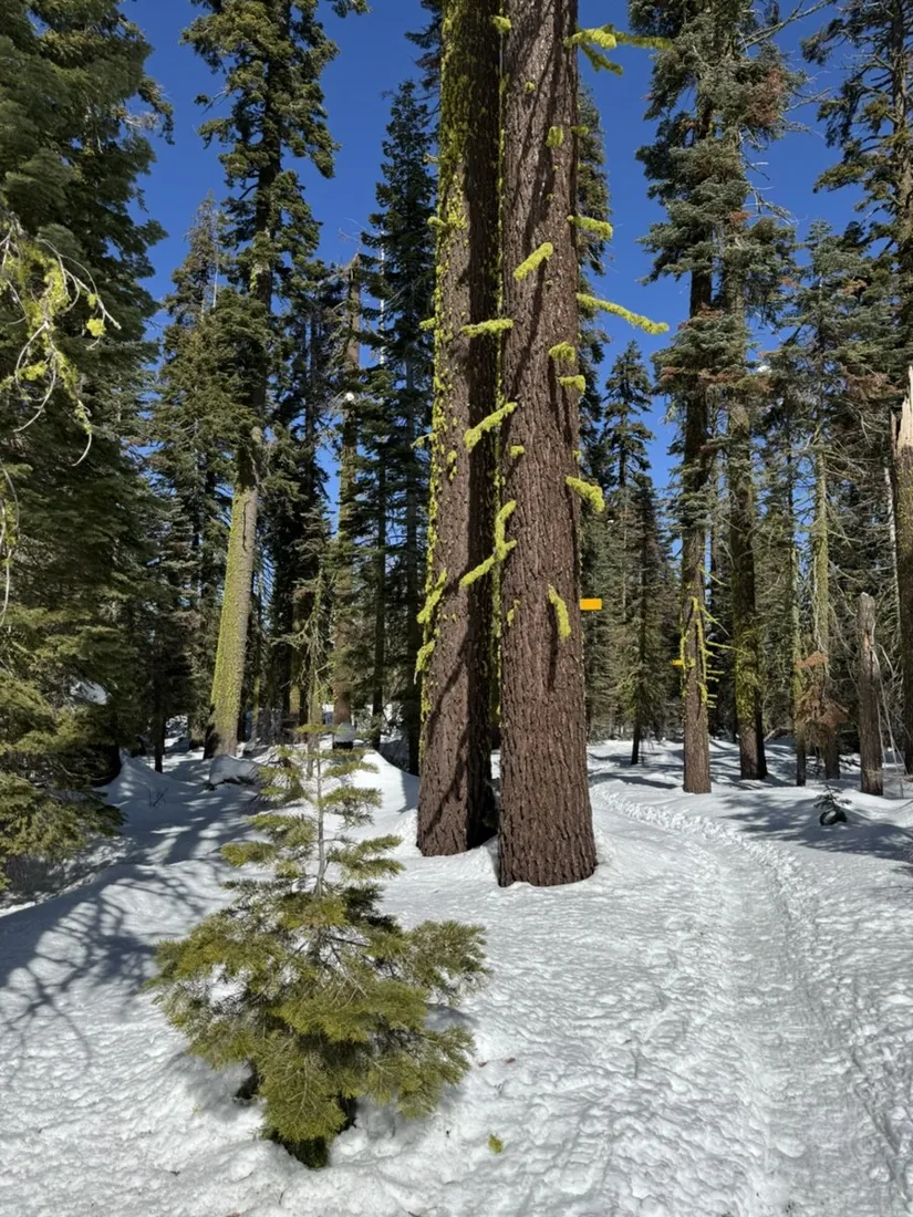
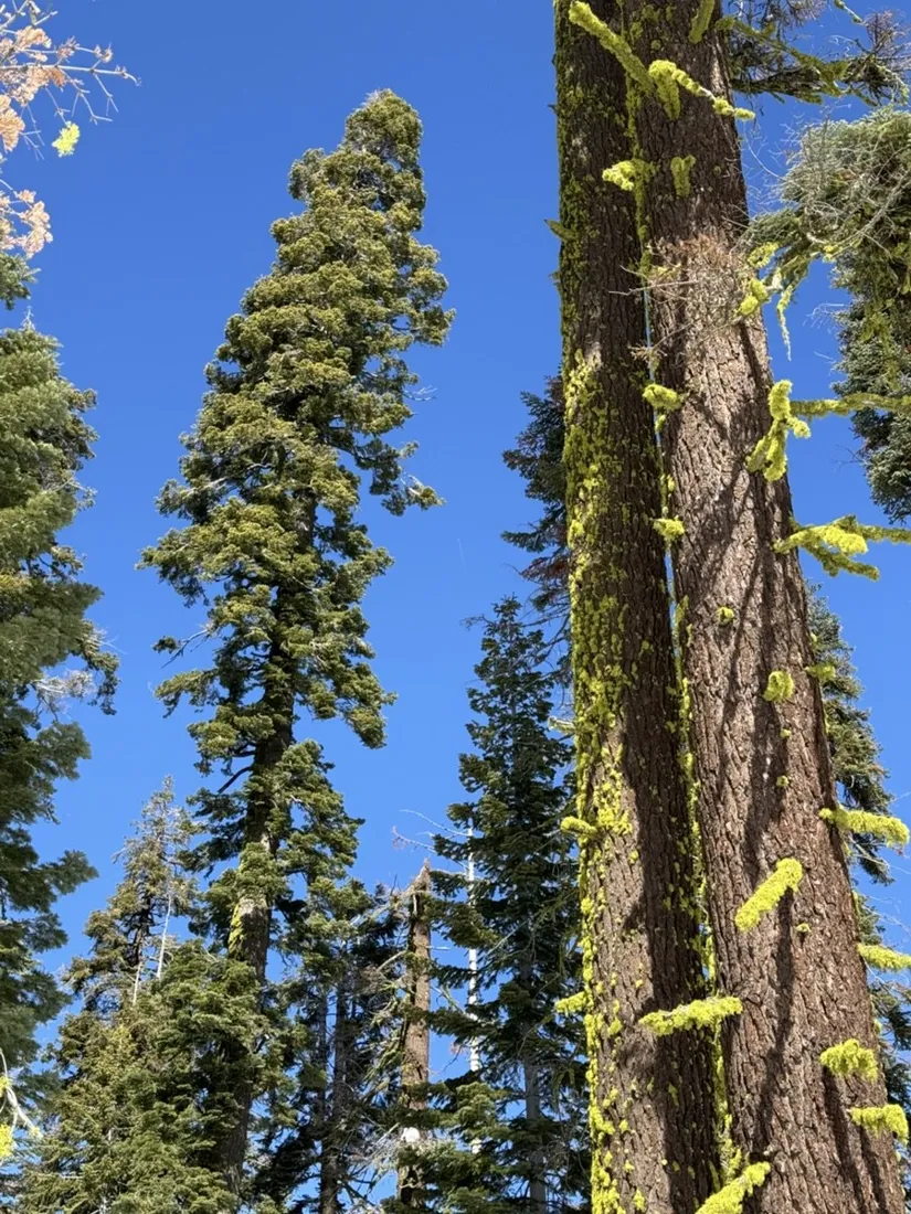
Marked trees, buried trail
The summer path is under two meters of snow — navigation is yellow markers on trees and your own judgment. The recorded line is the safety net: however the meadows confuse you on the way back, the way home is drawn on the map.
Winter recording in practice
The phone stayed in an inner pocket the whole day; live stats were checked on the wrist. Cold cost about a quarter of the battery — the recording was never in danger.
About the place: Yosemite National Park, California, USA
Dewey Point hangs on the southern rim of Yosemite Valley, California, directly opposite El Capitan. In winter the route starts at the Badger Pass ski area on the closed Glacier Point Road and follows marked winter route poles through the forest — a snowshoe or ski tour rather than a hike, typically possible December through March. Permits aren't needed for day tours; the rim cornices demand respectful distance.
Get NomadTracks free on the App Store
More track stories
- Overlanding Namibia: 4,250 km from the Kalahari to the Kunene
- Mount Whitney in two days: 24 km to the roof of the Lower 48
- Grant Park, the Bean & the Museum Campus: a 10.5 km Chicago run
- A morning run through downtown Chicago: 9.7 km past Navy Pier and the lakefront
- Running Lincoln's Springfield: 8.8 km through the Illinois capital
- Camps Bay to Table Mountain: the steep way up Cape Town's icon
- Dürrensee to the Drei Zinnen: a Dolomites classic
- Maurer Wald loop: a 9.7 km trail run on the edge of Vienna
- Camping Šobec and the birth of the Sava: a 7 km morning run
- Sailing the Šibenik archipelago: 69 nautical-style kilometers under sail
- Canoeing Caddo Lake: 9 km through a flooded cypress forest
- Mount Shasta mountain-bike loop: 28.6 km of volcano singletrack
- Lofoten lake hike: 9.6 km through Norway's green wilderness
- Cinder Cone, Lassen Volcanic NP: a 6 km climb up a perfect volcano
- Drakensberg amphitheatre: 13 km to the top of Tugela Falls
- The Olive Trail, Namib-Naukluft: 10.9 km through a desert canyon
- Mount St. Helens: 16 km through the blast zone to the viewpoints
- Double O Arch via Devils Garden: 12 km through Arches' fin country
- The everyday loop: 12 km of redwoods and fog above Redwood City
- Lake Tahoe rim ride: 28 km of singletrack above the blue
- Pinnacles High Peaks loop: 12 km among the condor spires
- Golden Canyon to Zabriskie badlands: 6 km below sea level
- Hoh Rain Forest: a 4 km walk through the moss cathedral
- Oahu waterfall trail: 5 km of mud, roots and jungle
- Riding to Lake Helen: 17 km up a closed park road through the snow
- Phillips Cave: a 6.5 km walk to Namibia's White Elephant rock art
- Koiimasis: 9 km through the granite of the Tiras Mountains
- Cathedral Gorge: a short ride through Nevada's clay cathedral
- Riding Black Rock City: the GPS trace of a city that doesn't exist
- Peekaboo Loop, Bryce Canyon: 15 km among the hoodoos