Hiking · Dolomites, South Tyrol, Italy · recorded with NomadTracks
Dürrensee to the Drei Zinnen: a Dolomites classic
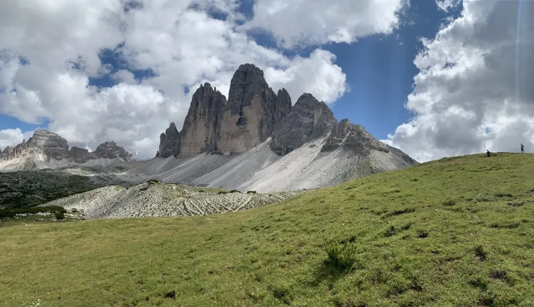
The Drei Zinnen (Tre Cime di Lavaredo) are the Dolomites distilled into three towers. This 16.7 km route starts at the turquoise Dürrensee far below instead of the toll-road parking lot — more climbing (about 950 m), a fraction of the crowd, and the full reveal of the north faces at the end.
About this data: this track and its photos were personally shared with us as samples by a NomadTracks user. NomadTracks never uploads, collects or shares your tracks or photos — your recordings stay on your devices and in your own cloud.
Download GPX Coordinates, elevation and relative times — recording dates are normalized out, photos not included.

The long approach is the point
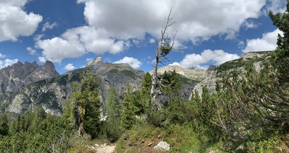
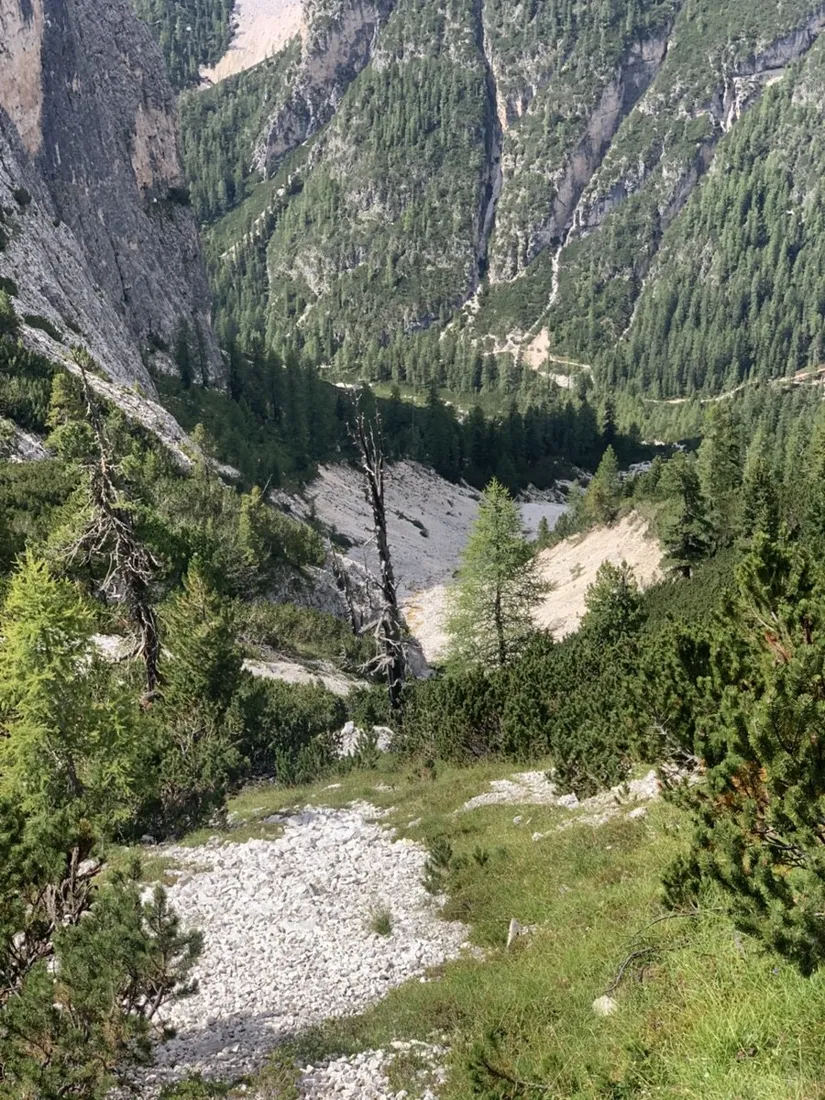
From the lake the trail works up through the Rienztal, pine forest giving way to gravel flats and then the huge amphitheater below the north faces. The recorded elevation profile shows the two-stage character: gentle valley kilometers, then the step up to the Drei-Zinnen-Hütte.
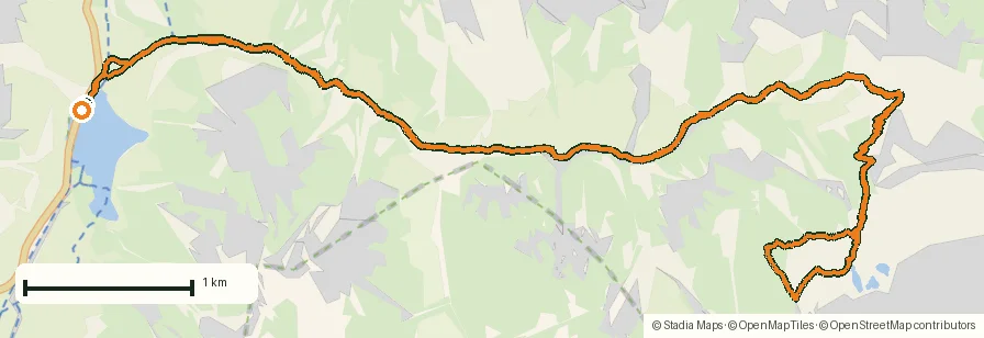
Paper map, live position
The Sextner Dolomiten Tabacco sheet was photographed and georeferenced in NomadTracks before the trip — the classic 1:25,000 cartography with a live blue dot on it beats any generic basemap for judging the cirque's scale.
About the place: Dolomites, South Tyrol, Italy
The Tre Cime di Lavaredo (Drei Zinnen) are the emblem of the Sexten Dolomites in South Tyrol, Italy, a UNESCO World Heritage landscape of pale vertical rock above green valley floors. Starting at the turquoise Dürrensee (Lago di Landro) on the Höhlenstein valley road avoids the busy toll road to Auronzo hut; the hiking season runs mid-June to late September, with the Drei-Zinnen-Hütte open for refreshments below the famous north faces.
Get NomadTracks free on the App Store
More track stories
- Overlanding Namibia: 4,250 km from the Kalahari to the Kunene
- Mount Whitney in two days: 24 km to the roof of the Lower 48
- Grant Park, the Bean & the Museum Campus: a 10.5 km Chicago run
- A morning run through downtown Chicago: 9.7 km past Navy Pier and the lakefront
- Running Lincoln's Springfield: 8.8 km through the Illinois capital
- Camps Bay to Table Mountain: the steep way up Cape Town's icon
- Maurer Wald loop: a 9.7 km trail run on the edge of Vienna
- Camping Šobec and the birth of the Sava: a 7 km morning run
- Sailing the Šibenik archipelago: 69 nautical-style kilometers under sail
- Canoeing Caddo Lake: 9 km through a flooded cypress forest
- Mount Shasta mountain-bike loop: 28.6 km of volcano singletrack
- Lofoten lake hike: 9.6 km through Norway's green wilderness
- Cinder Cone, Lassen Volcanic NP: a 6 km climb up a perfect volcano
- Drakensberg amphitheatre: 13 km to the top of Tugela Falls
- The Olive Trail, Namib-Naukluft: 10.9 km through a desert canyon
- Mount St. Helens: 16 km through the blast zone to the viewpoints
- Double O Arch via Devils Garden: 12 km through Arches' fin country
- The everyday loop: 12 km of redwoods and fog above Redwood City
- Lake Tahoe rim ride: 28 km of singletrack above the blue
- Dewey Point in winter: 12 km on snowshoes to Yosemite's quiet rim
- Pinnacles High Peaks loop: 12 km among the condor spires
- Golden Canyon to Zabriskie badlands: 6 km below sea level
- Hoh Rain Forest: a 4 km walk through the moss cathedral
- Oahu waterfall trail: 5 km of mud, roots and jungle
- Riding to Lake Helen: 17 km up a closed park road through the snow
- Phillips Cave: a 6.5 km walk to Namibia's White Elephant rock art
- Koiimasis: 9 km through the granite of the Tiras Mountains
- Cathedral Gorge: a short ride through Nevada's clay cathedral
- Riding Black Rock City: the GPS trace of a city that doesn't exist
- Peekaboo Loop, Bryce Canyon: 15 km among the hoodoos