Hiking · Oahu, Hawaii, USA · recorded with NomadTracks
Oahu waterfall trail: 5 km of mud, roots and jungle
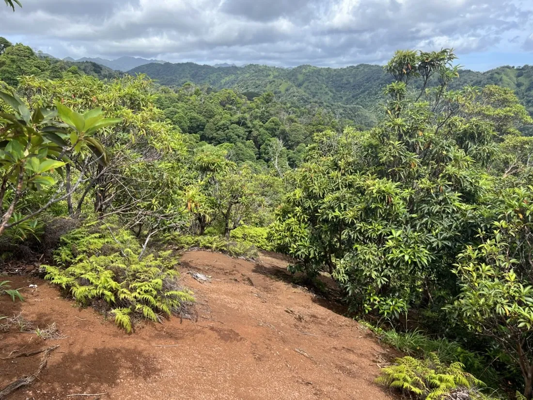
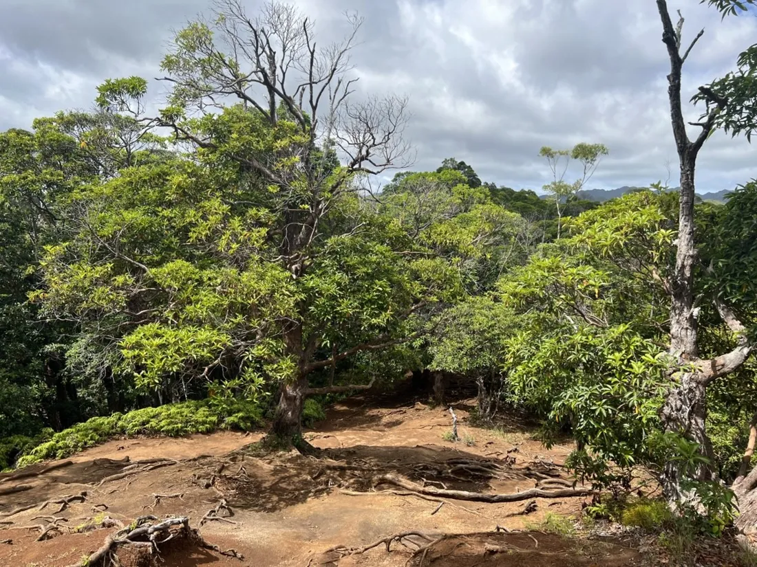
Hawaiian trails are slip-and-grin affairs: 4.7 km of red mud, banyan roots and dripping jungle, with a waterfall as the prize. Recorded between rain showers on Oahu's windward side.
About this data: this track and its photos were personally shared with us as samples by a NomadTracks user. NomadTracks never uploads, collects or shares your tracks or photos — your recordings stay on your devices and in your own cloud.
Download GPX Coordinates, elevation and relative times — recording dates are normalized out, photos not included.

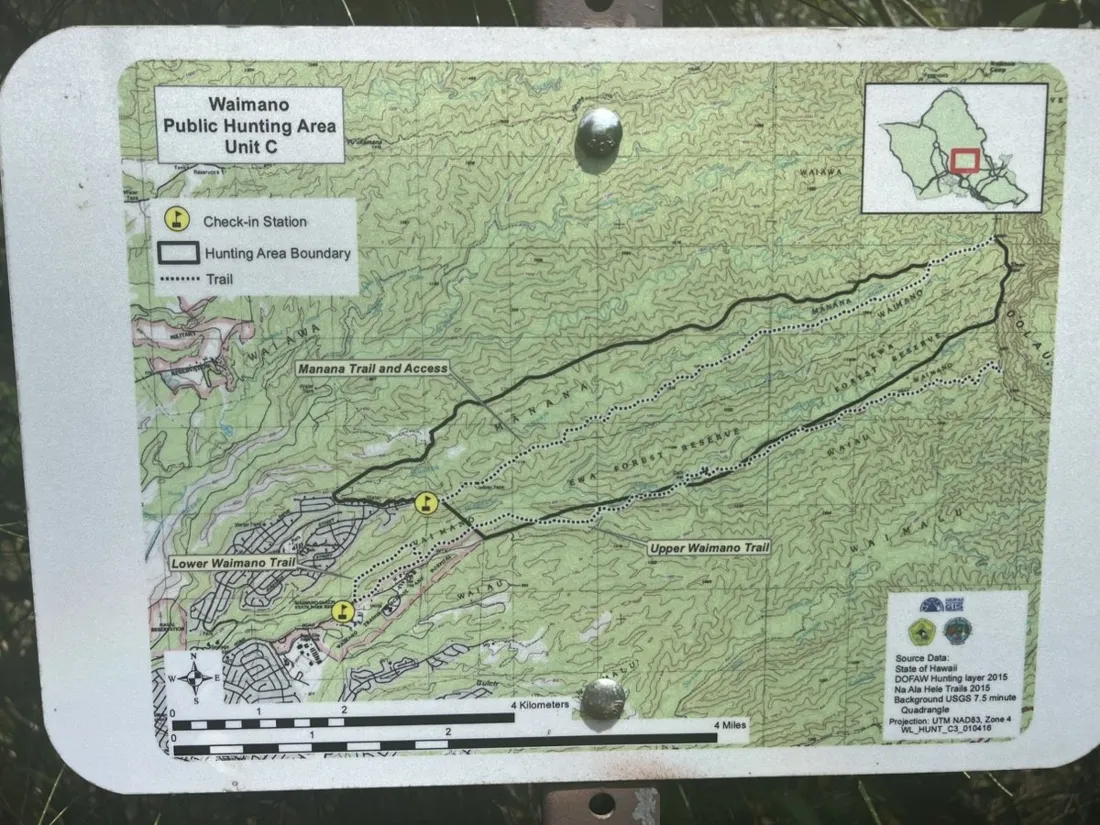
The trailhead-map trick, tropical edition
The wooden map board at the trailhead got photographed and georeferenced before setting off — thirty seconds of work, and the hand-drawn trail network became a live map with a blue dot. On junction-rich jungle trails this is worth more than any global map layer.
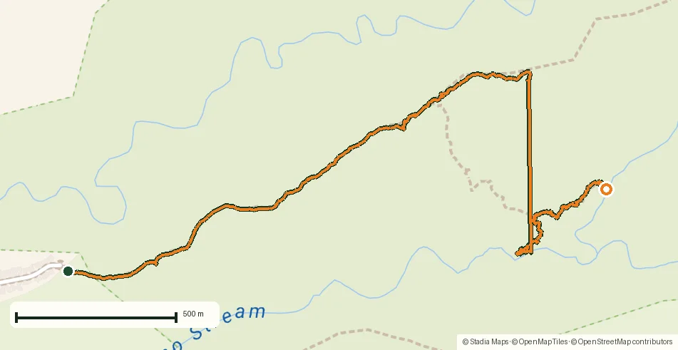
Mud math
The pace chart is a comedy of friction: confident kilometers on the ridge, then a crawl down the muddy chute to the falls. The numbers don't lie — and they make next time's time budget realistic.
About the place: Oahu, Hawaii, USA
Windward Oahu's valleys funnel trade-wind clouds into daily showers, keeping the waterfall trails lush, muddy and slick year-round. Hawaiian jungle hiking has its own rules: red clay over roots, fast-rising streams after rain, and trailhead boards whose hand-drawn maps are often better than any app's base layer — photograph and georeference them.
Get NomadTracks free on the App Store
More track stories
- Overlanding Namibia: 4,250 km from the Kalahari to the Kunene
- Mount Whitney in two days: 24 km to the roof of the Lower 48
- Grant Park, the Bean & the Museum Campus: a 10.5 km Chicago run
- A morning run through downtown Chicago: 9.7 km past Navy Pier and the lakefront
- Running Lincoln's Springfield: 8.8 km through the Illinois capital
- Camps Bay to Table Mountain: the steep way up Cape Town's icon
- Dürrensee to the Drei Zinnen: a Dolomites classic
- Maurer Wald loop: a 9.7 km trail run on the edge of Vienna
- Camping Šobec and the birth of the Sava: a 7 km morning run
- Sailing the Šibenik archipelago: 69 nautical-style kilometers under sail
- Canoeing Caddo Lake: 9 km through a flooded cypress forest
- Mount Shasta mountain-bike loop: 28.6 km of volcano singletrack
- Lofoten lake hike: 9.6 km through Norway's green wilderness
- Cinder Cone, Lassen Volcanic NP: a 6 km climb up a perfect volcano
- Drakensberg amphitheatre: 13 km to the top of Tugela Falls
- The Olive Trail, Namib-Naukluft: 10.9 km through a desert canyon
- Mount St. Helens: 16 km through the blast zone to the viewpoints
- Double O Arch via Devils Garden: 12 km through Arches' fin country
- The everyday loop: 12 km of redwoods and fog above Redwood City
- Lake Tahoe rim ride: 28 km of singletrack above the blue
- Dewey Point in winter: 12 km on snowshoes to Yosemite's quiet rim
- Pinnacles High Peaks loop: 12 km among the condor spires
- Golden Canyon to Zabriskie badlands: 6 km below sea level
- Hoh Rain Forest: a 4 km walk through the moss cathedral
- Riding to Lake Helen: 17 km up a closed park road through the snow
- Phillips Cave: a 6.5 km walk to Namibia's White Elephant rock art
- Koiimasis: 9 km through the granite of the Tiras Mountains
- Cathedral Gorge: a short ride through Nevada's clay cathedral
- Riding Black Rock City: the GPS trace of a city that doesn't exist
- Peekaboo Loop, Bryce Canyon: 15 km among the hoodoos