Hiking · Arches National Park, Utah, USA · recorded with NomadTracks
Double O Arch via Devils Garden: 12 km through Arches' fin country
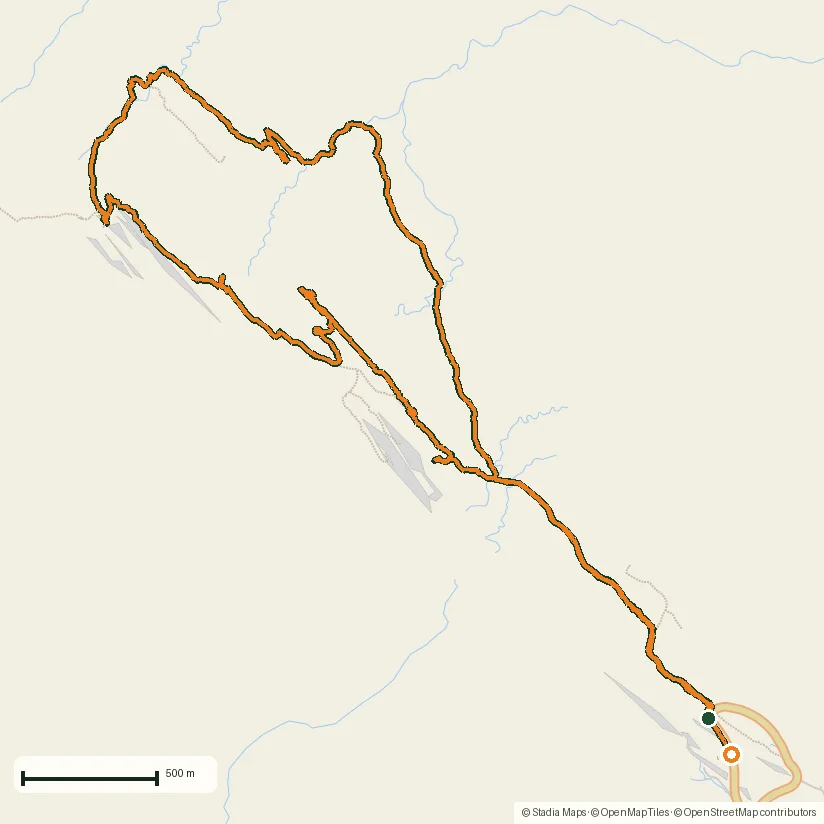
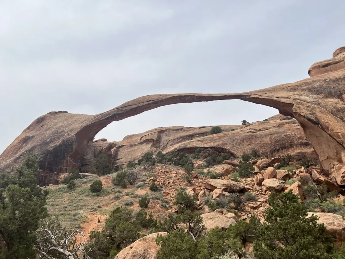
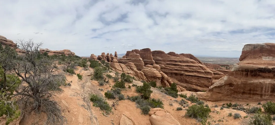
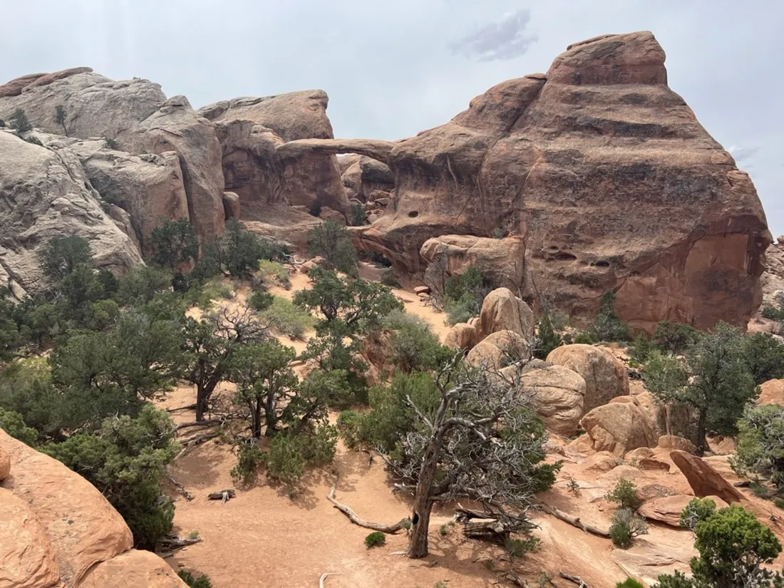
Past Landscape Arch — so thin it looks photoshopped — the Devils Garden trail stops being a path and becomes a route: up sandstone fins, along slickrock ledges, out to Double O Arch and back on the primitive loop. 12.3 km, about 500 m of accumulated gain, and constant route-finding fun.
About this data: this track and its photos were personally shared with us as samples by a NomadTracks user. NomadTracks never uploads, collects or shares your tracks or photos — your recordings stay on your devices and in your own cloud.
Download GPX Coordinates, elevation and relative times — recording dates are normalized out, photos not included.

When the trail is a cairn line
On slickrock there is no trodden path — just cairns and judgment. This is prime recorded-track territory: the line keeps you honest on the primitive loop where every fin gap looks equally plausible.
The NPS map, georeferenced
Arches hands out a fine paper map at the entrance station. Two minutes of control points and it rides along as a live overlay — official trail names and your position, fully offline in a park with practically no coverage past the visitor center.
About the place: Arches National Park, Utah, USA
Devils Garden sits at the end of the park road in Arches National Park, Utah, and holds the densest collection of natural arches on the planet — Landscape Arch's 88-meter span among them. Beyond it, the trail to Double O Arch crosses bare sandstone fins marked only by cairns. Spring and fall are the seasons; summer hiking starts at dawn, and there is no water anywhere on the trail.
Get NomadTracks free on the App Store
More track stories
- Overlanding Namibia: 4,250 km from the Kalahari to the Kunene
- Mount Whitney in two days: 24 km to the roof of the Lower 48
- Grant Park, the Bean & the Museum Campus: a 10.5 km Chicago run
- A morning run through downtown Chicago: 9.7 km past Navy Pier and the lakefront
- Running Lincoln's Springfield: 8.8 km through the Illinois capital
- Camps Bay to Table Mountain: the steep way up Cape Town's icon
- Dürrensee to the Drei Zinnen: a Dolomites classic
- Maurer Wald loop: a 9.7 km trail run on the edge of Vienna
- Camping Šobec and the birth of the Sava: a 7 km morning run
- Sailing the Šibenik archipelago: 69 nautical-style kilometers under sail
- Canoeing Caddo Lake: 9 km through a flooded cypress forest
- Mount Shasta mountain-bike loop: 28.6 km of volcano singletrack
- Lofoten lake hike: 9.6 km through Norway's green wilderness
- Cinder Cone, Lassen Volcanic NP: a 6 km climb up a perfect volcano
- Drakensberg amphitheatre: 13 km to the top of Tugela Falls
- The Olive Trail, Namib-Naukluft: 10.9 km through a desert canyon
- Mount St. Helens: 16 km through the blast zone to the viewpoints
- The everyday loop: 12 km of redwoods and fog above Redwood City
- Lake Tahoe rim ride: 28 km of singletrack above the blue
- Dewey Point in winter: 12 km on snowshoes to Yosemite's quiet rim
- Pinnacles High Peaks loop: 12 km among the condor spires
- Golden Canyon to Zabriskie badlands: 6 km below sea level
- Hoh Rain Forest: a 4 km walk through the moss cathedral
- Oahu waterfall trail: 5 km of mud, roots and jungle
- Riding to Lake Helen: 17 km up a closed park road through the snow
- Phillips Cave: a 6.5 km walk to Namibia's White Elephant rock art
- Koiimasis: 9 km through the granite of the Tiras Mountains
- Cathedral Gorge: a short ride through Nevada's clay cathedral
- Riding Black Rock City: the GPS trace of a city that doesn't exist
- Peekaboo Loop, Bryce Canyon: 15 km among the hoodoos