Trail running · Maurer Wald, Vienna, Austria · recorded with NomadTracks
Maurer Wald loop: a 9.7 km trail run on the edge of Vienna
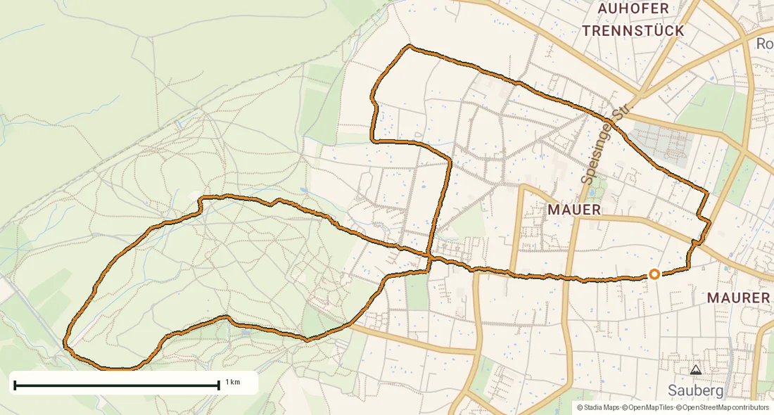
Not every recorded track is an expedition. This one is an ordinary, wonderful thing: a 9.7-kilometer trail-running loop on the southwestern edge of Vienna, through the Maurer Wald — the city's own corner of the Wienerwald, the Vienna Woods.
Just under an hour, about 216 meters of climbing, from gravel forest roads up to the vineyards above Mauer with the whole city spread out below — then back down to where it started.
About this data: this track and its photos were personally shared with us as samples by a NomadTracks user. NomadTracks never uploads, collects or shares your tracks or photos — your recordings stay on your devices and in your own cloud.
Download GPX Coordinates, elevation and relative times — recording dates are normalized out, photos not included.

A forest loop on the city's doorstep
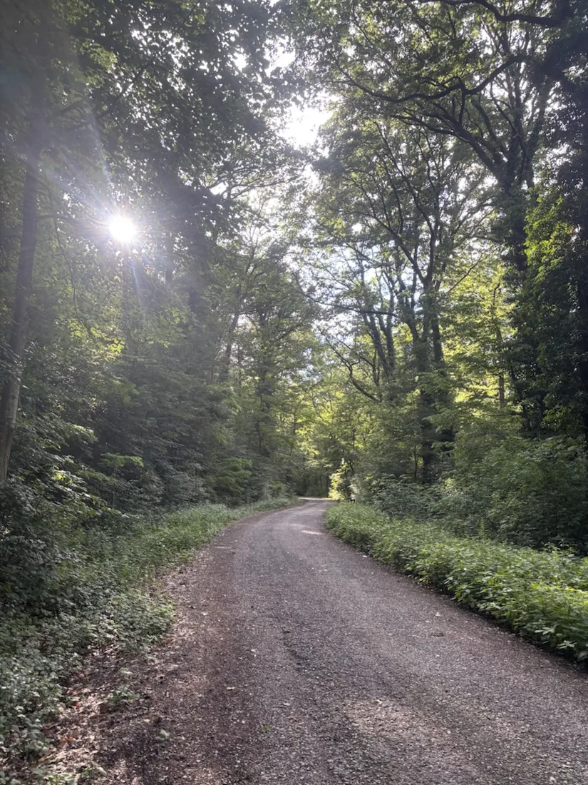
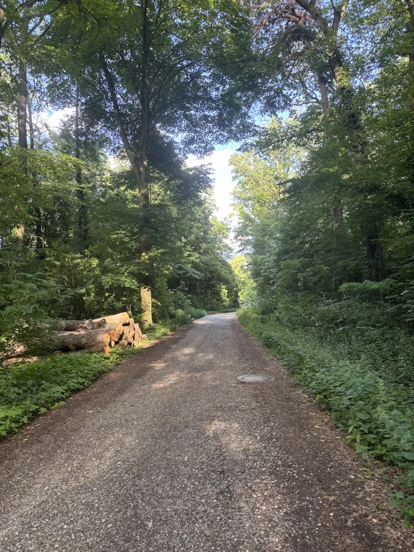
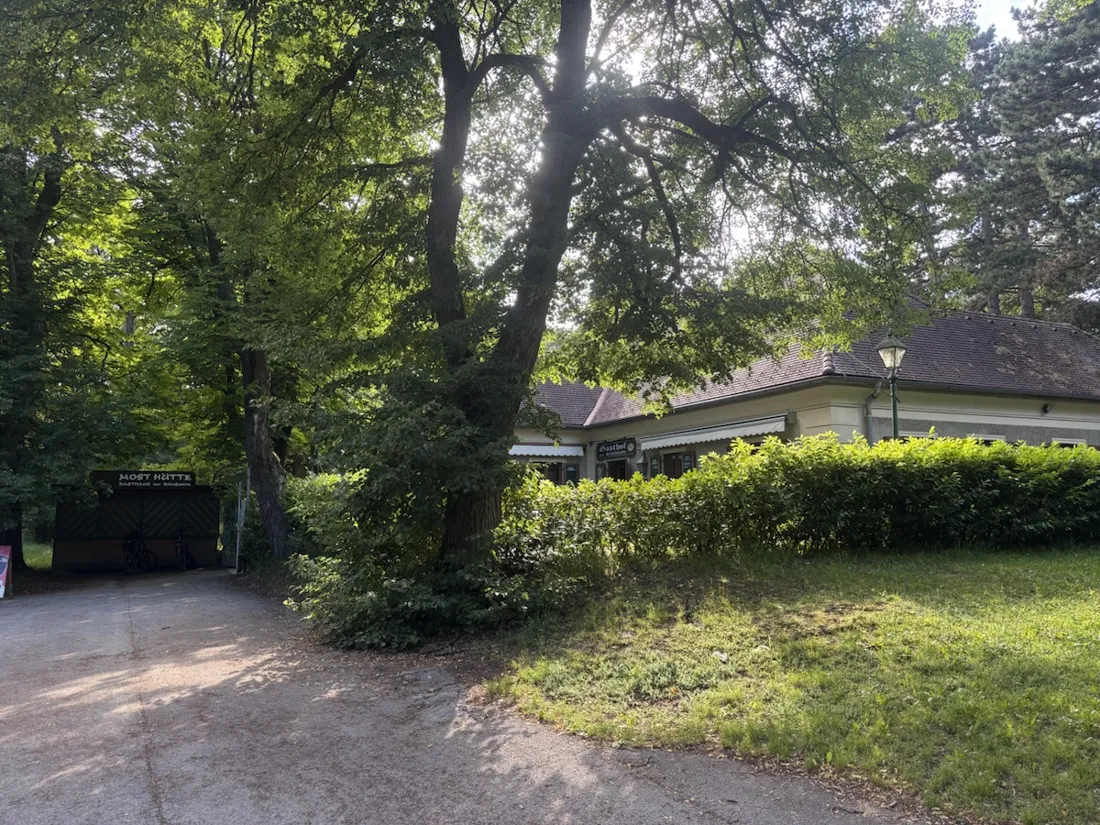
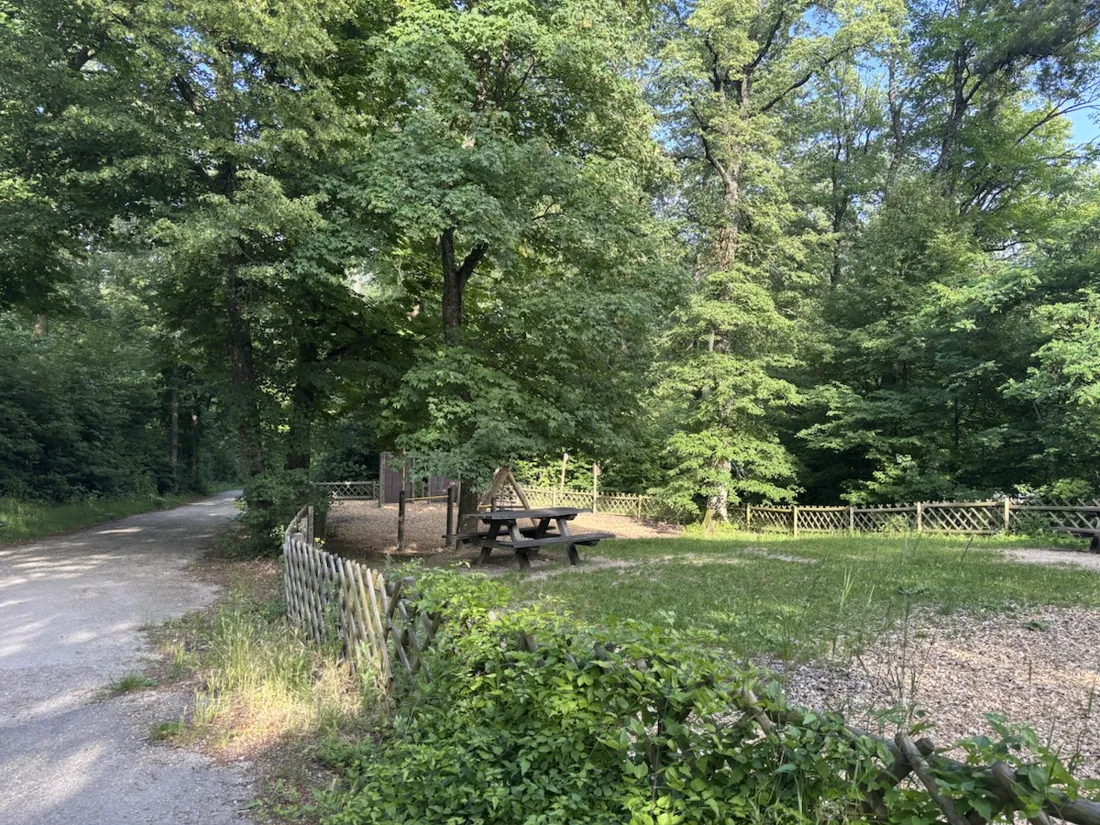
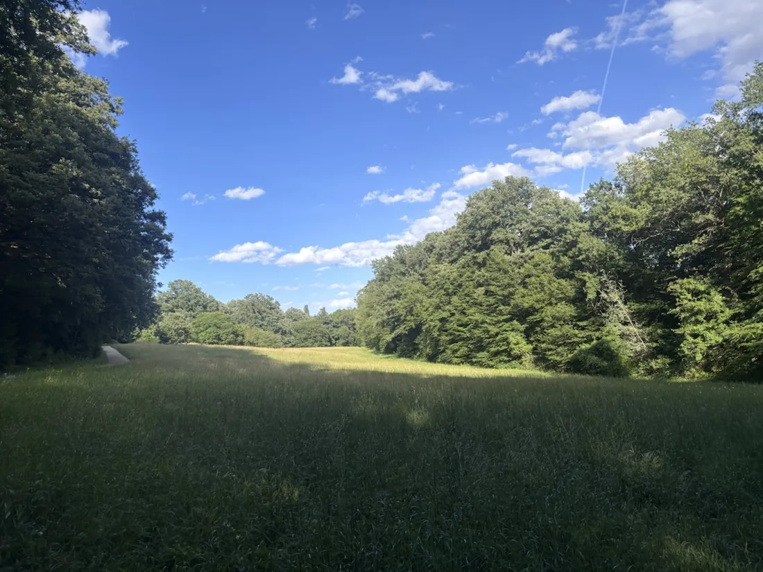
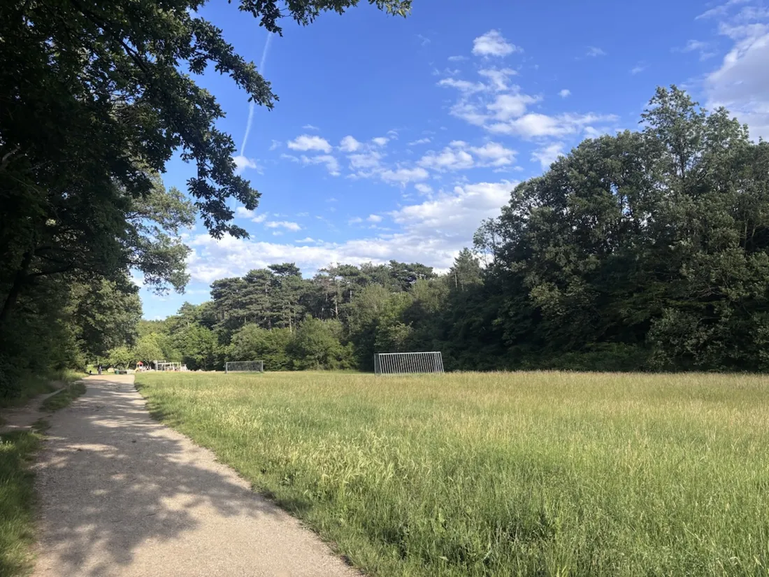
The route runs almost entirely on the Maurer Wald's gravel forest roads: shaded, well-graded, and busy enough with locals that you're rarely truly alone. It passes the old forest inn — the Gasthaus zur Schießstätte — a trailside playground and a meadow clearing before the real climb begins. For a run that starts at the city's edge, it feels a long way from town.
From forest floor to vineyard panorama
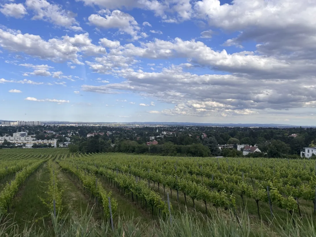
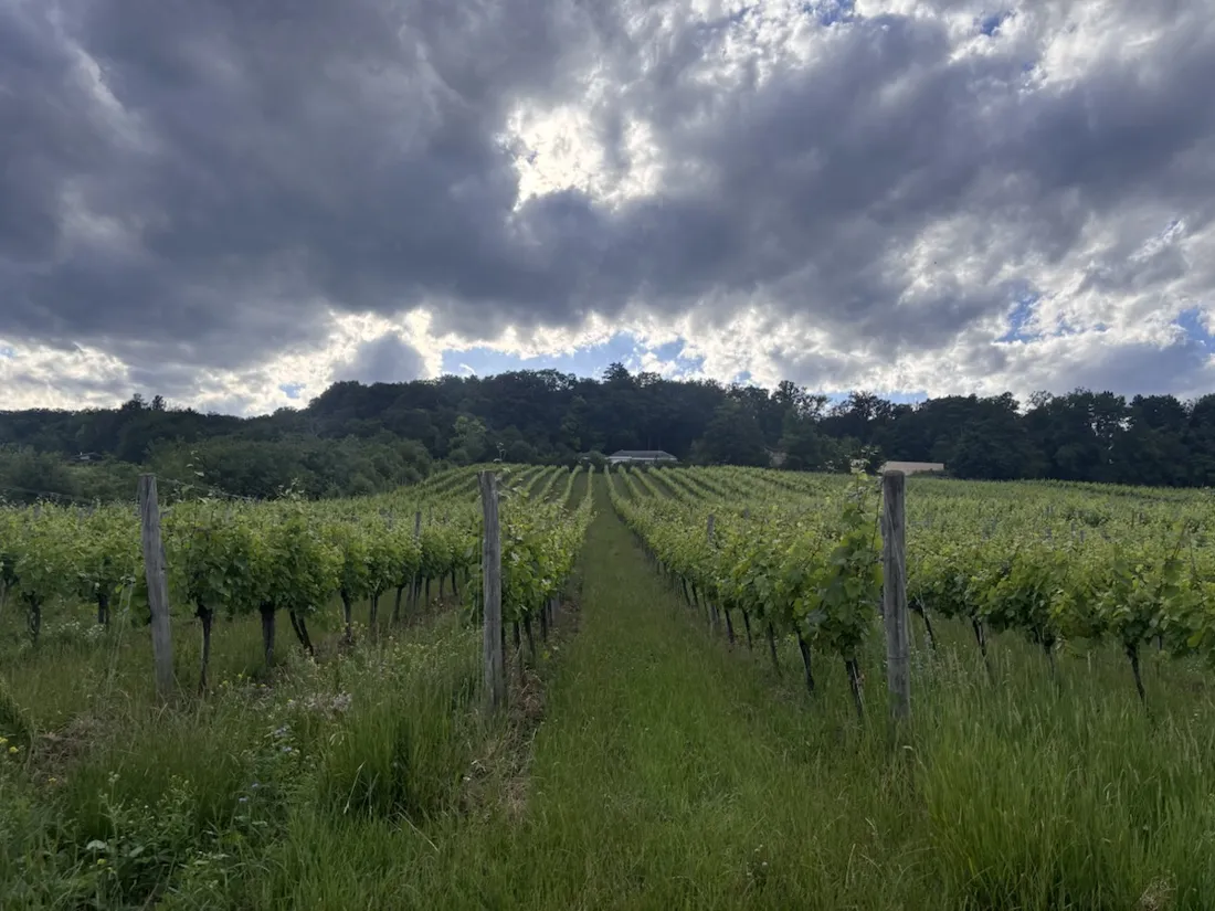
The second half pulls up to about 365 meters, where the trees open onto the vineyards on Mauer's sunny slopes. Vienna is one of the few capitals with serious wine inside the city limits, and this is where you see it: rows of vines dropping away toward the rooftops, the city hazy in the distance. The elevation profile tells the whole shape — a long, gentle pull, a panoramic high point, a quick descent home.
Why record a regular loop
An expedition is an obvious thing to record; a home running route is the quiet one. But the recorded line is what turns a run into something repeatable — exact distance, the real pace chart, where the climb actually bit, and a GPX you can hand to a friend who wants to run it too. The photos drop onto the map exactly where they were taken.
About the place: Maurer Wald, Vienna, Austria
Mauer is the southwestern corner of Vienna, in the 23rd district (Liesing), where the city runs straight into the Wienerwald — the Vienna Woods, a UNESCO-listed biosphere reserve. The Maurer Wald's network of gravel forest roads is a local favorite for running and walking, and on the sunny lower slopes the Maurerberg vineyards still grow the Gemischter Satz that Vienna is uniquely known for — wine made inside the city limits, with a long view back over the rooftops.
Get NomadTracks free — iOS & Android
More track stories
- Overlanding Namibia: 4,250 km from the Kalahari to the Kunene
- Mount Whitney in two days: 24 km to the roof of the Lower 48
- Grant Park, the Bean & the Museum Campus: a 10.5 km Chicago run
- A morning run through downtown Chicago: 9.7 km past Navy Pier and the lakefront
- Running Lincoln's Springfield: 8.8 km through the Illinois capital
- Camps Bay to Table Mountain: the steep way up Cape Town's icon
- Dürrensee to the Drei Zinnen: a Dolomites classic
- Camping Šobec and the birth of the Sava: a 7 km morning run
- Sailing the Šibenik archipelago: 69 nautical-style kilometers under sail
- Canoeing Caddo Lake: 9 km through a flooded cypress forest
- Mount Shasta mountain-bike loop: 28.6 km of volcano singletrack
- Lofoten lake hike: 9.6 km through Norway's green wilderness
- Cinder Cone, Lassen Volcanic NP: a 6 km climb up a perfect volcano
- Drakensberg amphitheatre: 13 km to the top of Tugela Falls
- The Olive Trail, Namib-Naukluft: 10.9 km through a desert canyon
- Mount St. Helens: 16 km through the blast zone to the viewpoints
- Double O Arch via Devils Garden: 12 km through Arches' fin country
- The everyday loop: 12 km of redwoods and fog above Redwood City
- Lake Tahoe rim ride: 28 km of singletrack above the blue
- Dewey Point in winter: 12 km on snowshoes to Yosemite's quiet rim
- Pinnacles High Peaks loop: 12 km among the condor spires
- Golden Canyon to Zabriskie badlands: 6 km below sea level
- Hoh Rain Forest: a 4 km walk through the moss cathedral
- Oahu waterfall trail: 5 km of mud, roots and jungle
- Riding to Lake Helen: 17 km up a closed park road through the snow
- Phillips Cave: a 6.5 km walk to Namibia's White Elephant rock art
- Koiimasis: 9 km through the granite of the Tiras Mountains
- Cathedral Gorge: a short ride through Nevada's clay cathedral
- Riding Black Rock City: the GPS trace of a city that doesn't exist
- Peekaboo Loop, Bryce Canyon: 15 km among the hoodoos