Hiking · Bryce Canyon, Utah, USA · recorded with NomadTracks
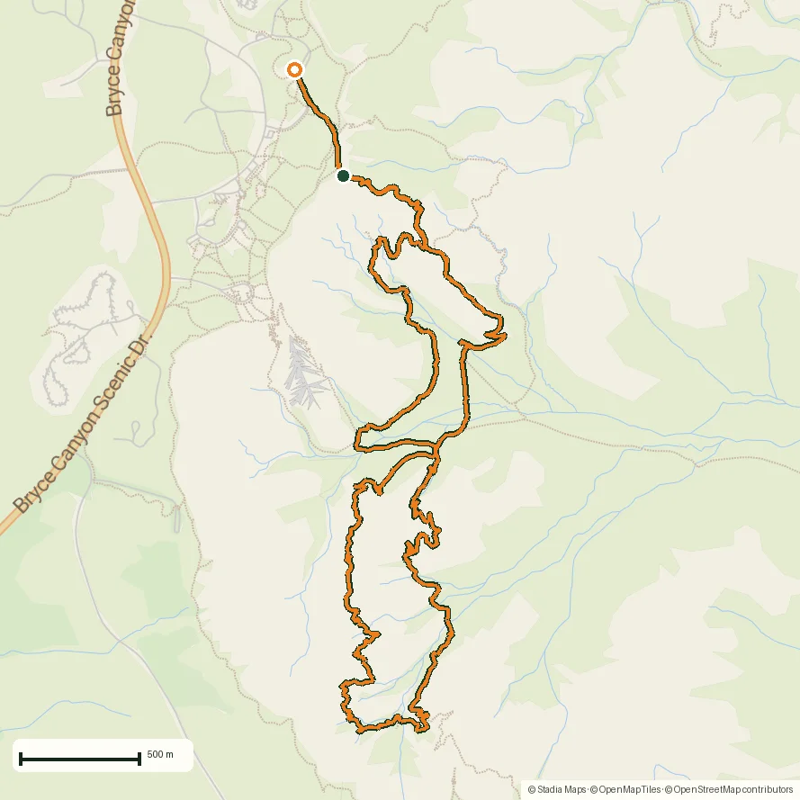
Peekaboo Loop, Bryce Canyon: 15 km among the hoodoos
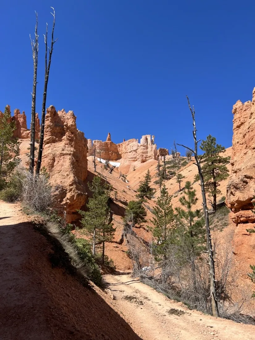
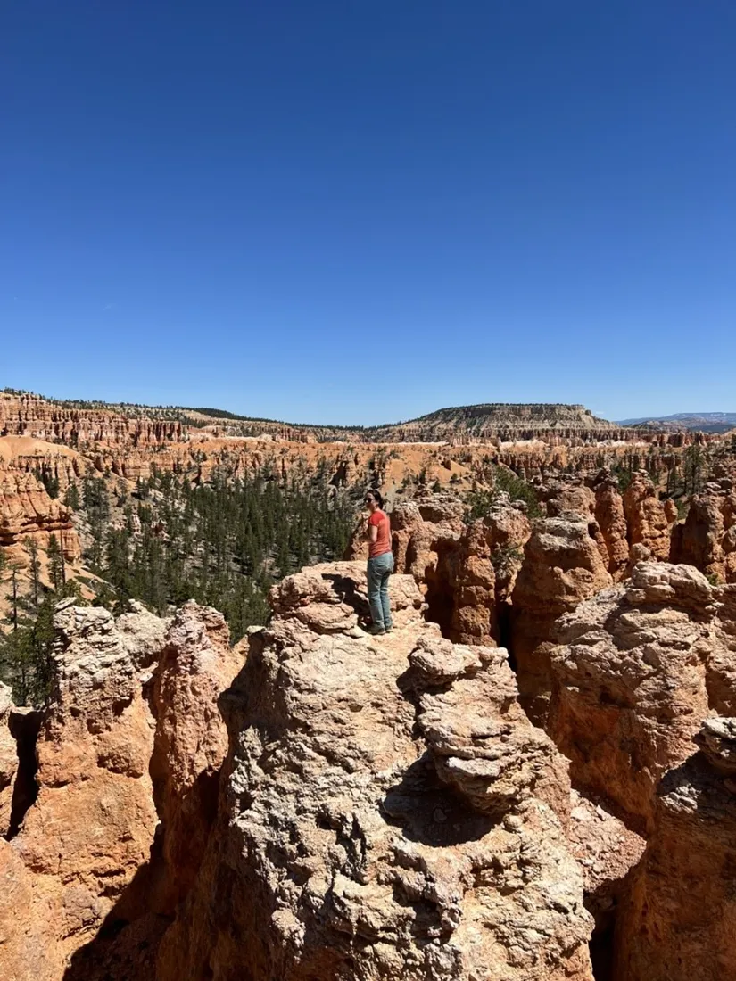
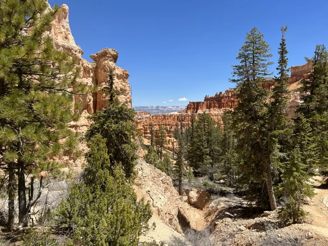
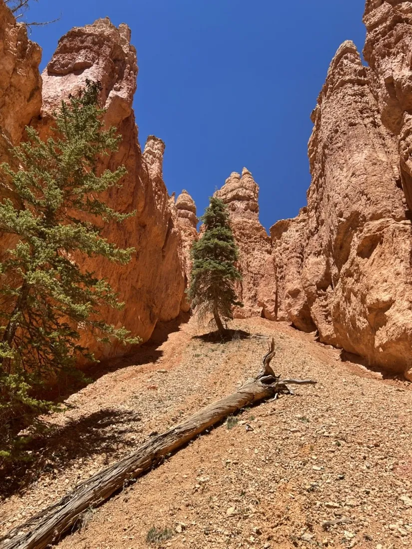
Bryce Canyon from the rim is a postcard; from the canyon floor it's an architecture tour. This 14.9 km combination of Queens Garden, Peekaboo Loop and Navajo Trail dives below the rim and weaves through the hoodoos, with about 890 m of accumulated climbing in constant small doses.
About this data: this track and its photos were personally shared with us as samples by a NomadTracks user. NomadTracks never uploads, collects or shares your tracks or photos — your recordings stay on your devices and in your own cloud.
Download GPX Coordinates, elevation and relative times — recording dates are normalized out, photos not included.

Where the meters hide
No single big climb — the elevation profile is a saw blade. That's Bryce: every amphitheater costs 60 m down and 60 m back up at 2,400 m altitude. Knowing this from the chart is the difference between planning a stroll and packing enough water.
The national-park map, alive
The NPS hands you a beautiful paper trail map at the gate. Georeferenced in NomadTracks in two minutes at the trailhead, it becomes the live map you actually navigate with — official trail names, ranger annotations and your blue dot in one view. This is the workflow the custom-maps feature was built for.
About the place: Bryce Canyon, Utah, USA
Bryce Canyon National Park in southern Utah is not a canyon but a row of eroding amphitheaters at 2,400 m, filled with the world's largest concentration of hoodoos. The Queens Garden, Navajo and Peekaboo trails interconnect below the rim between Sunrise and Sunset Points; the altitude means cool mornings even in summer and snow-dusted hoodoos from November to April.
Get NomadTracks free on the App Store
More track stories
- Overlanding Namibia: 4,250 km from the Kalahari to the Kunene
- Mount Whitney in two days: 24 km to the roof of the Lower 48
- Grant Park, the Bean & the Museum Campus: a 10.5 km Chicago run
- A morning run through downtown Chicago: 9.7 km past Navy Pier and the lakefront
- Running Lincoln's Springfield: 8.8 km through the Illinois capital
- Camps Bay to Table Mountain: the steep way up Cape Town's icon
- Dürrensee to the Drei Zinnen: a Dolomites classic
- Maurer Wald loop: a 9.7 km trail run on the edge of Vienna
- Camping Šobec and the birth of the Sava: a 7 km morning run
- Sailing the Šibenik archipelago: 69 nautical-style kilometers under sail
- Canoeing Caddo Lake: 9 km through a flooded cypress forest
- Mount Shasta mountain-bike loop: 28.6 km of volcano singletrack
- Lofoten lake hike: 9.6 km through Norway's green wilderness
- Cinder Cone, Lassen Volcanic NP: a 6 km climb up a perfect volcano
- Drakensberg amphitheatre: 13 km to the top of Tugela Falls
- The Olive Trail, Namib-Naukluft: 10.9 km through a desert canyon
- Mount St. Helens: 16 km through the blast zone to the viewpoints
- Double O Arch via Devils Garden: 12 km through Arches' fin country
- The everyday loop: 12 km of redwoods and fog above Redwood City
- Lake Tahoe rim ride: 28 km of singletrack above the blue
- Dewey Point in winter: 12 km on snowshoes to Yosemite's quiet rim
- Pinnacles High Peaks loop: 12 km among the condor spires
- Golden Canyon to Zabriskie badlands: 6 km below sea level
- Hoh Rain Forest: a 4 km walk through the moss cathedral
- Oahu waterfall trail: 5 km of mud, roots and jungle
- Riding to Lake Helen: 17 km up a closed park road through the snow
- Phillips Cave: a 6.5 km walk to Namibia's White Elephant rock art
- Koiimasis: 9 km through the granite of the Tiras Mountains
- Cathedral Gorge: a short ride through Nevada's clay cathedral
- Riding Black Rock City: the GPS trace of a city that doesn't exist