Hiking · Olympic National Park, Washington, USA · recorded with NomadTracks
Hoh Rain Forest: a 4 km walk through the moss cathedral
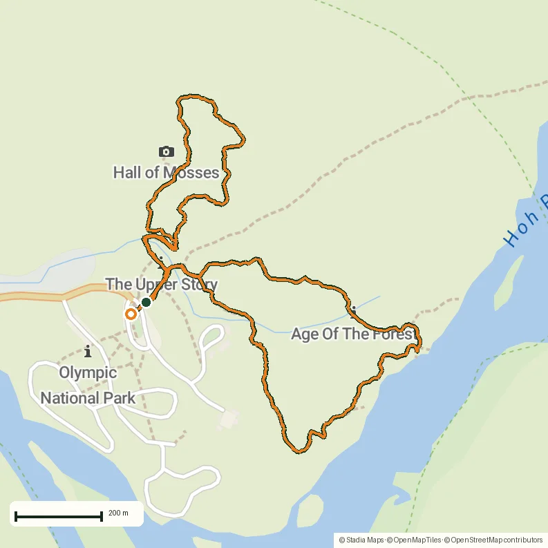
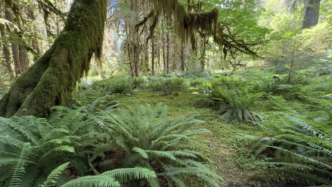
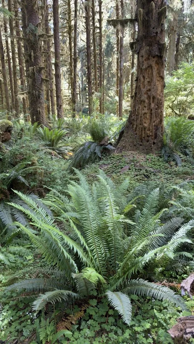
Not every track is about distance. This one is 3.6 km of the Hoh Rain Forest — one of the quietest places in the continental US, where the moss hangs in curtains and the path wanders between thousand-year-old trees.
About this data: this track and its photos were personally shared with us as samples by a NomadTracks user. NomadTracks never uploads, collects or shares your tracks or photos — your recordings stay on your devices and in your own cloud.
Download GPX Coordinates, elevation and relative times — recording dates are normalized out, photos not included.

Tracks as a diary, not a workout
A walk like this gets recorded for the same reason you photograph it: to keep it. The track pins the photos to the exact bend where the light came through — and years later the little line replays the morning.
POIs for the small things
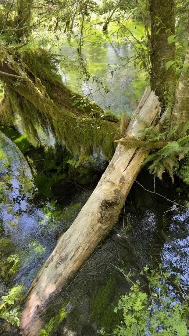
The biggest maple, the nurse log with six saplings in a row — pinned with photos and notes. The Hoh rewards attention to small things, and POIs are built for exactly that.
About the place: Olympic National Park, Washington, USA
The Hoh Rain Forest on the west side of Olympic National Park, Washington, receives over three meters of rain a year — the wettest forest in the contiguous United States. Bigleaf maples carry curtains of club moss, fallen 'nurse logs' raise rows of new spruce, and the One Square Inch of Silence project once identified it as the quietest place in the lower 48. The short loops near the visitor center walk year-round.
Get NomadTracks free on the App Store
More track stories
- Overlanding Namibia: 4,250 km from the Kalahari to the Kunene
- Mount Whitney in two days: 24 km to the roof of the Lower 48
- Grant Park, the Bean & the Museum Campus: a 10.5 km Chicago run
- A morning run through downtown Chicago: 9.7 km past Navy Pier and the lakefront
- Running Lincoln's Springfield: 8.8 km through the Illinois capital
- Camps Bay to Table Mountain: the steep way up Cape Town's icon
- Dürrensee to the Drei Zinnen: a Dolomites classic
- Maurer Wald loop: a 9.7 km trail run on the edge of Vienna
- Camping Šobec and the birth of the Sava: a 7 km morning run
- Sailing the Šibenik archipelago: 69 nautical-style kilometers under sail
- Canoeing Caddo Lake: 9 km through a flooded cypress forest
- Mount Shasta mountain-bike loop: 28.6 km of volcano singletrack
- Lofoten lake hike: 9.6 km through Norway's green wilderness
- Cinder Cone, Lassen Volcanic NP: a 6 km climb up a perfect volcano
- Drakensberg amphitheatre: 13 km to the top of Tugela Falls
- The Olive Trail, Namib-Naukluft: 10.9 km through a desert canyon
- Mount St. Helens: 16 km through the blast zone to the viewpoints
- Double O Arch via Devils Garden: 12 km through Arches' fin country
- The everyday loop: 12 km of redwoods and fog above Redwood City
- Lake Tahoe rim ride: 28 km of singletrack above the blue
- Dewey Point in winter: 12 km on snowshoes to Yosemite's quiet rim
- Pinnacles High Peaks loop: 12 km among the condor spires
- Golden Canyon to Zabriskie badlands: 6 km below sea level
- Oahu waterfall trail: 5 km of mud, roots and jungle
- Riding to Lake Helen: 17 km up a closed park road through the snow
- Phillips Cave: a 6.5 km walk to Namibia's White Elephant rock art
- Koiimasis: 9 km through the granite of the Tiras Mountains
- Cathedral Gorge: a short ride through Nevada's clay cathedral
- Riding Black Rock City: the GPS trace of a city that doesn't exist
- Peekaboo Loop, Bryce Canyon: 15 km among the hoodoos