Hiking · Tiras Mountains, Namibia · recorded with NomadTracks
Koiimasis: 9 km through the granite of the Tiras Mountains
The Tiras Mountains sit between the Namib's dunes and the Koiimasis valley — a landscape of red granite domes stacked like giants' marbles over golden grass. This 9 km loop wanders out from the farm, climbs between the boulders and times the turnaround for sunset.
About this data: this track and its photos were personally shared with us as samples by a NomadTracks user. NomadTracks never uploads, collects or shares your tracks or photos — your recordings stay on your devices and in your own cloud.
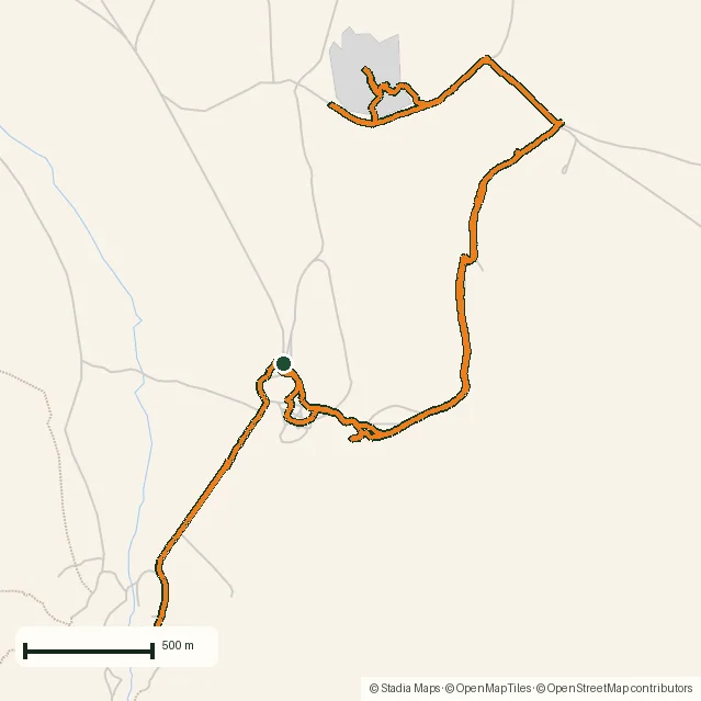
Download GPX Coordinates, elevation and relative times — recording dates are normalized out, photos not included.

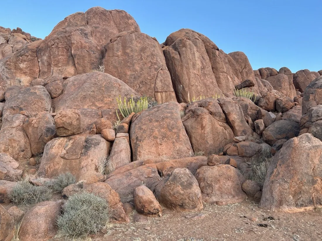
Boulder country
There is no marked trail through the kopjes — you pick lines between the granite eggs, and every gap looks the same on the way back. That's exactly the terrain where the recorded line earns its keep: out is exploration, back is following your own orange thread.
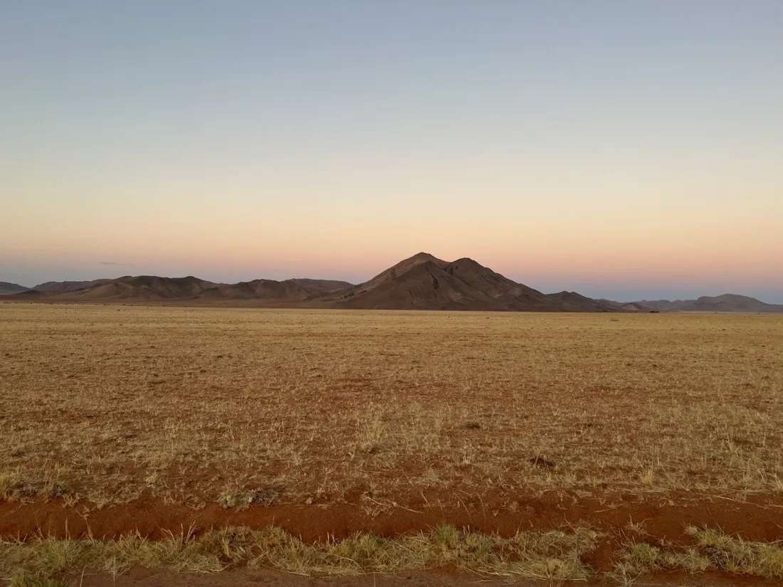
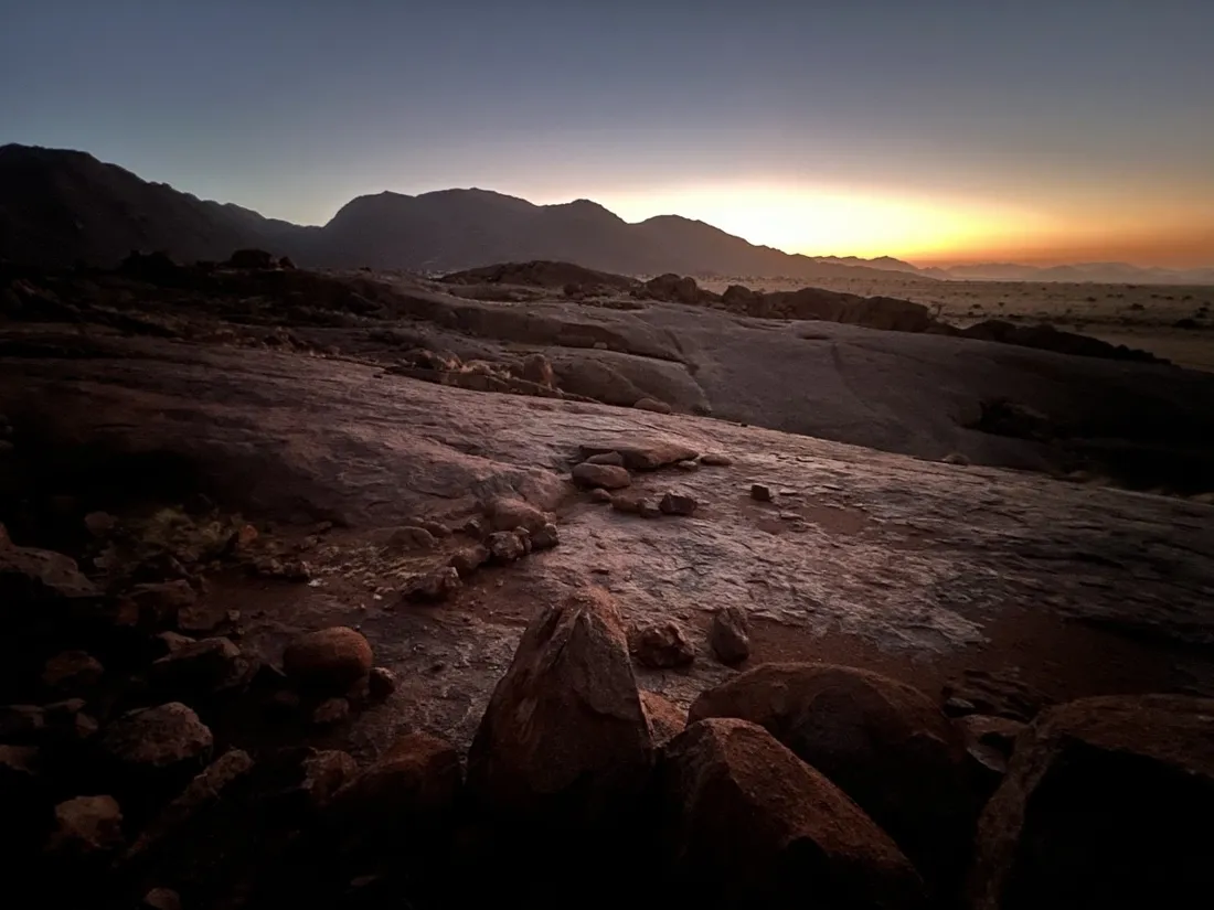
The sunset economics of the desert
The last kilometer of this track was recorded in fading gold light — the elevation chart is flat, the photos are not. Knowing your pace from the live stats is what lets you push to one more viewpoint and still beat the dark to the farm gate.
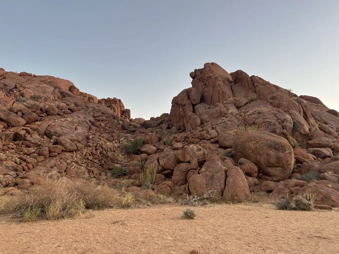
About the place: Tiras Mountains, Namibia
The Tiras Mountains rise between the Namib dunes and the Koiimasis valley in southern Namibia, along the celebrated D707 — often called one of the most beautiful roads in the country. Guest farms like Koiimasis offer access to the granite boulder country; there are no marked trails, water or shade, so evening loops with a GPS track and a headlamp reserve are the sensible format.
Get NomadTracks free on the App Store
More track stories
- Overlanding Namibia: 4,250 km from the Kalahari to the Kunene
- Mount Whitney in two days: 24 km to the roof of the Lower 48
- Grant Park, the Bean & the Museum Campus: a 10.5 km Chicago run
- A morning run through downtown Chicago: 9.7 km past Navy Pier and the lakefront
- Running Lincoln's Springfield: 8.8 km through the Illinois capital
- Camps Bay to Table Mountain: the steep way up Cape Town's icon
- Dürrensee to the Drei Zinnen: a Dolomites classic
- Maurer Wald loop: a 9.7 km trail run on the edge of Vienna
- Camping Šobec and the birth of the Sava: a 7 km morning run
- Sailing the Šibenik archipelago: 69 nautical-style kilometers under sail
- Canoeing Caddo Lake: 9 km through a flooded cypress forest
- Mount Shasta mountain-bike loop: 28.6 km of volcano singletrack
- Lofoten lake hike: 9.6 km through Norway's green wilderness
- Cinder Cone, Lassen Volcanic NP: a 6 km climb up a perfect volcano
- Drakensberg amphitheatre: 13 km to the top of Tugela Falls
- The Olive Trail, Namib-Naukluft: 10.9 km through a desert canyon
- Mount St. Helens: 16 km through the blast zone to the viewpoints
- Double O Arch via Devils Garden: 12 km through Arches' fin country
- The everyday loop: 12 km of redwoods and fog above Redwood City
- Lake Tahoe rim ride: 28 km of singletrack above the blue
- Dewey Point in winter: 12 km on snowshoes to Yosemite's quiet rim
- Pinnacles High Peaks loop: 12 km among the condor spires
- Golden Canyon to Zabriskie badlands: 6 km below sea level
- Hoh Rain Forest: a 4 km walk through the moss cathedral
- Oahu waterfall trail: 5 km of mud, roots and jungle
- Riding to Lake Helen: 17 km up a closed park road through the snow
- Phillips Cave: a 6.5 km walk to Namibia's White Elephant rock art
- Cathedral Gorge: a short ride through Nevada's clay cathedral
- Riding Black Rock City: the GPS trace of a city that doesn't exist
- Peekaboo Loop, Bryce Canyon: 15 km among the hoodoos