Running · Šobec, Lesce, Slovenia · recorded with NomadTracks
Camping Šobec and the birth of the Sava: a 7 km morning run
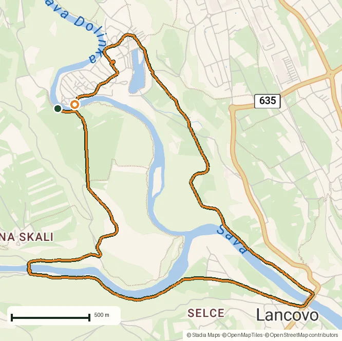
Not every recording is a summit day. This one is a flat, easy 7-kilometer morning run — a shade under an hour, with plenty of photo stops — looping the rivers around Camping Šobec near Lesce, in the Upper Carniola corner of Slovenia between Bled and Radovljica.
It's an ordinary run in an extraordinary spot: the loop threads the exact place where the Sava is born — the confluence where the Sava Dolinka and the Sava Bohinjka meet and become one river — with the Julian Alps and the Karavanke ranged around the horizon.
About this data: this track and its photos were personally shared with us as samples by a NomadTracks user. NomadTracks never uploads, collects or shares your tracks or photos — your recordings stay on your devices and in your own cloud.
Download GPX Coordinates, elevation and relative times — recording dates are normalized out, photos not included.
Where the Sava is born
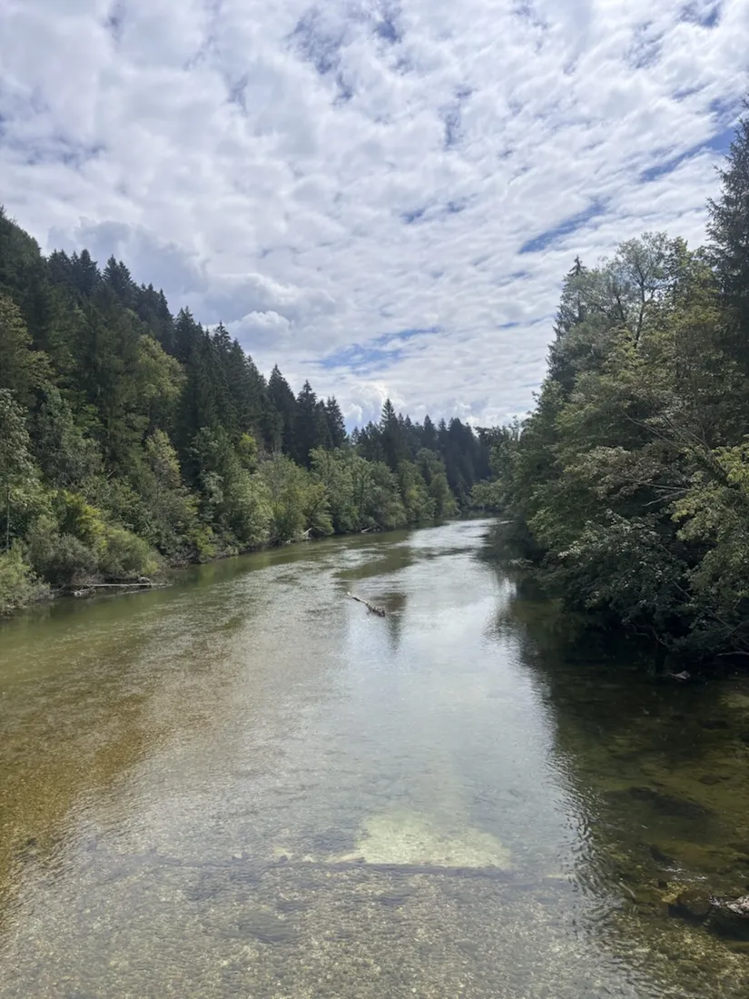
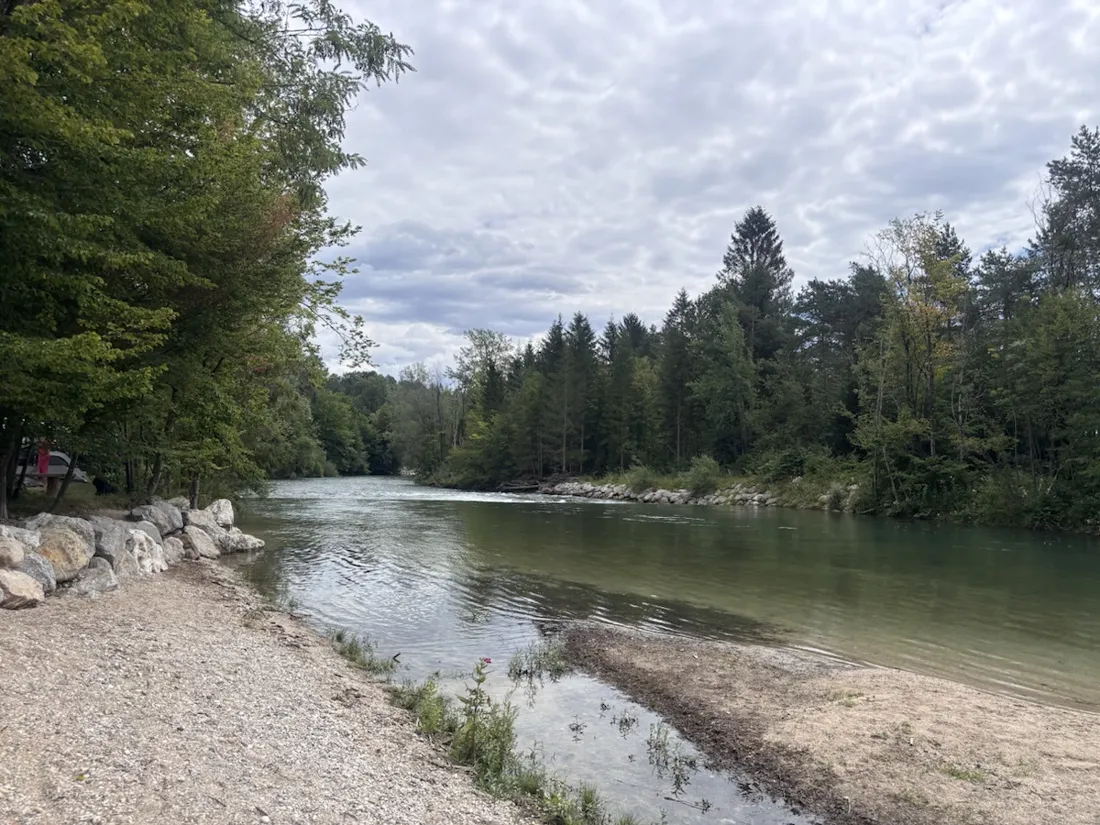
Two rivers come down out of the mountains here: the Sava Dolinka, 45 km from the Upper Sava Valley beneath Bled, and the Sava Bohinjka, 41 km from Lake Bohinj under the Jelovica plateau. Just below Radovljica, at Lancovo, they meet — and from that confluence flows the Sava, the main water artery of central Slovenia and, far downstream, one of the great rivers of the Balkans. This run crosses the Bodeški most over the clear Sava Bohinjka, passes the old Bodešče gauging station (that thin cable strung across the water in the photos is its measuring line), and follows the young Sava along its first kilometers. The Bohinjka is reckoned one of the cleanest and most beautiful rivers in the country, and it looks it.
Slovenia's biggest campsite, in a pine forest
Camping Šobec sits right on this triangle of water and woodland. Spread over about 15 hectares of shady pine forest between the Sava Dolinka and a small lake — Šobčev bajer, barely 2.6 hectares and three meters deep — it is the largest campsite in Slovenia and a five-star one, voted the country's best large campsite in 2024, with a Blue Flag for its river beach. In the morning, before the day-trippers arrive, its gravel tracks and river paths make a quiet, level running circuit; the run starts and ends here.
Clean water, wild fish, pebble beaches
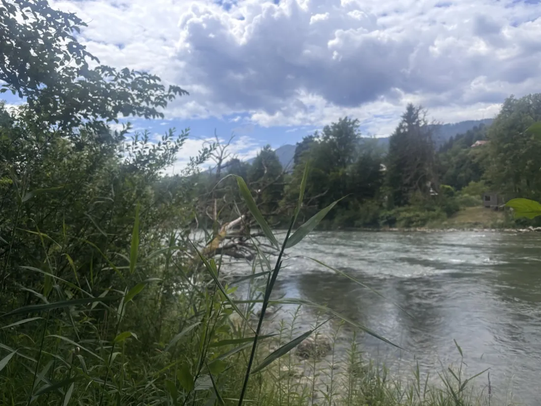
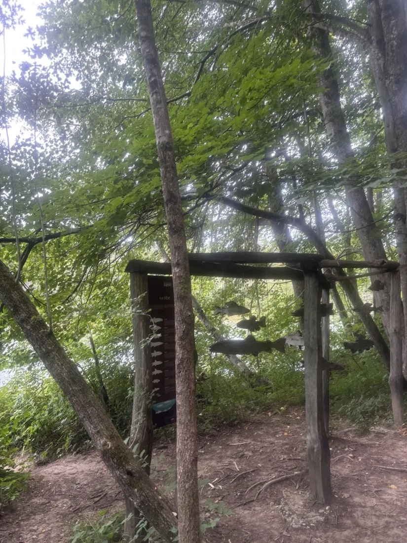
The “Savske ribe” panel along the bank — a wooden frame hung with metal silhouettes of fish — is a small nature-trail marker, and it is earned: these are famous fly-fishing rivers, home to the marble trout and grayling that draw anglers from across Europe. Between the pools the water shelves into wide gravel and pebble beaches, the kind in the photos, where the Sava Dolinka runs shallow and cold over rounded stones. Flat, clear and cold even in July — a fine place to finish a run.
Why record a flat run
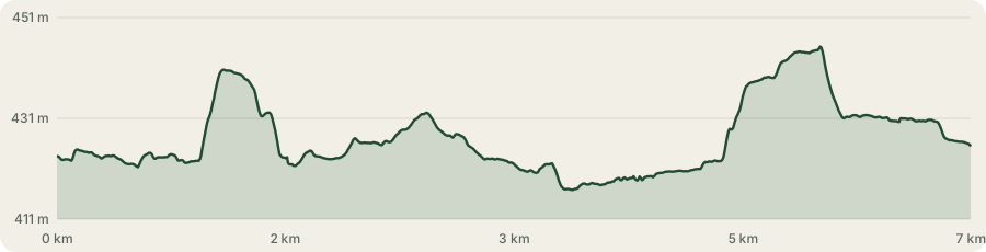
The elevation profile barely moves — a total range of under 30 meters across the whole loop — and that is exactly why it's worth showing: not every worthwhile track is a climb. The recorded line captures the precise 7 km, the real pace, and every photo dropped onto the map where it was taken, so the shape of an ordinary morning by the water is kept exactly. The GPX downloads with coordinates and relative times for anyone who wants to run the same loop.
About the place: Šobec, Lesce, Slovenia
Camping Šobec, near Lesce in the Upper Carniola (Gorenjska) region of Slovenia, is the country's largest campsite — around 15 hectares of pine forest between the Sava Dolinka river and a small bathing lake, the Šobčev bajer, midway between Bled and Radovljica. Just downstream, at Lancovo below Radovljica, the Sava Dolinka and the Sava Bohinjka join to form the Sava, the longest river of Slovenia; the surrounding waters are among the cleanest in the country and celebrated fly-fishing rivers for marble trout and grayling, ringed by the Julian Alps, the Karavanke and the Jelovica plateau.
Get NomadTracks free — iOS & Android
More track stories
- Overlanding Namibia: 4,250 km from the Kalahari to the Kunene
- Mount Whitney in two days: 24 km to the roof of the Lower 48
- Grant Park, the Bean & the Museum Campus: a 10.5 km Chicago run
- A morning run through downtown Chicago: 9.7 km past Navy Pier and the lakefront
- Running Lincoln's Springfield: 8.8 km through the Illinois capital
- Camps Bay to Table Mountain: the steep way up Cape Town's icon
- Dürrensee to the Drei Zinnen: a Dolomites classic
- Baleal: a 5.6 km morning run out to Peniche's old whaling island
- Sagres: a 4.8 km morning loop around the Algarve’s last headland
- Maurer Wald loop: a 9.7 km trail run on the edge of Vienna
- The Slow Trail around the Pressegger See: a 5.7 km reed-belt loop
- Vorderberg to the Dellacher Alm: a wild 13 km off-trail climb in the Carnic Alps
- Sailing the Šibenik archipelago: 69 nautical-style kilometers under sail
- Canoeing Caddo Lake: 9 km through a flooded cypress forest
- Mount Shasta mountain-bike loop: 28.6 km of volcano singletrack
- Lofoten lake hike: 9.6 km through Norway's green wilderness
- Cinder Cone, Lassen Volcanic NP: a 6 km climb up a perfect volcano
- Tugela Falls hike: Sentinel route, GPX and coordinates
- The Olive Trail, Namib-Naukluft: 10.9 km through a desert canyon
- Mount St. Helens: 16 km through the blast zone to the viewpoints
- Double O Arch via Devils Garden: 12 km through Arches' fin country
- The everyday loop: 12 km of redwoods and fog above Redwood City
- Lake Tahoe rim ride: 28 km of singletrack above the blue
- Dewey Point in winter: 12 km on snowshoes to Yosemite's quiet rim
- Pinnacles High Peaks loop: 12 km among the condor spires
- Golden Canyon to Zabriskie badlands: 6 km below sea level
- Hoh Rain Forest: a 4 km walk through the moss cathedral
- Oahu waterfall trail: 5 km of mud, roots and jungle
- Riding to Lake Helen: 17 km up a closed park road through the snow
- Phillips Cave: a 6.5 km walk to Namibia's White Elephant rock art
- Koiimasis: 9 km through the granite of the Tiras Mountains
- Cathedral Gorge: a short ride through Nevada's clay cathedral
- Riding Black Rock City: the GPS trace of a city that doesn't exist
- Peekaboo Loop, Bryce Canyon: 15 km among the hoodoos
- Steinhof and the golden dome: a 9.7 km evening run in Vienna
- Wilhelminenberg by evening: a 10.2 km run over Vienna’s western hills