Hiking · Pinnacles National Park, California, USA · recorded with NomadTracks
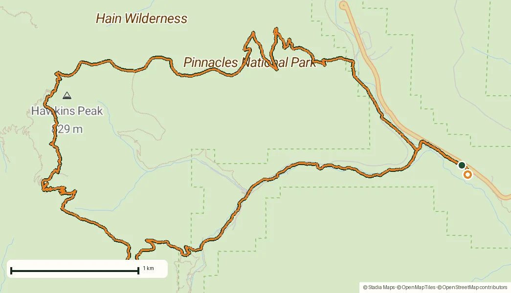
Pinnacles High Peaks loop: 12 km among the condor spires
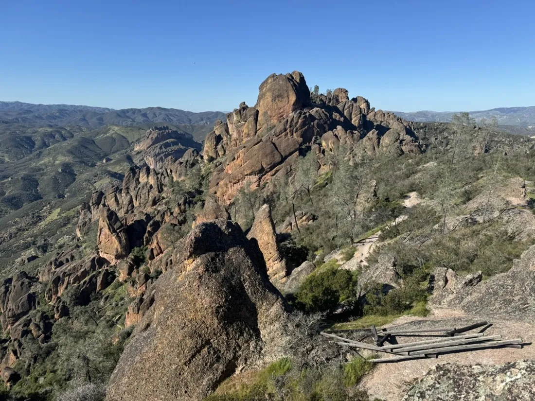
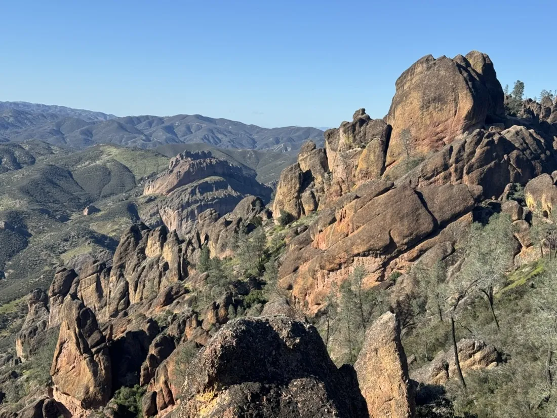
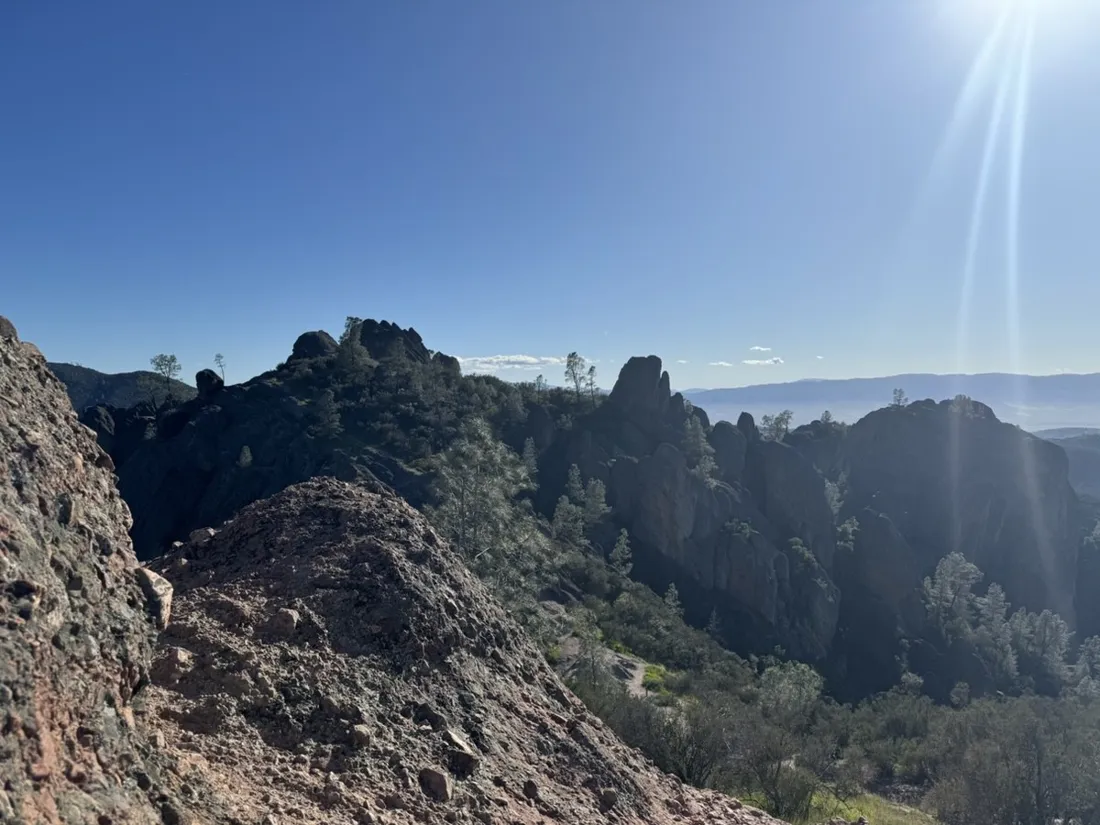
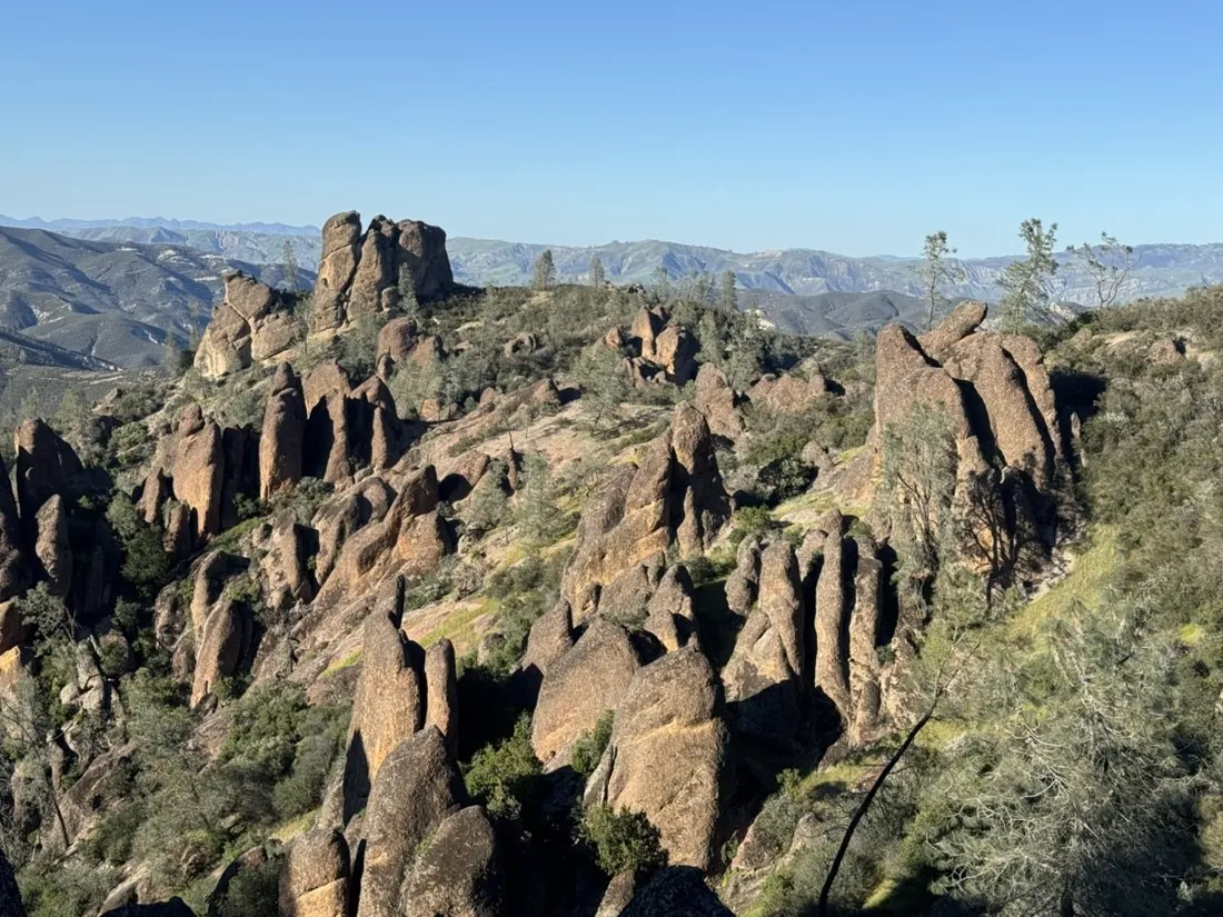
Pinnacles is what's left of an ancient volcano that drifted 300 km up the San Andreas fault — and the High Peaks loop threads right through its teeth: 12.1 km, 574 m of climbing, with stairways blasted into the rock and California condors riding the thermals overhead.
About this data: this track and its photos were personally shared with us as samples by a NomadTracks user. NomadTracks never uploads, collects or shares your tracks or photos — your recordings stay on your devices and in your own cloud.
Download GPX Coordinates, elevation and relative times — recording dates are normalized out, photos not included.

The steep-and-narrow section
The heart of the loop is a stretch of carved steps and railings through the spires themselves. The elevation chart shows it as a brief, sharp sawtooth — short meters, long memories.
Heat math
Pinnacles bakes from late spring on. The recorded pace chart makes the planning honest: the same loop that takes three hours in February is a five-hour water-hauling exercise in July.
About the place: Pinnacles National Park, California, USA
Pinnacles National Park in central California protects the eroded remains of an ancient volcano carried 300 km north along the San Andreas fault. The High Peaks loop threads the spires on stairways cut in the 1930s, and the park is a release site of the California Condor Recovery Program — check the thermals above the ridge. Spring wildflower season is the sweet spot; summers are brutally hot.
Get NomadTracks free on the App Store
More track stories
- Overlanding Namibia: 4,250 km from the Kalahari to the Kunene
- Mount Whitney in two days: 24 km to the roof of the Lower 48
- Grant Park, the Bean & the Museum Campus: a 10.5 km Chicago run
- A morning run through downtown Chicago: 9.7 km past Navy Pier and the lakefront
- Running Lincoln's Springfield: 8.8 km through the Illinois capital
- Camps Bay to Table Mountain: the steep way up Cape Town's icon
- Dürrensee to the Drei Zinnen: a Dolomites classic
- Maurer Wald loop: a 9.7 km trail run on the edge of Vienna
- Camping Šobec and the birth of the Sava: a 7 km morning run
- Sailing the Šibenik archipelago: 69 nautical-style kilometers under sail
- Canoeing Caddo Lake: 9 km through a flooded cypress forest
- Mount Shasta mountain-bike loop: 28.6 km of volcano singletrack
- Lofoten lake hike: 9.6 km through Norway's green wilderness
- Cinder Cone, Lassen Volcanic NP: a 6 km climb up a perfect volcano
- Drakensberg amphitheatre: 13 km to the top of Tugela Falls
- The Olive Trail, Namib-Naukluft: 10.9 km through a desert canyon
- Mount St. Helens: 16 km through the blast zone to the viewpoints
- Double O Arch via Devils Garden: 12 km through Arches' fin country
- The everyday loop: 12 km of redwoods and fog above Redwood City
- Lake Tahoe rim ride: 28 km of singletrack above the blue
- Dewey Point in winter: 12 km on snowshoes to Yosemite's quiet rim
- Golden Canyon to Zabriskie badlands: 6 km below sea level
- Hoh Rain Forest: a 4 km walk through the moss cathedral
- Oahu waterfall trail: 5 km of mud, roots and jungle
- Riding to Lake Helen: 17 km up a closed park road through the snow
- Phillips Cave: a 6.5 km walk to Namibia's White Elephant rock art
- Koiimasis: 9 km through the granite of the Tiras Mountains
- Cathedral Gorge: a short ride through Nevada's clay cathedral
- Riding Black Rock City: the GPS trace of a city that doesn't exist
- Peekaboo Loop, Bryce Canyon: 15 km among the hoodoos