Hiking · Cape Town, South Africa · recorded with NomadTracks
Camps Bay to Table Mountain: the steep way up Cape Town's icon
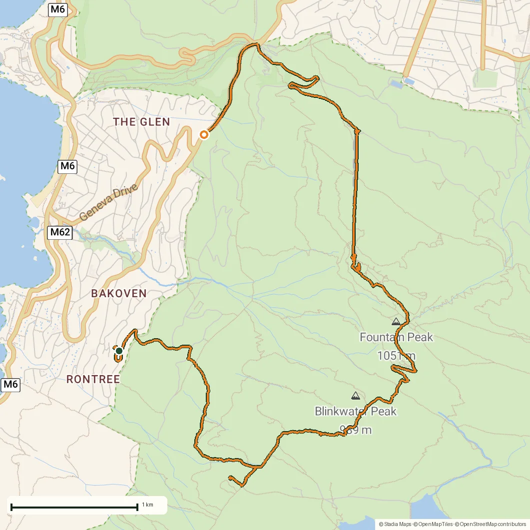
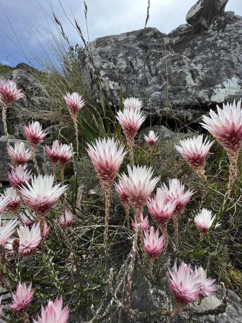
Starting at sea level on the Camps Bay beachfront and topping out on the Table Mountain plateau is the full-value version of Cape Town's signature hike: 12.3 km with about 1,130 m of elevation gain, through kasteelspoort ramps, fynbos and bare sandstone.
The recorded track climbs through three distinct zones — suburb, fynbos belt, summit rock — all clearly readable in the elevation profile.
About this data: this track and its photos were personally shared with us as samples by a NomadTracks user. NomadTracks never uploads, collects or shares your tracks or photos — your recordings stay on your devices and in your own cloud.
Download GPX Coordinates, elevation and relative times — recording dates are normalized out, photos not included.

Route character
The ascent via Kasteelspoort is steep but honest: no scrambling, just an unrelenting staircase with the Atlantic at your back. POIs dropped along the way — water points, the old cableway station viewpoint — are pinned with exact coordinates and photos in the track.
Why record it
Table Mountain's plateau is famous for sudden fog (the 'tablecloth'). With the recorded outbound track on the live map, retracing your exact route down is one glance, not a guess. The track syncs to the phone *and* watch, so the way home is on your wrist.
About the place: Cape Town, South Africa
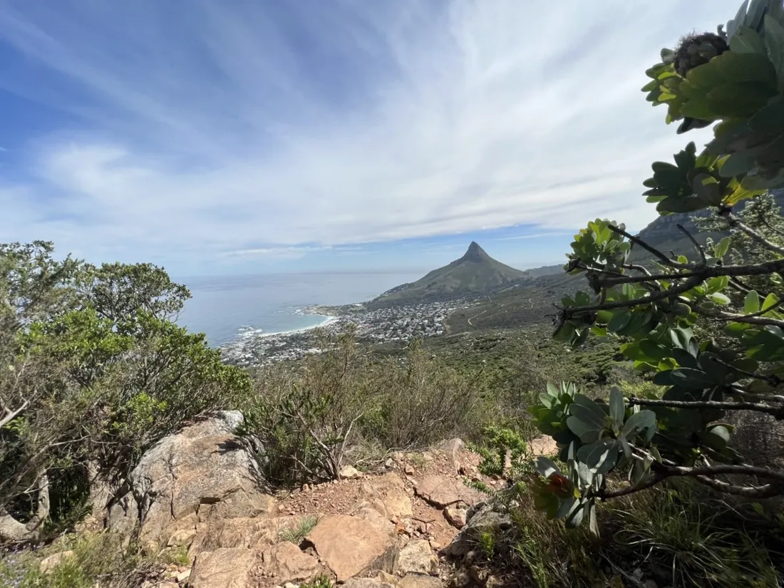
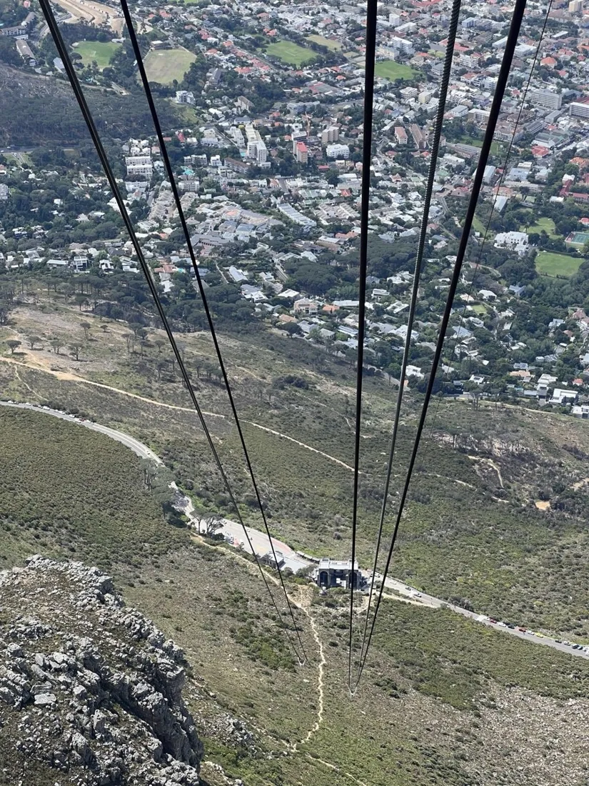
Table Mountain National Park rises directly out of Cape Town, and the western routes above Camps Bay — Kasteelspoort and its neighbors — climb through fynbos vegetation found nowhere else on earth. October to April offers the most stable weather, but the famous 'tablecloth' cloud can form in under an hour at any season; carrying a recorded track of your ascent route is genuinely useful, and locals advise hiking in groups. The cableway offers a knee-saving descent from the plateau.
Get NomadTracks free on the App Store
More track stories
- Overlanding Namibia: 4,250 km from the Kalahari to the Kunene
- Mount Whitney in two days: 24 km to the roof of the Lower 48
- Grant Park, the Bean & the Museum Campus: a 10.5 km Chicago run
- A morning run through downtown Chicago: 9.7 km past Navy Pier and the lakefront
- Running Lincoln's Springfield: 8.8 km through the Illinois capital
- Dürrensee to the Drei Zinnen: a Dolomites classic
- Maurer Wald loop: a 9.7 km trail run on the edge of Vienna
- Camping Šobec and the birth of the Sava: a 7 km morning run
- Sailing the Šibenik archipelago: 69 nautical-style kilometers under sail
- Canoeing Caddo Lake: 9 km through a flooded cypress forest
- Mount Shasta mountain-bike loop: 28.6 km of volcano singletrack
- Lofoten lake hike: 9.6 km through Norway's green wilderness
- Cinder Cone, Lassen Volcanic NP: a 6 km climb up a perfect volcano
- Drakensberg amphitheatre: 13 km to the top of Tugela Falls
- The Olive Trail, Namib-Naukluft: 10.9 km through a desert canyon
- Mount St. Helens: 16 km through the blast zone to the viewpoints
- Double O Arch via Devils Garden: 12 km through Arches' fin country
- The everyday loop: 12 km of redwoods and fog above Redwood City
- Lake Tahoe rim ride: 28 km of singletrack above the blue
- Dewey Point in winter: 12 km on snowshoes to Yosemite's quiet rim
- Pinnacles High Peaks loop: 12 km among the condor spires
- Golden Canyon to Zabriskie badlands: 6 km below sea level
- Hoh Rain Forest: a 4 km walk through the moss cathedral
- Oahu waterfall trail: 5 km of mud, roots and jungle
- Riding to Lake Helen: 17 km up a closed park road through the snow
- Phillips Cave: a 6.5 km walk to Namibia's White Elephant rock art
- Koiimasis: 9 km through the granite of the Tiras Mountains
- Cathedral Gorge: a short ride through Nevada's clay cathedral
- Riding Black Rock City: the GPS trace of a city that doesn't exist
- Peekaboo Loop, Bryce Canyon: 15 km among the hoodoos