Canoeing · Caddo Lake, Texas, USA · recorded with NomadTracks
Canoeing Caddo Lake: 9 km through a flooded cypress forest
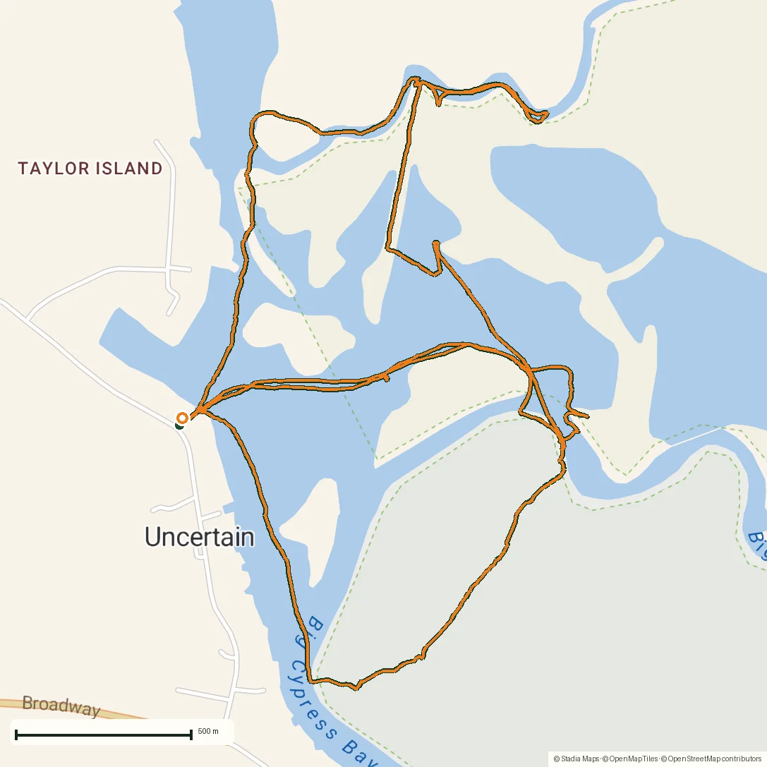
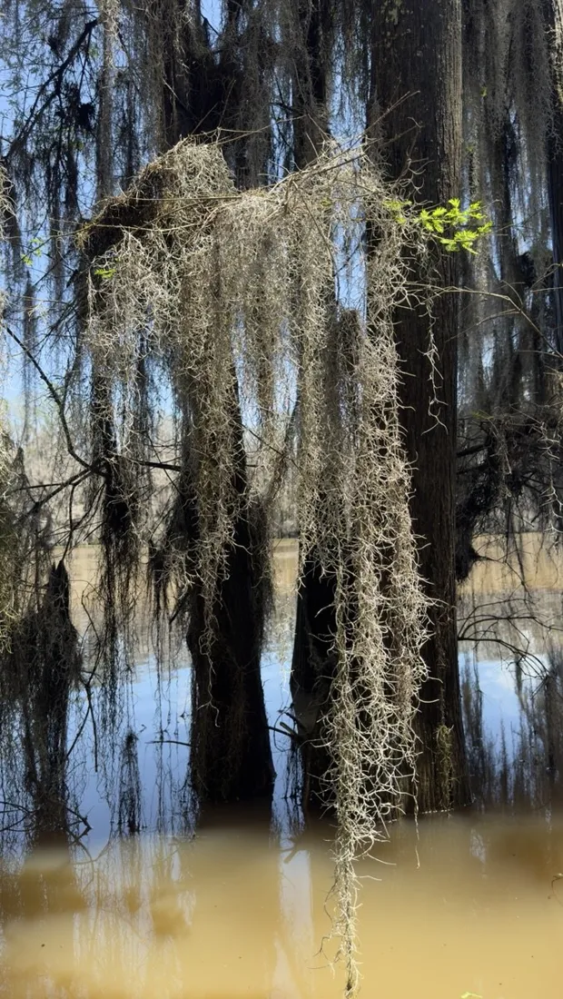
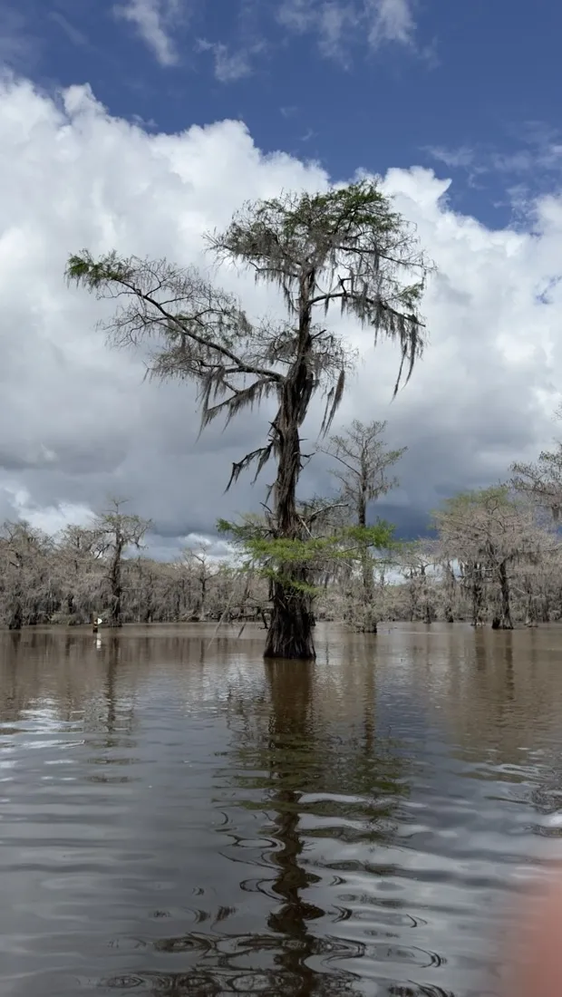
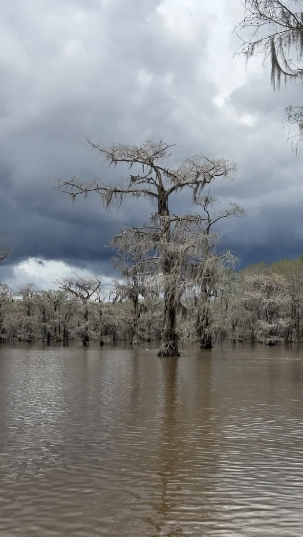
Caddo Lake is a labyrinth: thousands of bald cypresses standing in dark water, every channel looking like the last one. This 9 km paddle wanders deep into the maze — exactly the kind of place where a recorded track stops being a souvenir and becomes navigation.
About this data: this track and its photos were personally shared with us as samples by a NomadTracks user. NomadTracks never uploads, collects or shares your tracks or photos — your recordings stay on your devices and in your own cloud.
Download GPX Coordinates, elevation and relative times — recording dates are normalized out, photos not included.

A maze with no landmarks
On Caddo, GPS isn't a gadget, it's the way back. The boat lanes are marked, but one wrong gap between trees and the marks are gone. The live track line means your wake is always drawn on the map — turning around is following your own orange line home.
Quiet-water recording
A canoe track has no road network to lean on, so the raw GPS quality matters. The recorded line stays clean between the trees, and the speed chart afterwards is a meditation log: 4 km/h, herons, silence.
About the place: Caddo Lake, Texas, USA
Caddo Lake straddles the Texas–Louisiana border near the village of Uncertain, Texas, and is the largest bald-cypress forest in the world. Marked paddling trails thread the flooded forest, but side channels multiply endlessly — a GPS track is the practical difference between exploring and getting genuinely lost. Spring brings high water and nesting herons; autumn turns the cypress needles rust-orange.
Get NomadTracks free on the App Store
More track stories
- Overlanding Namibia: 4,250 km from the Kalahari to the Kunene
- Mount Whitney in two days: 24 km to the roof of the Lower 48
- Grant Park, the Bean & the Museum Campus: a 10.5 km Chicago run
- A morning run through downtown Chicago: 9.7 km past Navy Pier and the lakefront
- Running Lincoln's Springfield: 8.8 km through the Illinois capital
- Camps Bay to Table Mountain: the steep way up Cape Town's icon
- Dürrensee to the Drei Zinnen: a Dolomites classic
- Maurer Wald loop: a 9.7 km trail run on the edge of Vienna
- Camping Šobec and the birth of the Sava: a 7 km morning run
- Sailing the Šibenik archipelago: 69 nautical-style kilometers under sail
- Mount Shasta mountain-bike loop: 28.6 km of volcano singletrack
- Lofoten lake hike: 9.6 km through Norway's green wilderness
- Cinder Cone, Lassen Volcanic NP: a 6 km climb up a perfect volcano
- Drakensberg amphitheatre: 13 km to the top of Tugela Falls
- The Olive Trail, Namib-Naukluft: 10.9 km through a desert canyon
- Mount St. Helens: 16 km through the blast zone to the viewpoints
- Double O Arch via Devils Garden: 12 km through Arches' fin country
- The everyday loop: 12 km of redwoods and fog above Redwood City
- Lake Tahoe rim ride: 28 km of singletrack above the blue
- Dewey Point in winter: 12 km on snowshoes to Yosemite's quiet rim
- Pinnacles High Peaks loop: 12 km among the condor spires
- Golden Canyon to Zabriskie badlands: 6 km below sea level
- Hoh Rain Forest: a 4 km walk through the moss cathedral
- Oahu waterfall trail: 5 km of mud, roots and jungle
- Riding to Lake Helen: 17 km up a closed park road through the snow
- Phillips Cave: a 6.5 km walk to Namibia's White Elephant rock art
- Koiimasis: 9 km through the granite of the Tiras Mountains
- Cathedral Gorge: a short ride through Nevada's clay cathedral
- Riding Black Rock City: the GPS trace of a city that doesn't exist
- Peekaboo Loop, Bryce Canyon: 15 km among the hoodoos