Overlanding · Namibia · recorded with NomadTracks
Overlanding Namibia: 4,250 km from the Kalahari to the Kunene
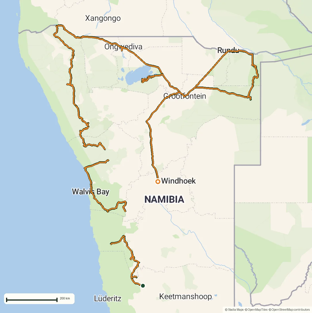
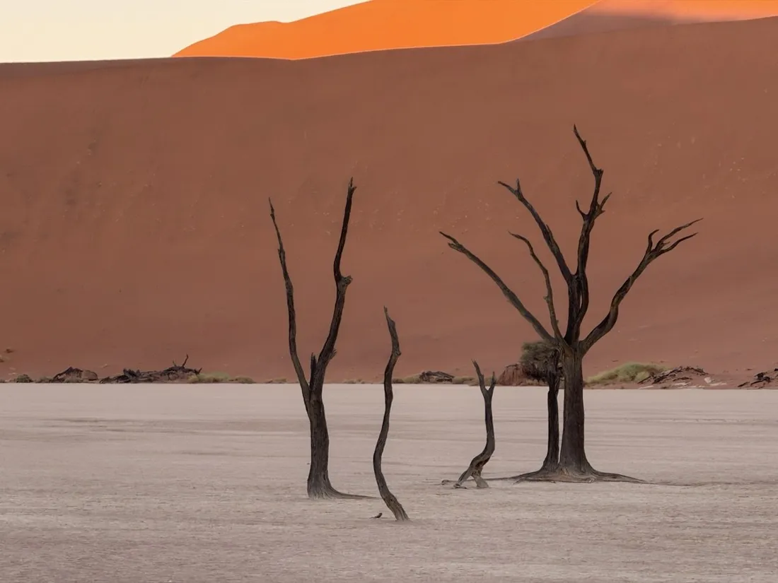
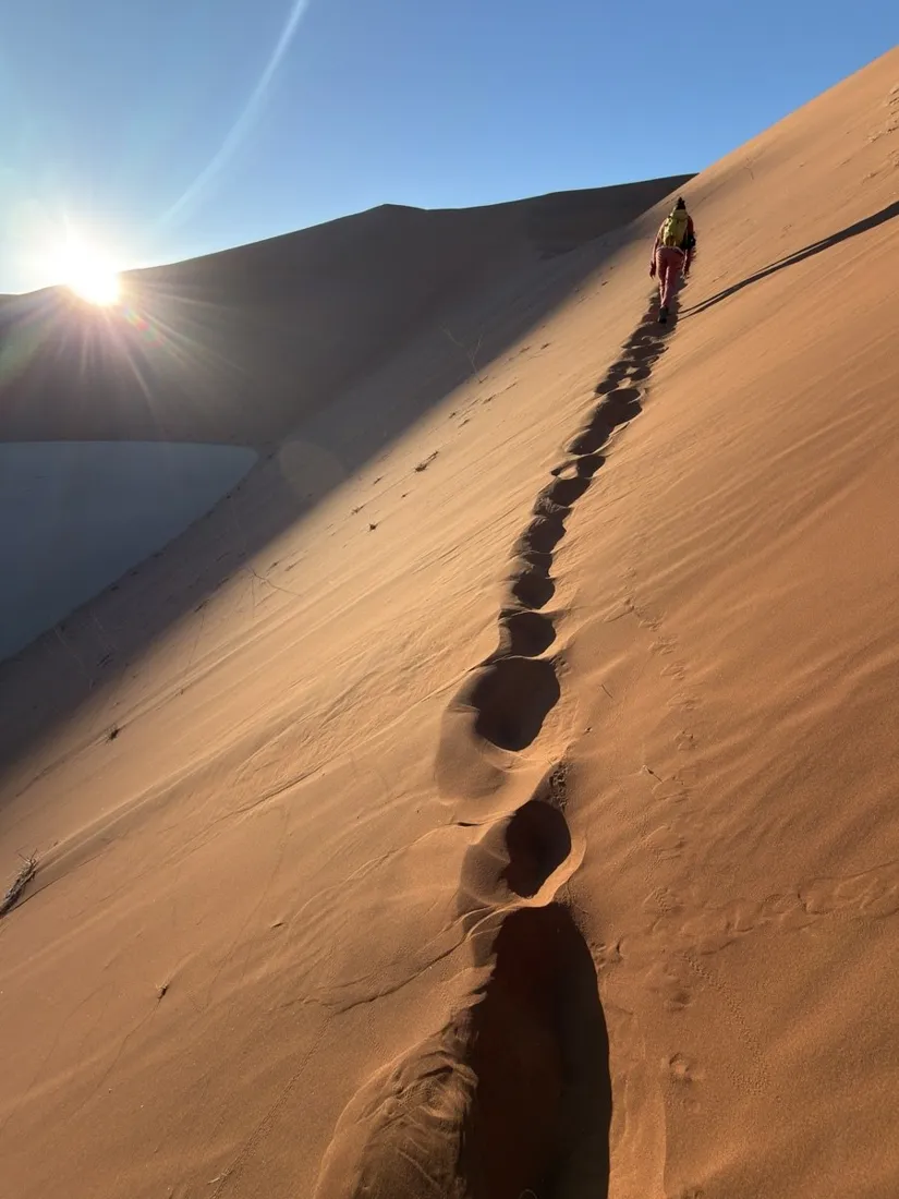
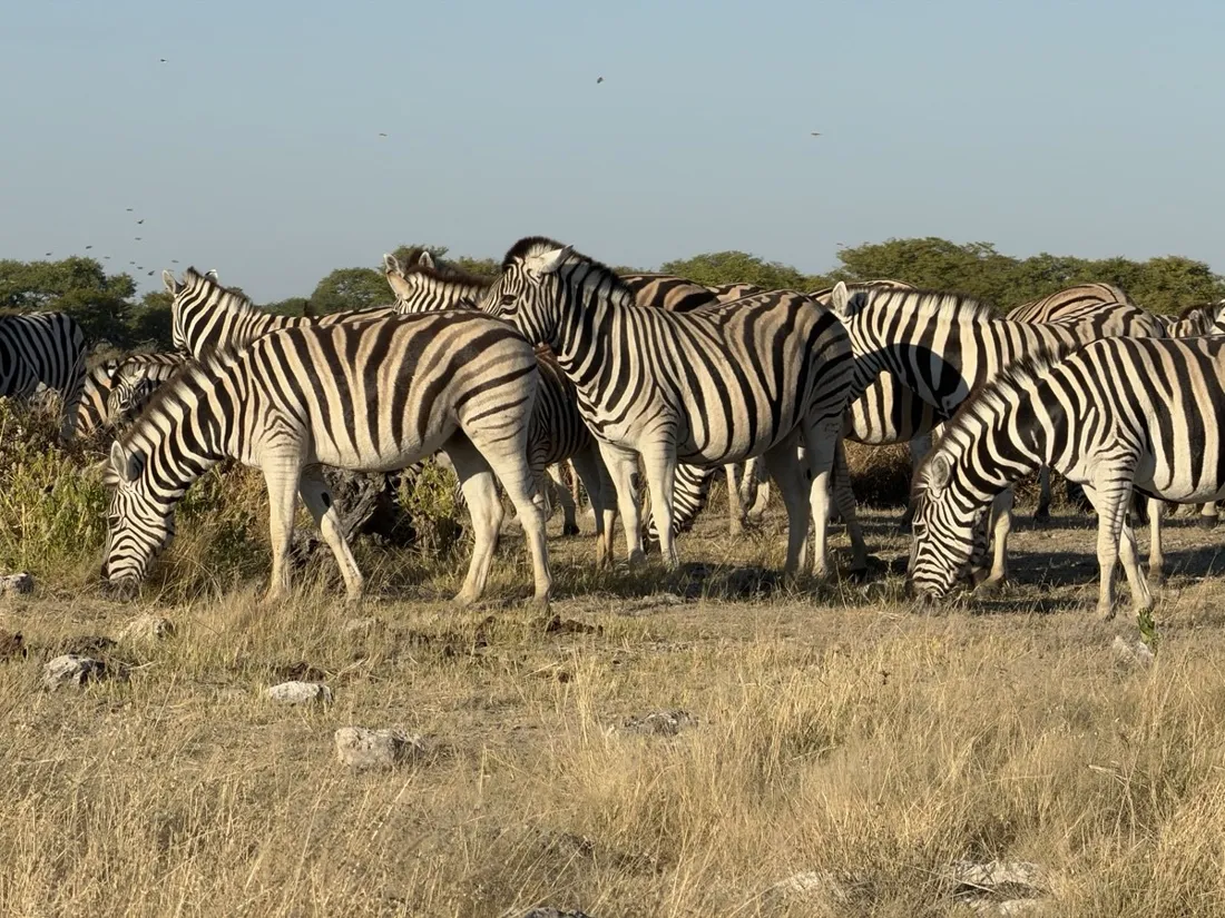
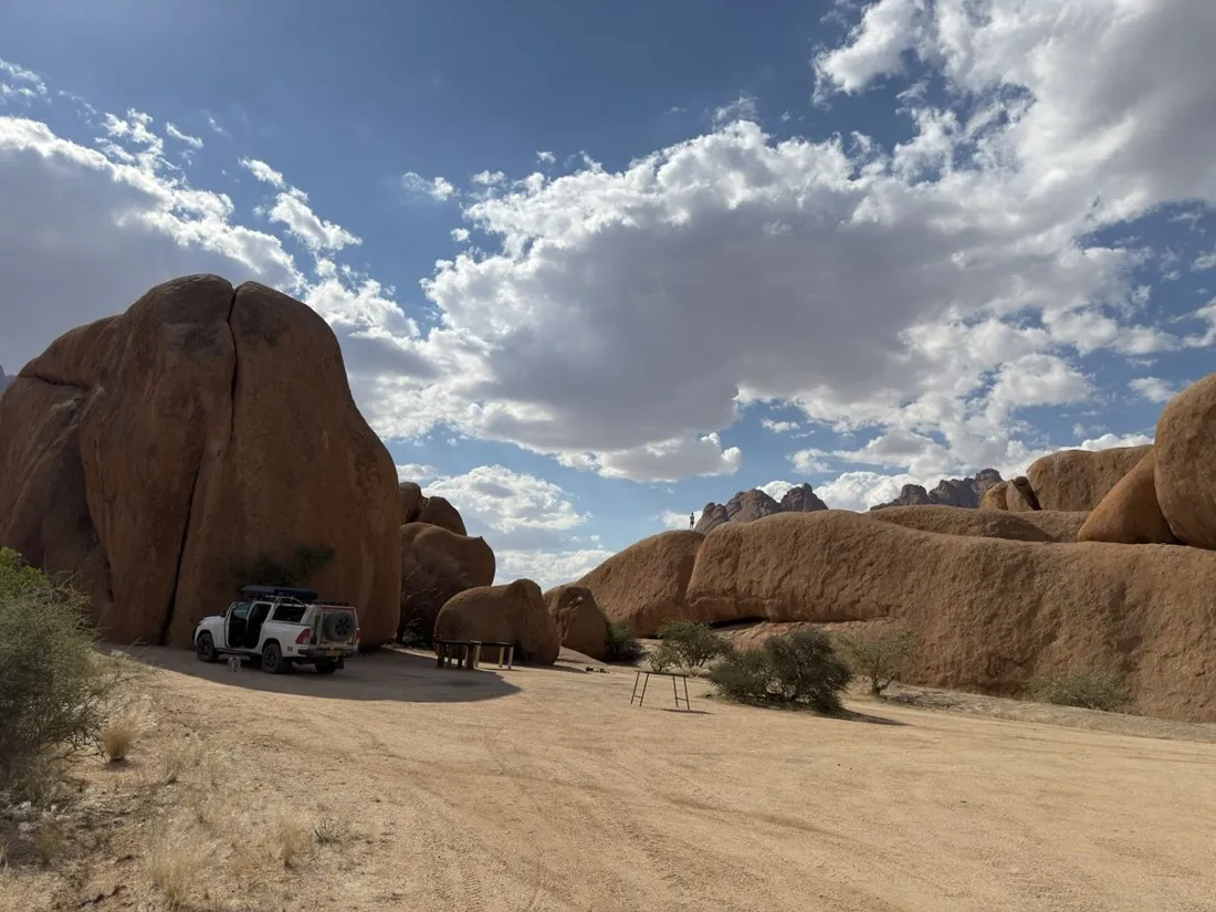
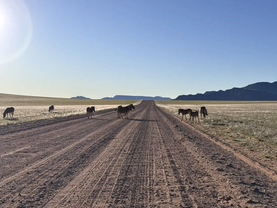
Twenty legs, three weeks, about 4,250 kilometers — this is the GPS diary of a full Namibia overlanding loop, recorded entirely with NomadTracks running on an iPhone mounted in a 4x4. From the red dunes of Sossusvlei over the granite domes of Spitzkoppe, along the Skeleton Coast to Kaokoland and the Epupa Falls, through Etosha and into the deep sand of Khaudum National Park.
Every leg is its own track with full elevation data; together they draw the whole expedition. The paper park maps for Etosha and Khaudum rode along as georeferenced overlays, so even where the road net thins to two sand ruts there was always a live position on the right map.
About this data: this track and its photos were personally shared with us as samples by a NomadTracks user. NomadTracks never uploads, collects or shares your tracks or photos — your recordings stay on your devices and in your own cloud.
Download GPX Coordinates, elevation and relative times — recording dates are normalized out, photos not included.

Why a GPS diary matters out here
Namibia's magic is its emptiness — and that emptiness eats road signs. Out of mobile coverage for days, the recorded track becomes your breadcrumb trail: you always know which fork you actually took, how far the last waterhole is behind you, and how the day's 400 km actually unfolded. The live Lock-Screen stats made fuel planning trivial: distance done, distance left, moving average.
Custom maps over empty basemaps
Standard map apps show Khaudum as a green void. The trick: photograph the park's paper map at the gate, set four control points in NomadTracks, and from then on your blue dot moves across the ranger map — campsites, waterholes and all. That single feature is why this app rode shotgun for three weeks.
The numbers
About 4,250 km of driving across 20 recorded legs, from sea level on the Skeleton Coast to 1,900 m on the Khorixas passes. Longest single leg: 557 km to Tsumkwe. Each leg keeps its own elevation, speed and time profile in the library — and exports as GPX for the next traveler.
About the place: Namibia
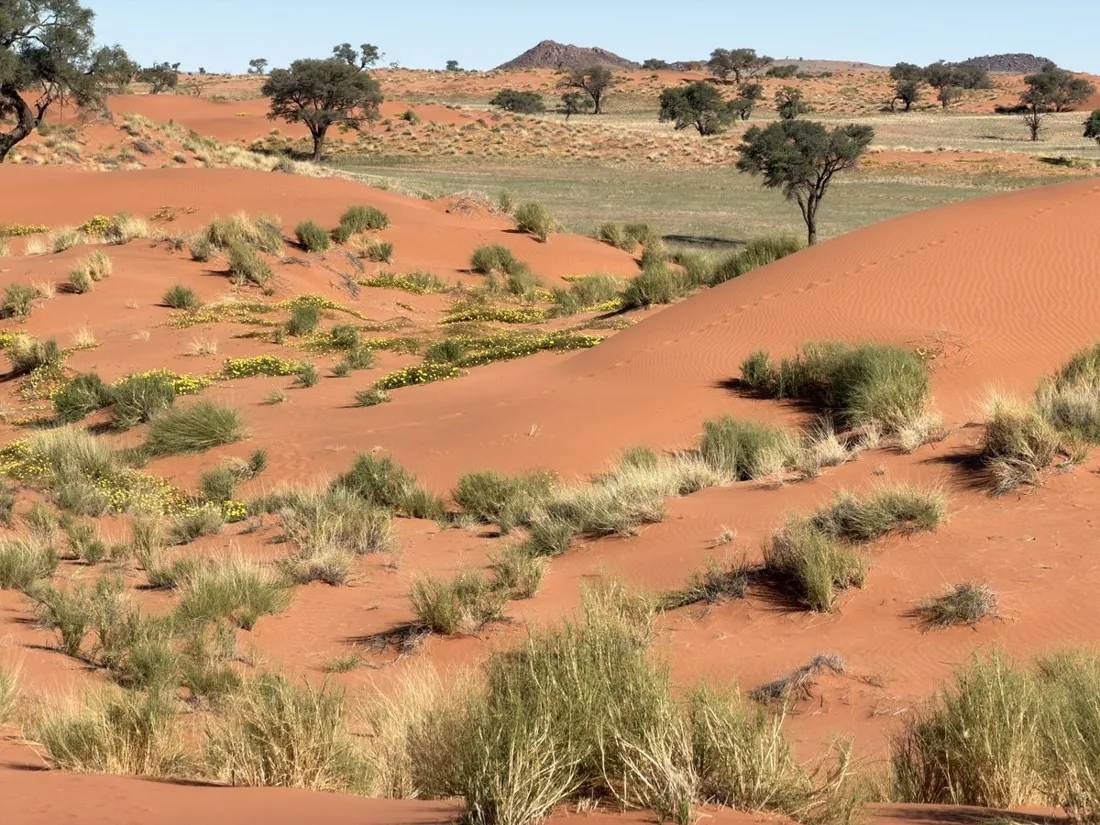
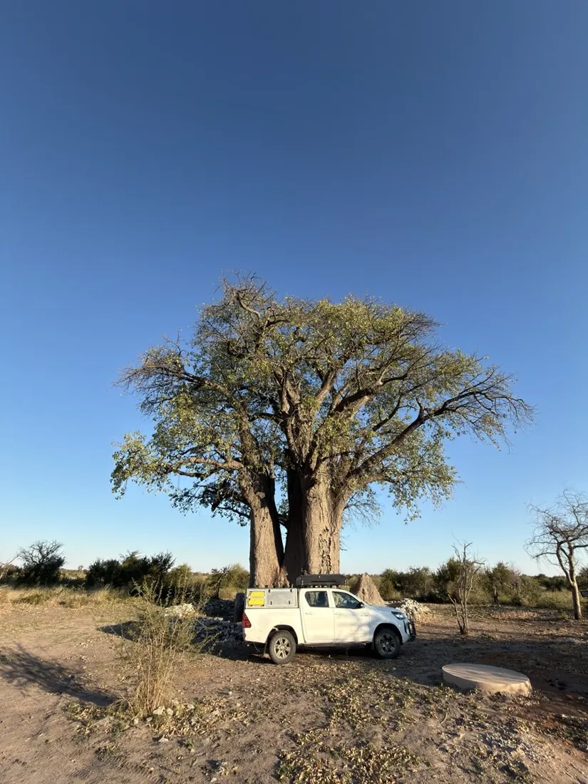
Namibia is overlanding country like almost nowhere else: a sparse network of well-graded gravel C- and D-roads connects Sossusvlei's red dunes, the Skeleton Coast, the granite of Spitzkoppe, Etosha's salt pan and the deep-sand tracks of Khaudum National Park. The dry winter months from May to September offer mild days, cold clear nights and the best wildlife viewing at waterholes; a 4x4 with long-range fuel and two spare tires is the standard setup, and distances between fuel stops routinely exceed 300 km.

Get NomadTracks free on the App Store
More track stories
- Mount Whitney in two days: 24 km to the roof of the Lower 48
- Grant Park, the Bean & the Museum Campus: a 10.5 km Chicago run
- A morning run through downtown Chicago: 9.7 km past Navy Pier and the lakefront
- Running Lincoln's Springfield: 8.8 km through the Illinois capital
- Camps Bay to Table Mountain: the steep way up Cape Town's icon
- Dürrensee to the Drei Zinnen: a Dolomites classic
- Maurer Wald loop: a 9.7 km trail run on the edge of Vienna
- Camping Šobec and the birth of the Sava: a 7 km morning run
- Sailing the Šibenik archipelago: 69 nautical-style kilometers under sail
- Canoeing Caddo Lake: 9 km through a flooded cypress forest
- Mount Shasta mountain-bike loop: 28.6 km of volcano singletrack
- Lofoten lake hike: 9.6 km through Norway's green wilderness
- Cinder Cone, Lassen Volcanic NP: a 6 km climb up a perfect volcano
- Drakensberg amphitheatre: 13 km to the top of Tugela Falls
- The Olive Trail, Namib-Naukluft: 10.9 km through a desert canyon
- Mount St. Helens: 16 km through the blast zone to the viewpoints
- Double O Arch via Devils Garden: 12 km through Arches' fin country
- The everyday loop: 12 km of redwoods and fog above Redwood City
- Lake Tahoe rim ride: 28 km of singletrack above the blue
- Dewey Point in winter: 12 km on snowshoes to Yosemite's quiet rim
- Pinnacles High Peaks loop: 12 km among the condor spires
- Golden Canyon to Zabriskie badlands: 6 km below sea level
- Hoh Rain Forest: a 4 km walk through the moss cathedral
- Oahu waterfall trail: 5 km of mud, roots and jungle
- Riding to Lake Helen: 17 km up a closed park road through the snow
- Phillips Cave: a 6.5 km walk to Namibia's White Elephant rock art
- Koiimasis: 9 km through the granite of the Tiras Mountains
- Cathedral Gorge: a short ride through Nevada's clay cathedral
- Riding Black Rock City: the GPS trace of a city that doesn't exist
- Peekaboo Loop, Bryce Canyon: 15 km among the hoodoos