Hiking · Vorderberg, Gailtal, Austria · recorded with NomadTracks
Vorderberg to the Dellacher Alm: a wild 13 km off-trail climb in the Carnic Alps
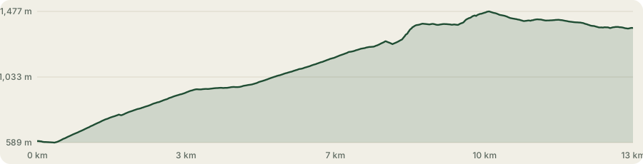
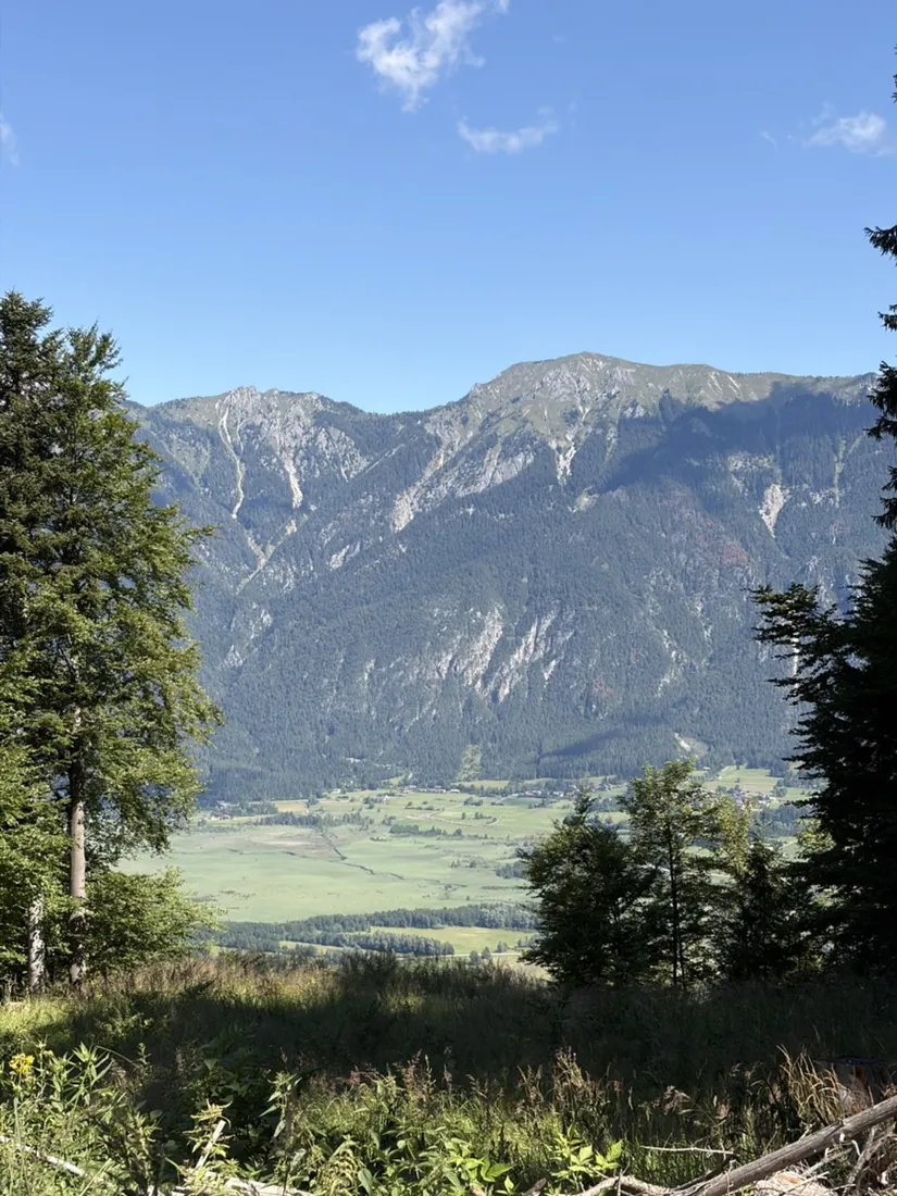
This is a recorded climb from the village of Vorderberg, at the southern edge of the lower Gailtal in Carinthia, up onto the north slope of the Carnic Alps — the range that carries Austria's border with Italy. It gains about 930 meters over roughly 13 kilometers, from the valley floor near 590 meters to the alpine pastures at almost 1,480 meters, and ends among the huts of the Dellacher Alm.
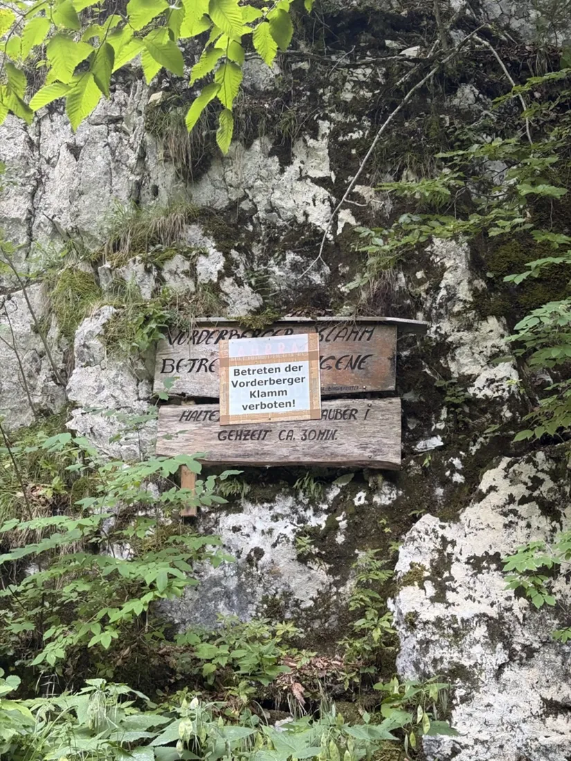
A warning up front: this is not a marked trail, and it is not a route to follow. Much of it crosses trackless forest, faint game paths and waist-high grass, and it starts beside the Vorderberger Klamm — a steep, water-filled gorge that is officially closed, with a “Betreten verboten” sign at its mouth. The recorded line is here as a story and a map of where one walker actually went, not as a recommendation. To reach these almen safely, use the marked approaches and the Eggeralm road instead.
About this data: this track and its photos were personally shared with us as samples by a NomadTracks user. NomadTracks never uploads, collects or shares your tracks or photos — your recordings stay on your devices and in your own cloud.

Download GPX Coordinates, elevation and relative times — recording dates are normalized out, photos not included.
A route to look at, not to follow
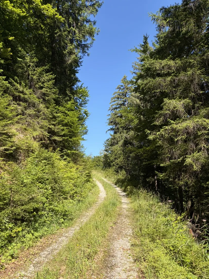
The track begins at Vorderberg and climbs almost at once off the beaten path. Below the first slopes lies the Vorderberger Klamm, a narrow gorge cut by the Vorderberger Bach and protected as a geopoint of the Geopark Karnische Alpen; it draws canyoners, but for walkers it is signed shut — the “Betreten der Vorderberger Klamm verboten!” notice in the photos is at the start. From there the recorded line works up through forest and open pasture on unmarked ground: forest roads that peter out, faint traces between the trees, and long stretches of high summer grass. There is real risk of losing the way and of steep, loose terrain. Please treat this page as the record of one ascent, not as a guide.
The almen of the Carnic north slope
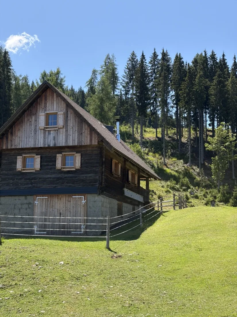
The reward at the top is a string of classic Carinthian almen — high summer pastures dotted with old wooden huts. The route passes the Latschacher Alm and reaches the Dellacher Alm, both on the north flank of the Carnic main ridge near the Poludnig. This whole shoulder is alm country: the neighbouring Egger Alm, with its small lake and its homecomers' chapel, sits at the same height, and the pastures are linked by the panoramic Eggeralm road and the eastern Karnischer Höhenweg (Carnic High Trail).
The Dellacher Alm: an Almdorf of 36 huts
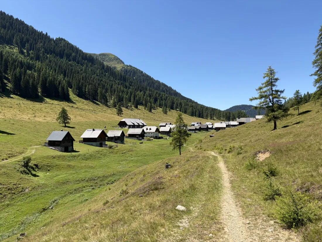
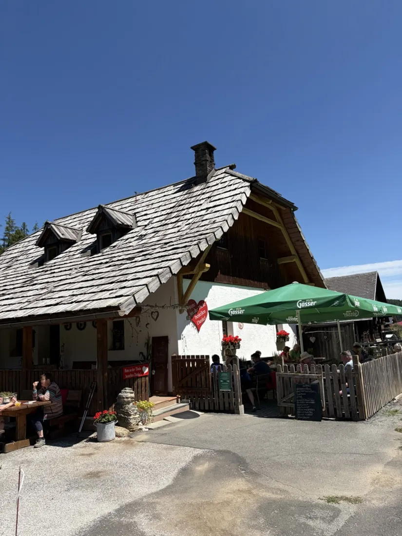
The Dellacher Alm is one of the larger alm villages in the area — around 36 shingle-roofed huts, some two dozen of them still let, scattered across open pasture at about 1,400 meters. It is a bewirtschaftete Alm: its Almgasthaus serves regional food and drink through the summer. On a clear day the huts, the larches and the rounded Carnic summits behind them make one of the most photogenic corners of the Gailtal, and it is where this recorded track ends.
Why record an off-trail line
Off-trail is exactly where a recorded track earns its keep. With no waymarks to follow, the GPS line is the only reliable account of where the route actually went — every turn through the trees, the true distance and climb, and the photos dropped onto the map exactly where they were taken. The elevation profile shows the shape of the day: a long, steady pull of some 900 meters from the valley to the pastures. The GPX downloads with coordinates and relative times — but read the warning above before you consider using it.
About the place: Vorderberg, Gailtal, Austria
The Dellacher Alm lies on the north slope of the Carnic Alps above Vorderberg in the lower Gailtal, in Carinthia near the Austria–Italy border. It is a large Almdorf — around 36 traditional shingle-roofed huts, some two dozen still let — on open summer pasture at about 1,400 meters, with a bewirtschaftete Almgasthaus, close to the Egger Alm and its lake and reachable by the panoramic Eggeralm road and the eastern Karnischer Höhenweg. The recorded climb up to it from Vorderberg is off-trail: it crosses trackless forest and high grass and passes the officially closed Vorderberger Klamm gorge — a route to read, not to follow.
Get NomadTracks free — iOS & Android
More track stories
- Overlanding Namibia: 4,250 km from the Kalahari to the Kunene
- Mount Whitney in two days: 24 km to the roof of the Lower 48
- Grant Park, the Bean & the Museum Campus: a 10.5 km Chicago run
- A morning run through downtown Chicago: 9.7 km past Navy Pier and the lakefront
- Running Lincoln's Springfield: 8.8 km through the Illinois capital
- Camps Bay to Table Mountain: the steep way up Cape Town's icon
- Dürrensee to the Drei Zinnen: a Dolomites classic
- Baleal: a 5.6 km morning run out to Peniche's old whaling island
- Sagres: a 4.8 km morning loop around the Algarve’s last headland
- Maurer Wald loop: a 9.7 km trail run on the edge of Vienna
- Camping Šobec and the birth of the Sava: a 7 km morning run
- The Slow Trail around the Pressegger See: a 5.7 km reed-belt loop
- Sailing the Šibenik archipelago: 69 nautical-style kilometers under sail
- Canoeing Caddo Lake: 9 km through a flooded cypress forest
- Mount Shasta mountain-bike loop: 28.6 km of volcano singletrack
- Lofoten lake hike: 9.6 km through Norway's green wilderness
- Cinder Cone, Lassen Volcanic NP: a 6 km climb up a perfect volcano
- Tugela Falls hike: Sentinel route, GPX and coordinates
- The Olive Trail, Namib-Naukluft: 10.9 km through a desert canyon
- Mount St. Helens: 16 km through the blast zone to the viewpoints
- Double O Arch via Devils Garden: 12 km through Arches' fin country
- The everyday loop: 12 km of redwoods and fog above Redwood City
- Lake Tahoe rim ride: 28 km of singletrack above the blue
- Dewey Point in winter: 12 km on snowshoes to Yosemite's quiet rim
- Pinnacles High Peaks loop: 12 km among the condor spires
- Golden Canyon to Zabriskie badlands: 6 km below sea level
- Hoh Rain Forest: a 4 km walk through the moss cathedral
- Oahu waterfall trail: 5 km of mud, roots and jungle
- Riding to Lake Helen: 17 km up a closed park road through the snow
- Phillips Cave: a 6.5 km walk to Namibia's White Elephant rock art
- Koiimasis: 9 km through the granite of the Tiras Mountains
- Cathedral Gorge: a short ride through Nevada's clay cathedral
- Riding Black Rock City: the GPS trace of a city that doesn't exist
- Peekaboo Loop, Bryce Canyon: 15 km among the hoodoos
- Steinhof and the golden dome: a 9.7 km evening run in Vienna
- Wilhelminenberg by evening: a 10.2 km run over Vienna’s western hills