Running · Sagres, Vila do Bispo, Portugal · recorded with NomadTracks
Sagres: a 4.8 km morning loop around the Algarve’s last headland
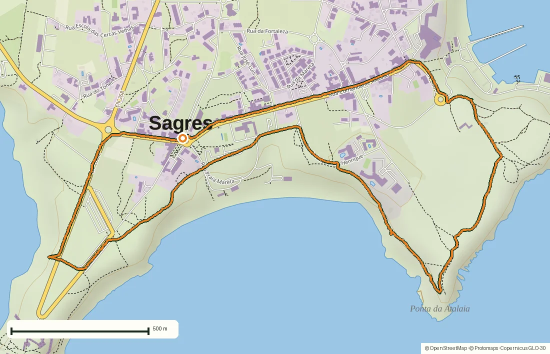
Sagres sits on a blunt limestone promontory at the southwestern end of the Algarve, where Portugal stops being a coastline and becomes a corner. This is a 4.8-kilometer loop around that headland, run at eight on an August morning before the wind got up.
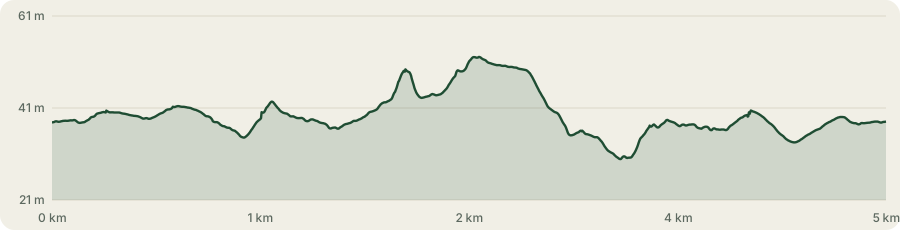
Thirty-three minutes, 29 meters of climbing, never more than about fifty meters above the sea — town streets, a clifftop road and bare limestone. A flat run with an absurd amount of coast in it.
About this data: this track and its photos were personally shared with us as samples by a NomadTracks user. NomadTracks never uploads, collects or shares your tracks or photos — your recordings stay on your devices and in your own cloud.
Download GPX Coordinates, elevation and relative times — recording dates are normalized out, photos not included.
Three coasts in five kilometres
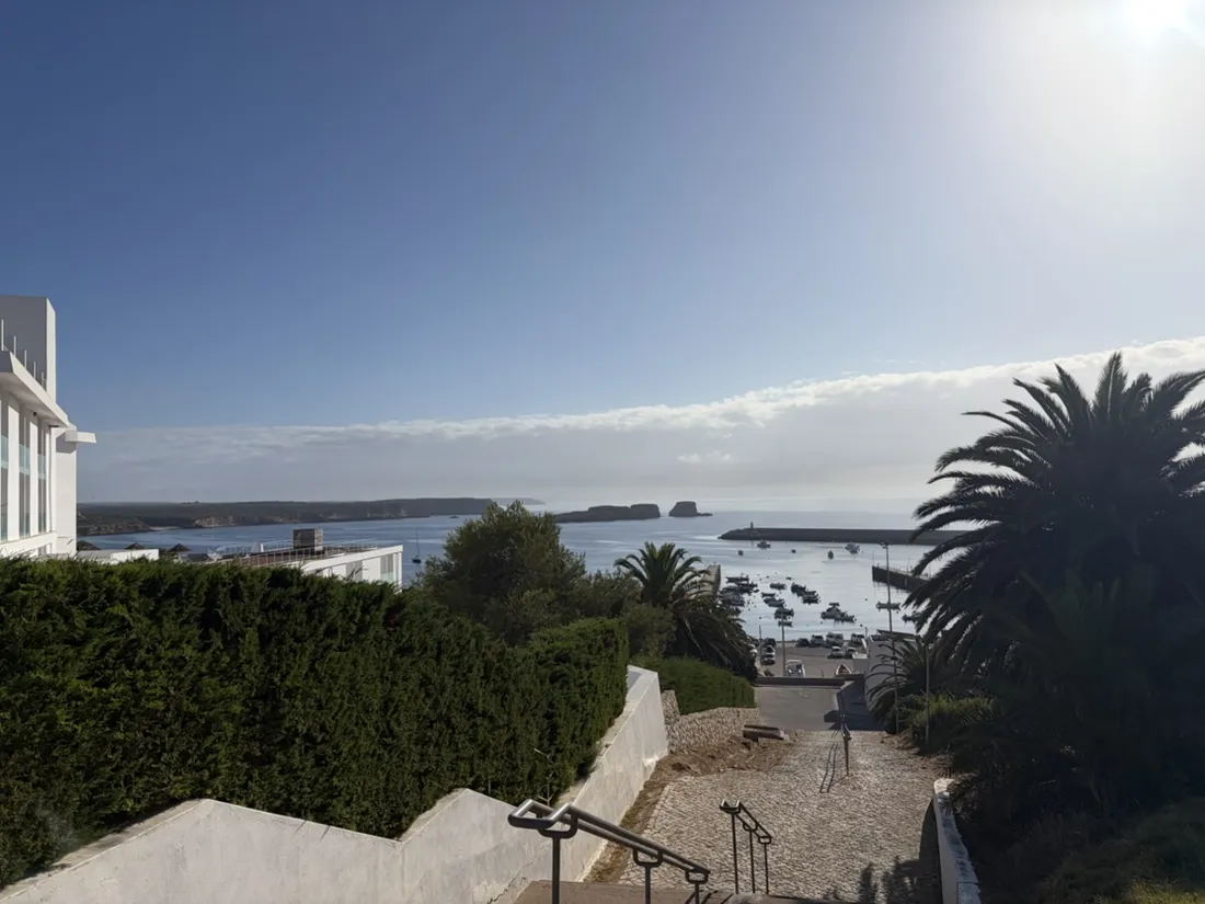
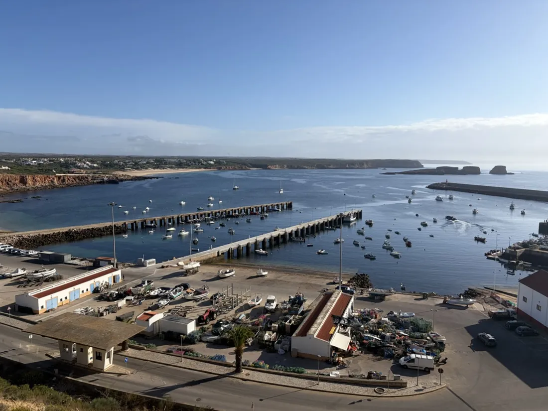
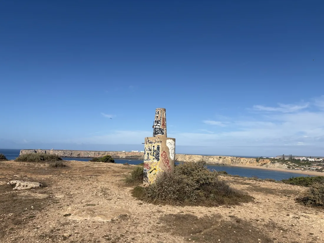
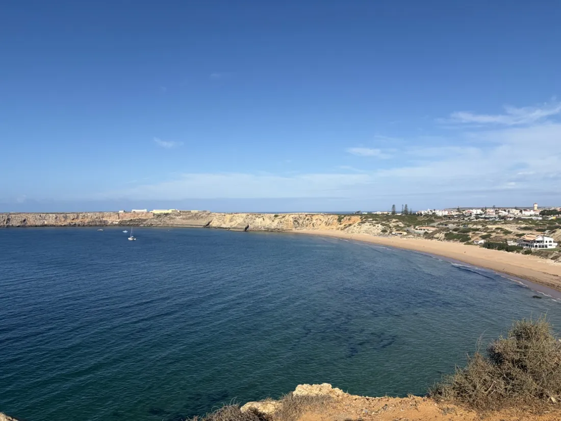
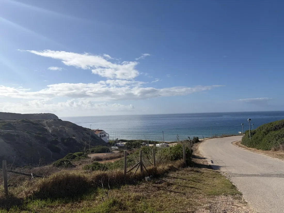
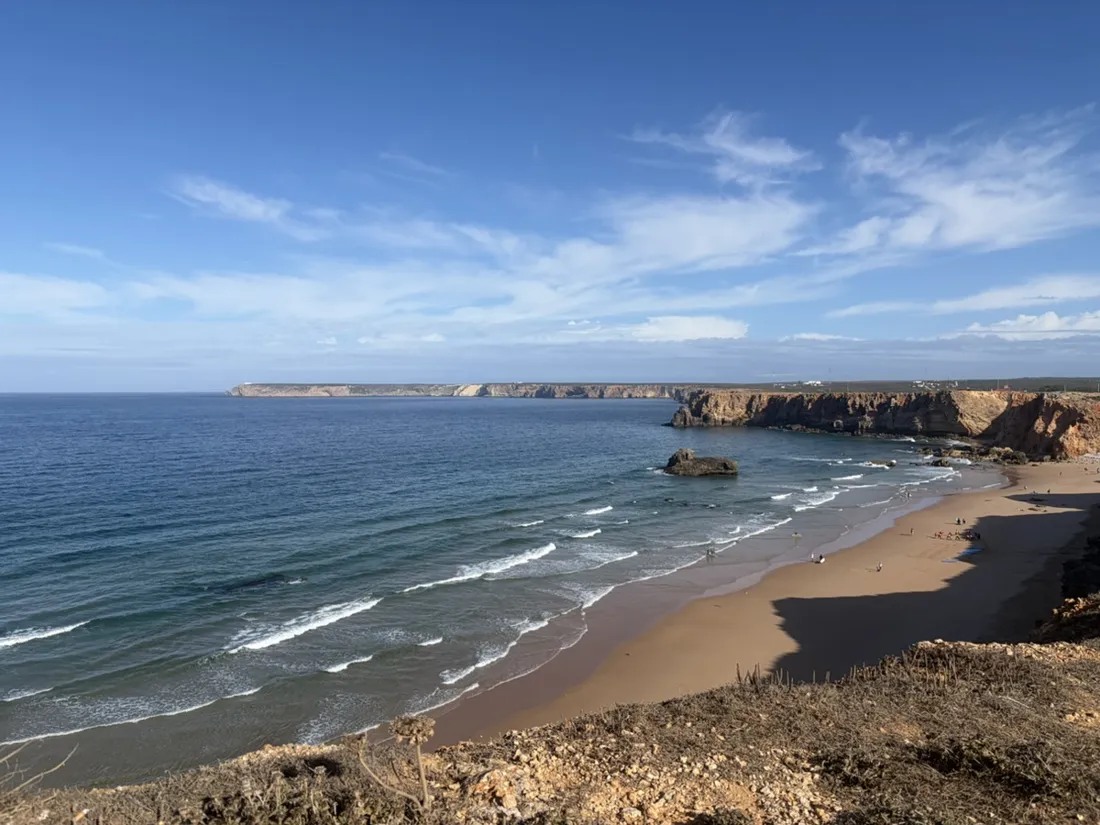
The promontory points south, so the sea is on three sides of it and the loop meets all three in turn. East first, above Porto da Baleeira and its working fishing fleet, looking out to the Martinhal islets. Then south along the cliff edge, where the ground goes bare and rocky and Praia da Mareta opens below in the sheltered bay. Then west, out to the plateau above Praia do Tonel, which faces straight into the Atlantic and looks it. Same run, three completely different bodies of water.
Why the beaches face different ways
That geometry is the whole point of Sagres for anyone who swims or surfs. Mareta faces south and is semi-sheltered; Tonel faces west and gets pounded, particularly in winter. When the wind ruins one, the other is usually workable — the walk between them is about ten minutes, and this run does it in three. The recorded line makes the trade-off legible: the sheltered side and the exposed side are barely a kilometre apart on the map.
The fortress on the skyline
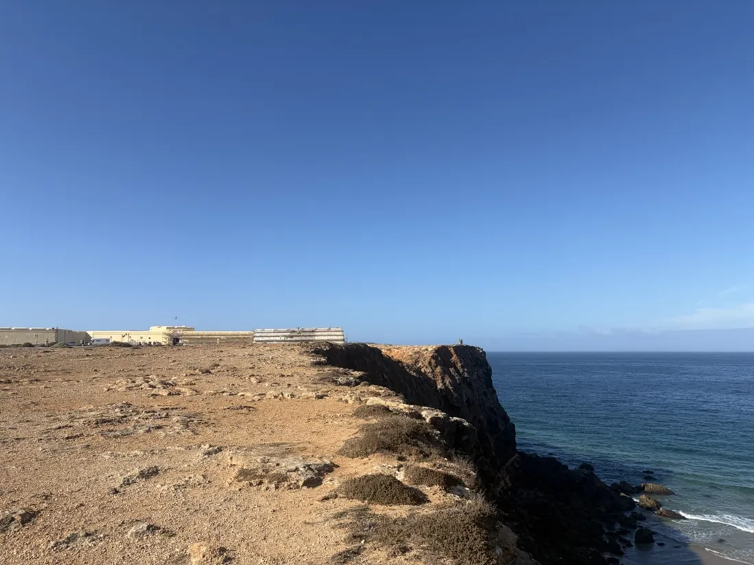
The long low wall visible from the western plateau is the Fortaleza de Sagres, which closes off the tip of the promontory. Inside it lies the Rosa dos Ventos, a stone circle 43 metres across, uncovered by excavation in 1919 and still unexplained — compass rose, sundial, or something else entirely. It is popularly tied to Henry the Navigator’s “school of navigation” here, though historians now treat the campus-with-a-faculty version as later legend rather than documented fact, and the paving itself is unlikely to be that old.
A flat run that is not a boring one
Twenty-nine meters of climbing over five kilometres is nothing — the elevation profile is almost a straight line. What the recording actually captures is the pace: steady through the streets, then a slow drift as the clifftop sections open up and the running turns into stopping to look. Eleven photographs in thirty-three minutes is not a tempo run. It is the correct way to run somewhere for the first time.
About the place: Sagres, Vila do Bispo, Portugal
Sagres is the westernmost village of the Algarve, in the municipality of Vila do Bispo, about a hundred kilometres west of Faro. Four beaches sit within walking distance of the centre — Mareta, Tonel, Baleeira and Martinhal — on three sides of the promontory, and the whole coast belongs to the Parque Natural do Sudoeste Alentejano e Costa Vicentina, which is why the cliffs are still empty. Six kilometres west is Cabo de São Vicente, the actual southwestern corner of mainland Europe, which the Romans called the Promontorium Sacrum. It is a famously windy, bare, un-Algarve-like place: no resort strip, a working fishing harbour, and surfers who come precisely because the swell here is not the gentle kind.
What the recording is good for
A first morning in a new place is exactly when a track is worth having. The saved line shows which streets actually connect to the cliff path, the photos sit on the map where the views were, and the GPX makes the loop repeatable at the same hour tomorrow — or bookmarks it for a return trip, which, given the name this file arrived under, is evidently the plan.
Get NomadTracks free — iOS & Android
More track stories
- Overlanding Namibia: 4,250 km from the Kalahari to the Kunene
- Mount Whitney in two days: 24 km to the roof of the Lower 48
- Grant Park, the Bean & the Museum Campus: a 10.5 km Chicago run
- A morning run through downtown Chicago: 9.7 km past Navy Pier and the lakefront
- Running Lincoln's Springfield: 8.8 km through the Illinois capital
- Camps Bay to Table Mountain: the steep way up Cape Town's icon
- Dürrensee to the Drei Zinnen: a Dolomites classic
- Baleal: a 5.6 km morning run out to Peniche's old whaling island
- Maurer Wald loop: a 9.7 km trail run on the edge of Vienna
- Camping Šobec and the birth of the Sava: a 7 km morning run
- The Slow Trail around the Pressegger See: a 5.7 km reed-belt loop
- Vorderberg to the Dellacher Alm: a wild 13 km off-trail climb in the Carnic Alps
- Sailing the Šibenik archipelago: 69 nautical-style kilometers under sail
- Canoeing Caddo Lake: 9 km through a flooded cypress forest
- Mount Shasta mountain-bike loop: 28.6 km of volcano singletrack
- Lofoten lake hike: 9.6 km through Norway's green wilderness
- Cinder Cone, Lassen Volcanic NP: a 6 km climb up a perfect volcano
- Tugela Falls hike: Sentinel route, GPX and coordinates
- The Olive Trail, Namib-Naukluft: 10.9 km through a desert canyon
- Mount St. Helens: 16 km through the blast zone to the viewpoints
- Double O Arch via Devils Garden: 12 km through Arches' fin country
- The everyday loop: 12 km of redwoods and fog above Redwood City
- Lake Tahoe rim ride: 28 km of singletrack above the blue
- Dewey Point in winter: 12 km on snowshoes to Yosemite's quiet rim
- Pinnacles High Peaks loop: 12 km among the condor spires
- Golden Canyon to Zabriskie badlands: 6 km below sea level
- Hoh Rain Forest: a 4 km walk through the moss cathedral
- Oahu waterfall trail: 5 km of mud, roots and jungle
- Riding to Lake Helen: 17 km up a closed park road through the snow
- Phillips Cave: a 6.5 km walk to Namibia's White Elephant rock art
- Koiimasis: 9 km through the granite of the Tiras Mountains
- Cathedral Gorge: a short ride through Nevada's clay cathedral
- Riding Black Rock City: the GPS trace of a city that doesn't exist
- Peekaboo Loop, Bryce Canyon: 15 km among the hoodoos
- Steinhof and the golden dome: a 9.7 km evening run in Vienna
- Wilhelminenberg by evening: a 10.2 km run over Vienna’s western hills