Running · Penzing, Vienna, Austria · recorded with NomadTracks
Steinhof and the golden dome: a 9.7 km evening run in Vienna
Not every recorded track needs a mountain. This one is a 9.7-kilometer running loop that never leaves Vienna’s 14th district — an early-September evening, 103 meters of climbing, from a brick parish church up to what is often called the first modern church in Europe, and back down again.
The clock says an hour and thirteen minutes, and it is honest about what kind of run this was: the route passes so much that the camera came out twenty-nine times. An ordinary home loop through a thoroughly extraordinary piece of city.
About this data: this track and its photos were personally shared with us as samples by a NomadTracks user. NomadTracks never uploads, collects or shares your tracks or photos — your recordings stay on your devices and in your own cloud.

Download GPX Coordinates, elevation and relative times — recording dates are normalized out, photos not included.

From Breitensee up to the Baumgartner Höhe
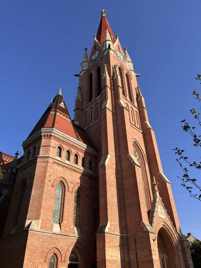
The loop starts on Kendlergasse in Breitensee, a few steps from the parish church — a neo-Gothic brick building by Ludwig Zatzka, finished in 1898 and consecrated in the presence of Emperor Franz Joseph I. From there the route runs west along Breitenseer Straße and then climbs, steadily and without any drama at all, for about four kilometers. The elevation profile is the honest picture of it: 239 m at the start, 322 m at the top, nothing steeper than an ordinary Viennese side street. The high point of this run is not a summit. It is a church door.
Otto Wagner’s church, at the top of the hill
The Kirche am Steinhof — properly the church of St. Leopold — was built between 1904 and 1907 to Otto Wagner’s design and is widely regarded as the first modern church in Europe. It stands on the highest ground of what was then a brand-new psychiatric hospital, and it was designed around the people who would use it: the floor slopes so it can be washed down, the pews have rounded corners, the holy water drips rather than standing in a basin. Outside, the walls are thin marble slabs pinned to brick with copper bolts — the same construction Wagner used on the Postsparkasse — and above them sits the dome that gave the hill its nickname. From a distance the gilding looks like a halved lemon, which is why the Baumgartner Höhe is known locally as the Lemoniberg. The glass and mosaics are by Koloman Moser, the angels by Othmar Schimkowitz.
A campus in the middle of becoming something else
The grounds around the church are the reason to run this loop now rather than in five years. The hospital laid out across the hillside in some sixty Jugendstil pavilions closed as Klinik Penzing in the mid-2020s, and the site is being handed over: the Central European University moved its campus into the center of the areal from the 2025/26 winter semester, and the remaining pavilions are being restored under monument protection for teaching, science and culture. On the evening this track was recorded the banners for Parallel Vienna were already up — the contemporary art fair takes over four of the historic buildings each September, and it opened the following morning. Pavilions in scaffolding, pavilions full of galleries, pavilions still empty, all within a few hundred meters of each other. It is a strange and quiet place to run through at golden hour.
The memorial you should not run past
On the lawn in front of the Jugendstiltheater stand 772 slim steel steles, each about 80 cm high with a light at the top that comes on at dusk. Each one stands for a child. Between 1940 and 1945 the Nazi clinic Am Spiegelgrund operated on these grounds, and 772 children and young people were murdered in it, classified as “uneducable”. The steles are set in a rigid grid roughly 70 cm apart, and the spacing is the point — it is meant to show the absence of any freedom at all. It is a few minutes from the church, on the same hilltop. This is the one place on the loop where the right thing to do is stop running.
Down past the stadium and home
West of the grounds the route drops to its lowest point, 222 m, and runs along the fence of the Allianz Stadion, where SK Rapid Wien have played since 2016 — 24,000 seated, 28,600 with the standing terrace, and a training pitch right against the footpath. From there it is a straight line back east along Hütteldorfer Straße through Baumgarten and Breitensee, roughly four kilometers of ordinary Viennese street, to the point where it started.
Why record a run through your own city
Nothing on this route needed navigating. The recorded line does something else: 9.72 km, one hour and thirteen minutes door to door, 103 meters of climbing, and an elevation profile whose single peak is a church. City runs are the tracks people are least likely to save and the ones they most often want back later — the loop you take visitors on, the evening the light was right. The GPX below has the coordinates and relative times for anyone who wants to run the same circuit.
About the place: Penzing, Vienna, Austria
Penzing is Vienna’s 14th district, running west from the Gürtel out to the edge of the Wienerwald. Its high ground, the Baumgartner Höhe, carries the Otto-Wagner-Areal: around sixty Jugendstil pavilions built from 1904 to 1907 as the Lower Austrian sanatorium “am Steinhof”, with Otto Wagner’s church of St. Leopold on the summit — widely called the first modern church in Europe and one of the defining buildings of Viennese Jugendstil, its gilded dome visible from much of the city. The hospital closed as Klinik Penzing in the mid-2020s; the Central European University began moving in for the 2025/26 winter semester and the pavilions are being restored for university, cultural and scientific use, while the Parallel Vienna art fair occupies four of them each September. The same hilltop holds the memorial to the 772 children murdered at the Nazi clinic Am Spiegelgrund between 1940 and 1945. Downhill to the west, in Hütteldorf, stands the Allianz Stadion of SK Rapid Wien; downhill to the east lies Breitensee with Ludwig Zatzka’s neo-Gothic brick parish church of 1898. The whole loop is on paved street and park road — a city running route, not a trail.


Get NomadTracks free — iOS & Android
More track stories
- Overlanding Namibia: 4,250 km from the Kalahari to the Kunene
- Mount Whitney in two days: 24 km to the roof of the Lower 48
- Grant Park, the Bean & the Museum Campus: a 10.5 km Chicago run
- A morning run through downtown Chicago: 9.7 km past Navy Pier and the lakefront
- Running Lincoln's Springfield: 8.8 km through the Illinois capital
- Camps Bay to Table Mountain: the steep way up Cape Town's icon
- Dürrensee to the Drei Zinnen: a Dolomites classic
- Baleal: a 5.6 km morning run out to Peniche's old whaling island
- Sagres: a 4.8 km morning loop around the Algarve’s last headland
- Maurer Wald loop: a 9.7 km trail run on the edge of Vienna
- Camping Šobec and the birth of the Sava: a 7 km morning run
- The Slow Trail around the Pressegger See: a 5.7 km reed-belt loop
- Vorderberg to the Dellacher Alm: a wild 13 km off-trail climb in the Carnic Alps
- Sailing the Šibenik archipelago: 69 nautical-style kilometers under sail
- Canoeing Caddo Lake: 9 km through a flooded cypress forest
- Mount Shasta mountain-bike loop: 28.6 km of volcano singletrack
- Lofoten lake hike: 9.6 km through Norway's green wilderness
- Cinder Cone, Lassen Volcanic NP: a 6 km climb up a perfect volcano
- Tugela Falls hike: Sentinel route, GPX and coordinates
- The Olive Trail, Namib-Naukluft: 10.9 km through a desert canyon
- Mount St. Helens: 16 km through the blast zone to the viewpoints
- Double O Arch via Devils Garden: 12 km through Arches' fin country
- The everyday loop: 12 km of redwoods and fog above Redwood City
- Lake Tahoe rim ride: 28 km of singletrack above the blue
- Dewey Point in winter: 12 km on snowshoes to Yosemite's quiet rim
- Pinnacles High Peaks loop: 12 km among the condor spires
- Golden Canyon to Zabriskie badlands: 6 km below sea level
- Hoh Rain Forest: a 4 km walk through the moss cathedral
- Oahu waterfall trail: 5 km of mud, roots and jungle
- Riding to Lake Helen: 17 km up a closed park road through the snow
- Phillips Cave: a 6.5 km walk to Namibia's White Elephant rock art
- Koiimasis: 9 km through the granite of the Tiras Mountains
- Cathedral Gorge: a short ride through Nevada's clay cathedral
- Riding Black Rock City: the GPS trace of a city that doesn't exist
- Peekaboo Loop, Bryce Canyon: 15 km among the hoodoos
- Wilhelminenberg by evening: a 10.2 km run over Vienna’s western hills