Running · Ottakring, Vienna, Austria · recorded with NomadTracks
Wilhelminenberg by evening: a 10.2 km run over Vienna’s western hills
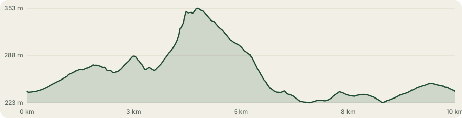
Vienna stops at a hill, and this is a 10.2-kilometre evening loop over it. Out of Penzing at 239 metres, up to 353 on the Wilhelminenberg, down through Ottakring to the lowest point at 223, and home: 171 metres of climbing, an hour and sixteen minutes, three Vienna districts on foot.
It is a run with a view in the middle of it — and with a great deal else on either side. The camera came out twenty times: a reservoir buried under a lawn, a palace on a hill that has two names because a prince ignored the authorities, a vineyard 350 metres above the Ringstraße, the largest municipal housing block of Red Vienna, and the oldest football pitch in Austria, five months after it reopened.
About this data: this track and its photos were personally shared with us as samples by a NomadTracks user. NomadTracks never uploads, collects or shares your tracks or photos — your recordings stay on your devices and in your own cloud.
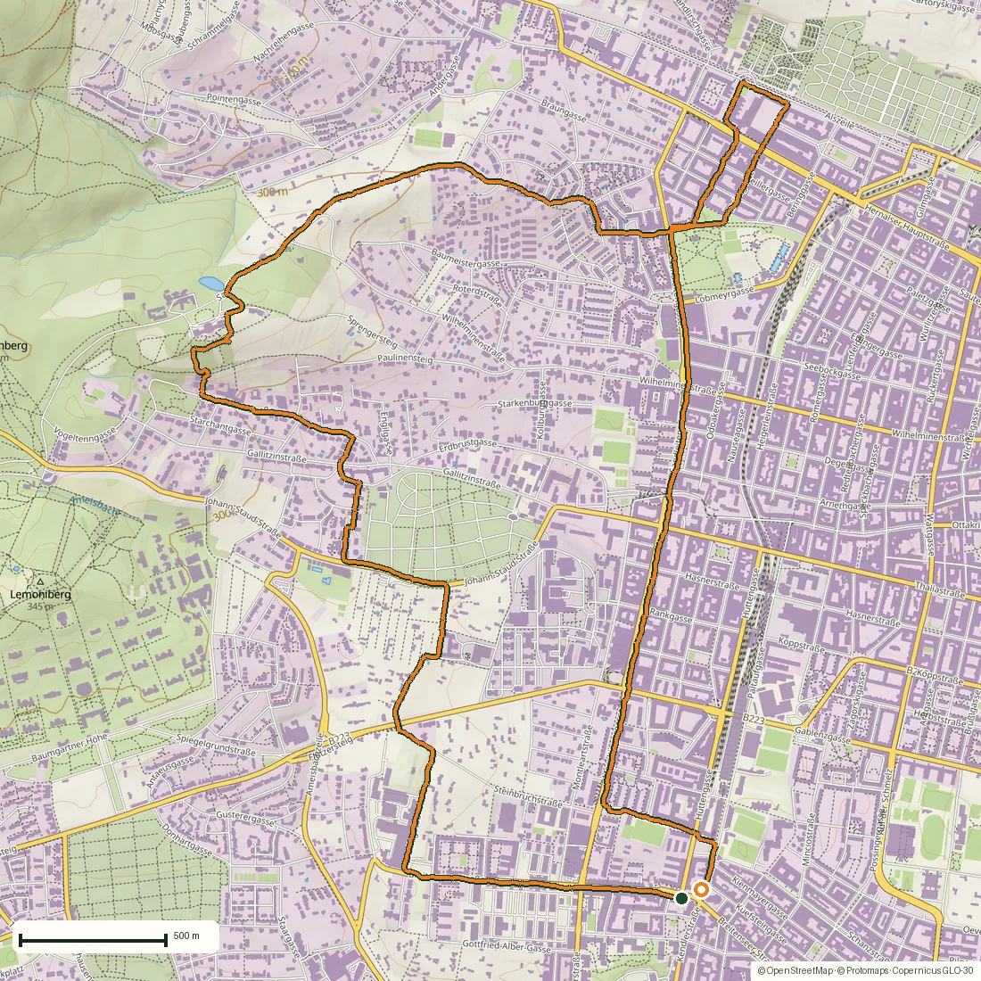
Download GPX Coordinates, elevation and relative times — recording dates are normalized out, photos not included.
Out of Penzing: a reservoir under the grass, then 88 steps
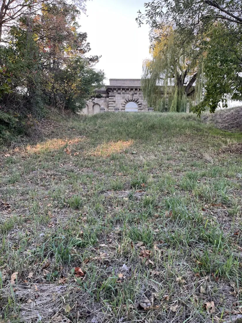
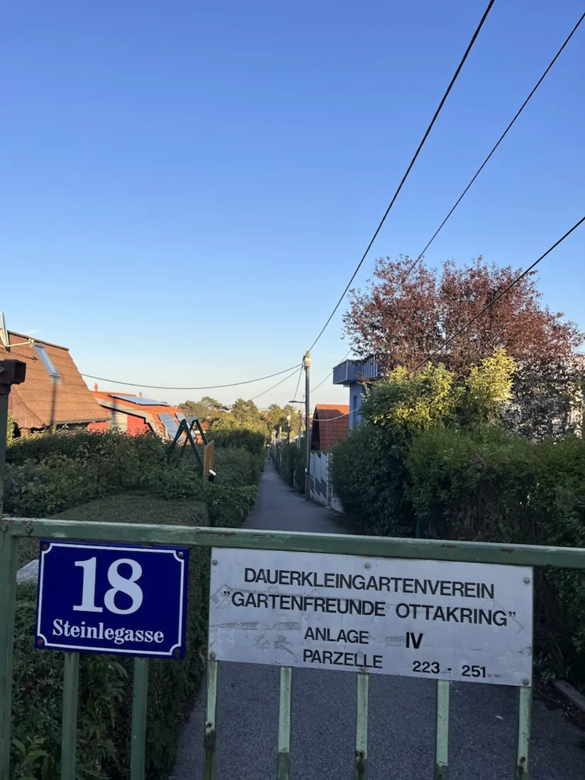
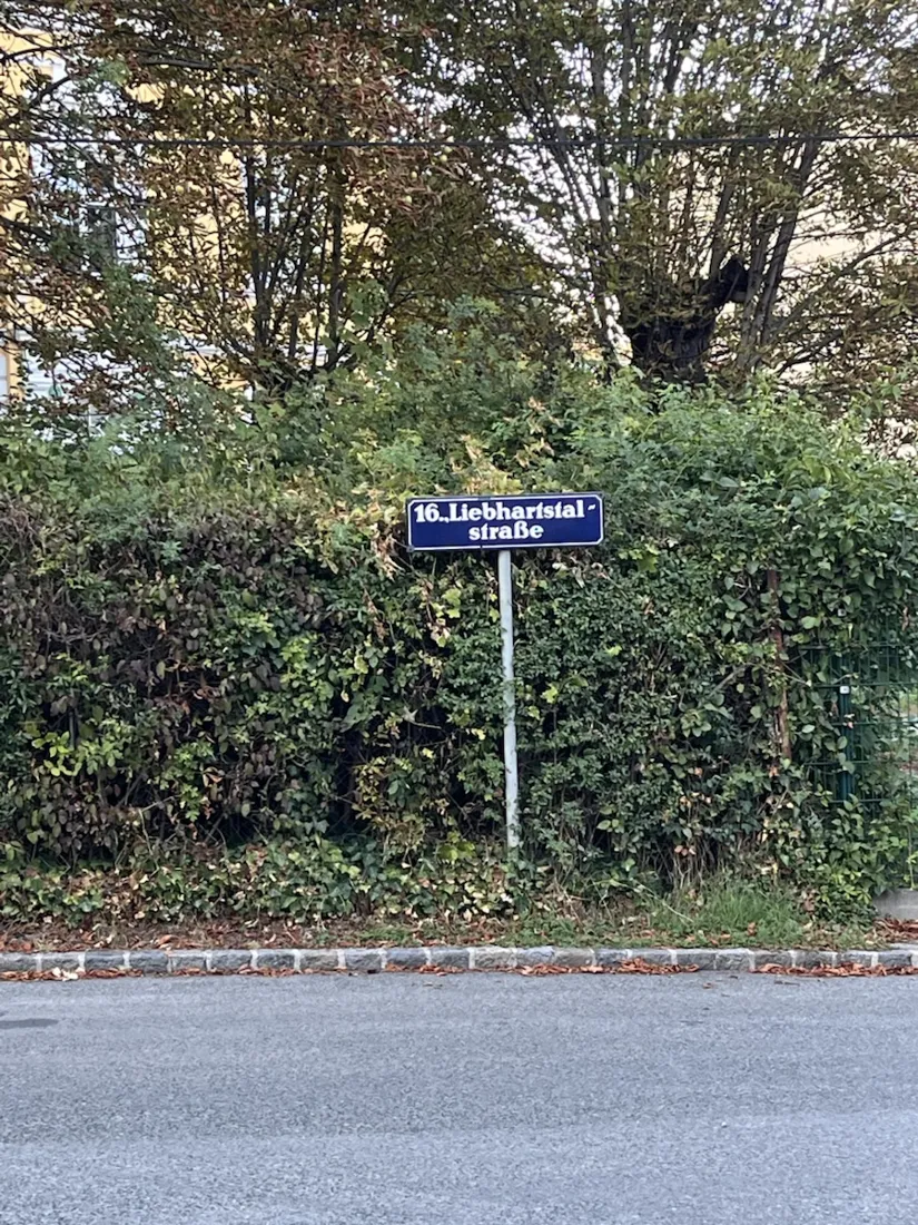
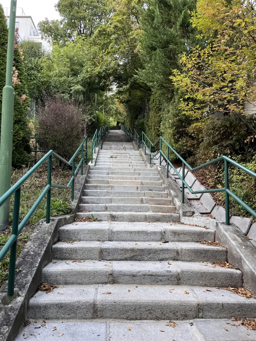
The loop starts at 239 m in Penzing and begins climbing almost at once. Ten minutes in, a grassy embankment in Breitensee turns out to have a stone portal set into its flank: the Wasserbehälter Breitensee, completed in 1896. When Vienna swallowed its outer villages in 1890 the new districts sat too high for the gravity-fed spring water to reach them, so the city built a pumping station and this reservoir above it — some 28,000 cubic metres under a roof you can walk across. It has been a listed monument since 2004 and it is still in service. Above it the route threads through allotment colonies, hedges and numbered garden gates, the part of Vienna that looks least like a capital city, until a blue enamel plate on Liebhartstalstraße announces the 16th district. The way out of the Liebhartstal valley is a staircase: the Paulinensteig, 88 steps in two flights with a handrail on both sides, and the one place on this loop where running stops and climbing starts.
A palace, and a hill with two names
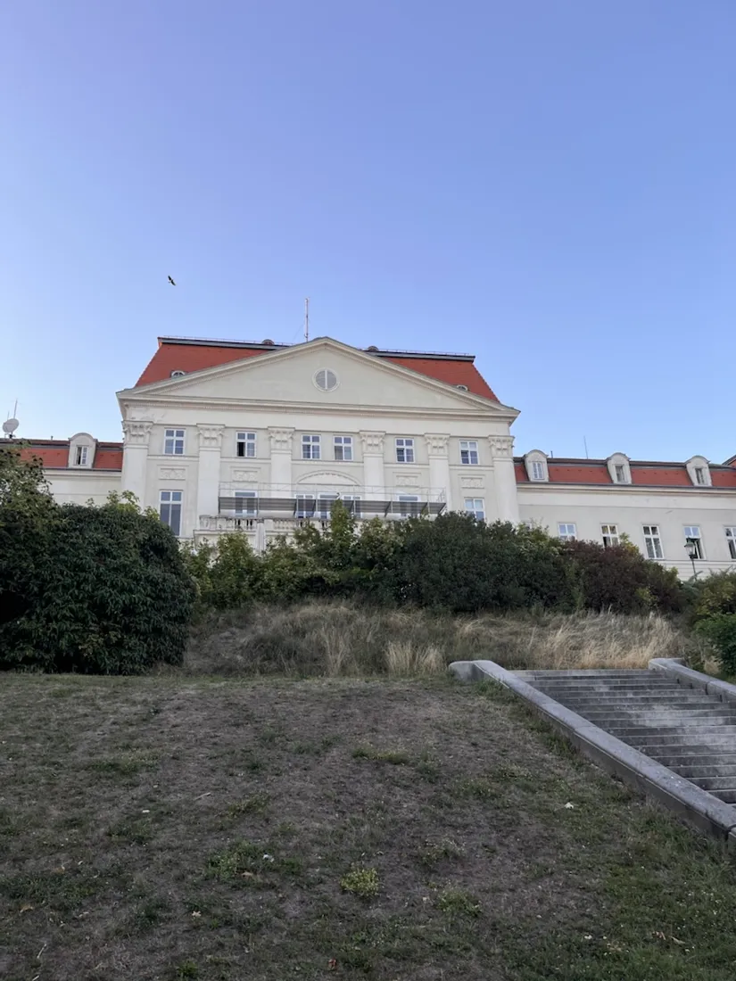
At 347 m the trees open onto Schloss Wilhelminenberg. The land above Ottakring belonged to Field Marshal Franz Moritz von Lacy and passed in 1780 to Dmitri Galitzin, the Russian ambassador in Vienna, who laid out the park that still gives the Gallitzinberg its name. A century later Prince Moritz de Montléart gave the estate to his wife, Wilhelmine Montléart-Sachsen-Curland, and asked for the hill to be renamed after her. The authorities said no. He put up plaques reading “Wilhelminenberg” anyway and had the new name pushed in the newspapers until it stuck — which is why one hill carries both names on the map to this day. Wilhelmine’s 1888 endowment for a hospital down in the district is the reason the Wilhelminenspital is called that. The palace in front of you is not hers: the dilapidated older house was demolished and rebuilt between 1903 and 1908 by Eduard Frauenfeld and Ignaz Sowinski, in the Neo-Empire style, as a residence for the archdukes. The City of Vienna bought the whole property, park and all, in 1927.
The part of the hill that is not picturesque
What the city made of it was the Kinderheim Wilhelminenberg. Between 1948 and 1977 children in the home were subjected to severe physical and psychological violence and to sexual abuse; a commission chaired by the judge Barbara Helige worked through the files and the testimony of former residents and published its report in June 2013, confirming what those residents had been saying for decades and passing some thirty names to the prosecutors. The building is a hotel today, with a terrace and one of the best views in Vienna. Both of those things are true at once, and the second is worth knowing while you are standing on the first.
A working vineyard with a capital city under it
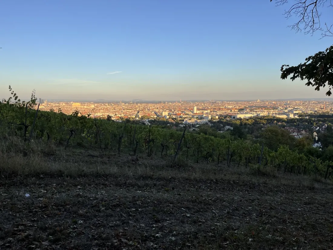
A hundred metres past the palace the path runs along the head of a vineyard, and this is the view the whole loop is built around: rows of vines dropping away downhill, and behind them Vienna flat to the horizon in the last orange light, at 18:35 on a September evening. Vienna is the only major capital with commercial wine growing inside the city limits — roughly 700 hectares, of which about 240 are Gemischter Satz, the old field blend that is planted, picked and pressed as one and became a DAC of its own in 2013. Some six of those hectares are here in the 16th district, on the slopes of the Wilhelminenberg and the Baumgartner Höhe. The high point of the run is just above the top row: 353 m, and still a good way below the Jubiläumswarte further along the ridge.
Down through the largest Gemeindebau of Red Vienna
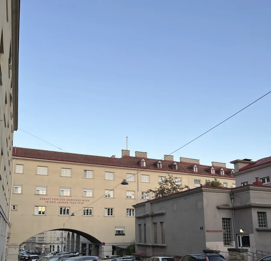
The descent runs east into Sandleiten, and at 242 m the route passes an archway with “Erbaut von der Gemeinde Wien in den Jahren 1925-1926” painted on the wall above it. This is the Sandleitenhof: 1,587 flats built in five phases between 1924 and 1929 to designs by Emil Hoppe, Otto Schönthal and Franz Matuschek, with Siegfried Theiß, Hans Jaksch and Franz Krauß on the open blocks north of the Rosenackerstraße. It is the largest municipal housing complex of interwar Red Vienna, laid out as a small town in its own right around the Matteottiplatz, with a washhouse that a painted sign still names. Running through it is nothing like running past a monument. The archways simply keep coming.
Austria’s oldest football ground, five months after it reopened
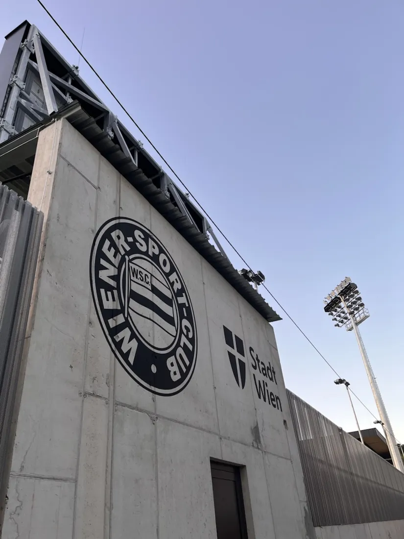
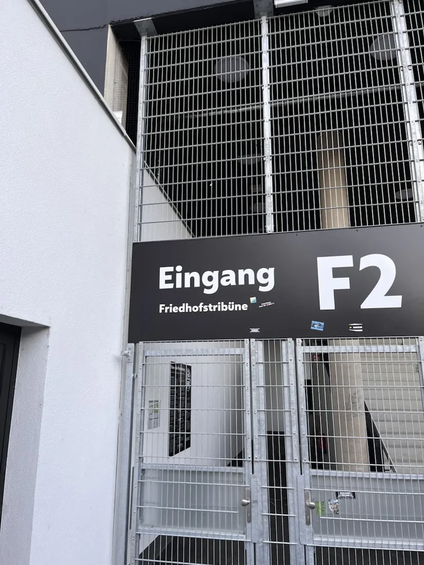
The lowest point of the loop, 223 m, is the fence of the Wiener Sport-Club Platz in Dornbach. Football has been played on this pitch since 16 October 1904, which makes it the oldest ground still in use in Austria. In the summer of 2024 the main stand and the Friedhofstribüne — the north stand, named for the Dornbach cemetery immediately behind it — were demolished and rebuilt, and the ground reopened on 17 April 2026 in front of 5,522 people, who watched SV Horn win by a goal. On an ordinary Tuesday evening in September it is a locked gate, a floodlight pylon and a heap of grass clippings on the players’ car park. From there the route runs south through Ottakring and back into Penzing, and ends where it began.
Why the photographs sit where they do
Twenty photographs over 10.2 kilometres, and each one carries the position where it was actually taken — not an approximation from the middle of the track. That is the quiet argument for recording an ordinary evening loop at all: a year from now the line is a shape you half remember, and the photos pinned along it are a date, a light and a place. Nothing on this route needed navigating. The GPX below is worth keeping anyway.
About the place: Ottakring, Vienna, Austria
The Gallitzinberg — better known as the Wilhelminenberg — is the western edge of Vienna’s 16th district, Ottakring, where the city runs out of streets and into the Wienerwald. Its wooded ridge carries Schloss Wilhelminenberg, rebuilt between 1903 and 1908 as an archducal residence on an estate that had belonged to Field Marshal Lacy and then to the Russian ambassador Dmitri Galitzin, whose park gave the hill its official name; the second name comes from Wilhelmine Montléart-Sachsen-Curland, whose husband forced it into use in the 1870s and whose endowment founded the Wilhelminenspital below. The City of Vienna bought the property in 1927 and ran a children’s home in it until the 1970s, the subject of a commission of inquiry that reported in 2013; the building is a hotel today. Below the palace lie some of the six hectares of vineyard still worked in the 16th district, with a view across the whole city. Downhill to the east is Sandleiten with the Sandleitenhof, the largest municipal housing complex of interwar Red Vienna; north-east, in Dornbach in the 17th district, is the Wiener Sport-Club Platz, the oldest football ground still in use in Austria, rebuilt in 2024–2026. The loop is run entirely on street, park road and public stairways — a city route, not a trail.
Get NomadTracks free — iOS & Android
More track stories
- Overlanding Namibia: 4,250 km from the Kalahari to the Kunene
- Mount Whitney in two days: 24 km to the roof of the Lower 48
- Grant Park, the Bean & the Museum Campus: a 10.5 km Chicago run
- A morning run through downtown Chicago: 9.7 km past Navy Pier and the lakefront
- Running Lincoln's Springfield: 8.8 km through the Illinois capital
- Camps Bay to Table Mountain: the steep way up Cape Town's icon
- Dürrensee to the Drei Zinnen: a Dolomites classic
- Baleal: a 5.6 km morning run out to Peniche's old whaling island
- Sagres: a 4.8 km morning loop around the Algarve’s last headland
- Maurer Wald loop: a 9.7 km trail run on the edge of Vienna
- Camping Šobec and the birth of the Sava: a 7 km morning run
- The Slow Trail around the Pressegger See: a 5.7 km reed-belt loop
- Vorderberg to the Dellacher Alm: a wild 13 km off-trail climb in the Carnic Alps
- Sailing the Šibenik archipelago: 69 nautical-style kilometers under sail
- Canoeing Caddo Lake: 9 km through a flooded cypress forest
- Mount Shasta mountain-bike loop: 28.6 km of volcano singletrack
- Lofoten lake hike: 9.6 km through Norway's green wilderness
- Cinder Cone, Lassen Volcanic NP: a 6 km climb up a perfect volcano
- Tugela Falls hike: Sentinel route, GPX and coordinates
- The Olive Trail, Namib-Naukluft: 10.9 km through a desert canyon
- Mount St. Helens: 16 km through the blast zone to the viewpoints
- Double O Arch via Devils Garden: 12 km through Arches' fin country
- The everyday loop: 12 km of redwoods and fog above Redwood City
- Lake Tahoe rim ride: 28 km of singletrack above the blue
- Dewey Point in winter: 12 km on snowshoes to Yosemite's quiet rim
- Pinnacles High Peaks loop: 12 km among the condor spires
- Golden Canyon to Zabriskie badlands: 6 km below sea level
- Hoh Rain Forest: a 4 km walk through the moss cathedral
- Oahu waterfall trail: 5 km of mud, roots and jungle
- Riding to Lake Helen: 17 km up a closed park road through the snow
- Phillips Cave: a 6.5 km walk to Namibia's White Elephant rock art
- Koiimasis: 9 km through the granite of the Tiras Mountains
- Cathedral Gorge: a short ride through Nevada's clay cathedral
- Riding Black Rock City: the GPS trace of a city that doesn't exist
- Peekaboo Loop, Bryce Canyon: 15 km among the hoodoos
- Steinhof and the golden dome: a 9.7 km evening run in Vienna