Hiking · Untertauern, Salzburg, Austria · recorded with NomadTracks
Over the Hengst to the Wildsee: 18.6 km in the Radstädter Tauern
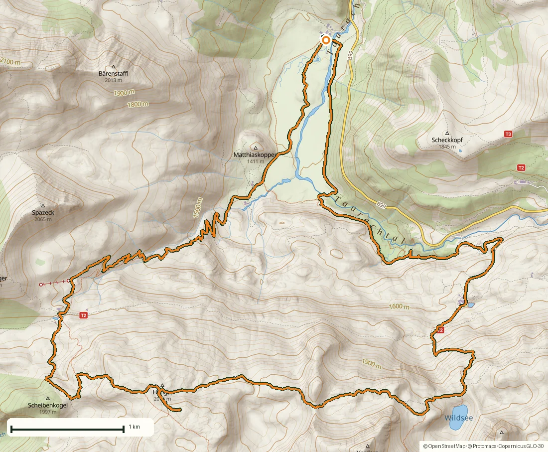
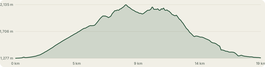
A full day in the Radstädter Tauern: 18.6 kilometres, 1,060 metres of climbing, five and a half hours from the Gnadenalm at 1,278 metres to 2,135 on the Hengst and back down again. Recorded on a Friday in September, with the cloud low enough all day to keep the tops interesting.
It is a loop of two halves. The way up is a valley and a hut; the way back is a high traverse under limestone walls, a cirque lake, and a waterfall you can walk behind. Fifty-two photographs, which is roughly one every four minutes of moving time.
About this data: this track and its photos were personally shared with us as samples by a NomadTracks user. NomadTracks never uploads, collects or shares your tracks or photos — your recordings stay on your devices and in your own cloud.
Download GPX Coordinates, elevation and relative times — recording dates are normalized out, photos not included.
Out of the Gnadenalm, up the valley
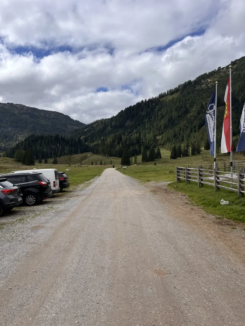
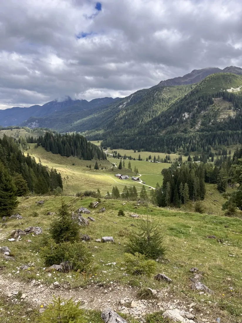
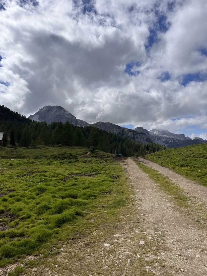
The start is the Gnadenalm on the old Tauern pass road above Untertauern, at 1,278 metres — a broad flat alm at the head of the Taurach, and the trailhead for most of what follows. The track runs south past the Hintergnadenalm at 1,336 metres and then turns uphill in earnest. The first four kilometres are the gentlest of the day and the last flat ground you get: from here the profile climbs almost without a break for two and a half hours, from valley floor through larch and dwarf pine onto open grass.
A hut that ran out of lease
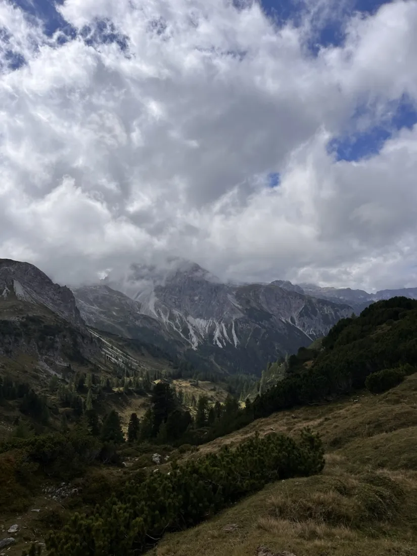
At 1,802 metres the route passes the Südwiener Hütte, and it is worth knowing what you are looking at. The hut was run by the Vienna Gebirgsverein section of the Austrian Alpine Club and stood on land belonging to three Agrargemeinschaften, on a hundred-year lease. That lease ran out. New terms could not be agreed, the building no longer met current requirements for rooms and wastewater, and there was no money for the rebuild it would have needed. It closed on 30 September 2024, a year and a half short of the hundredth birthday it would have had in 2026, and demolition is under consideration. For anyone planning this route the practical consequence is simple: there is no water, no food and no roof up here, and the winter room is out of service too. It was a stage on the Zentralalpenweg, so that long-distance line lost a link the same day.
A stallion where the map is wrong
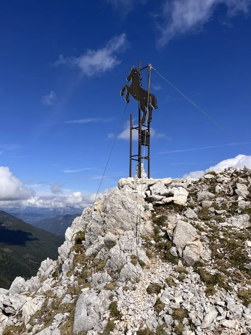
Above the hut the ground opens into the broad grass back of the Hengst, and at the top there is no cross but a rearing stallion cut out of steel — Hengst is German for stallion — guyed to the rock with steel cable. The recorder puts the summit at 2,135 metres. What is interesting is where: OpenStreetMap has the Hengst a couple of hundred metres off, and the recorded track is the one that is right. That is worth a moment on a site about GPS tracks. Mountain maps are not ground truth, they are somebody's earlier survey, and a recording made on the summit is a better witness to where a summit is than a node in a database.
The traverse under the Pleißlingkeile
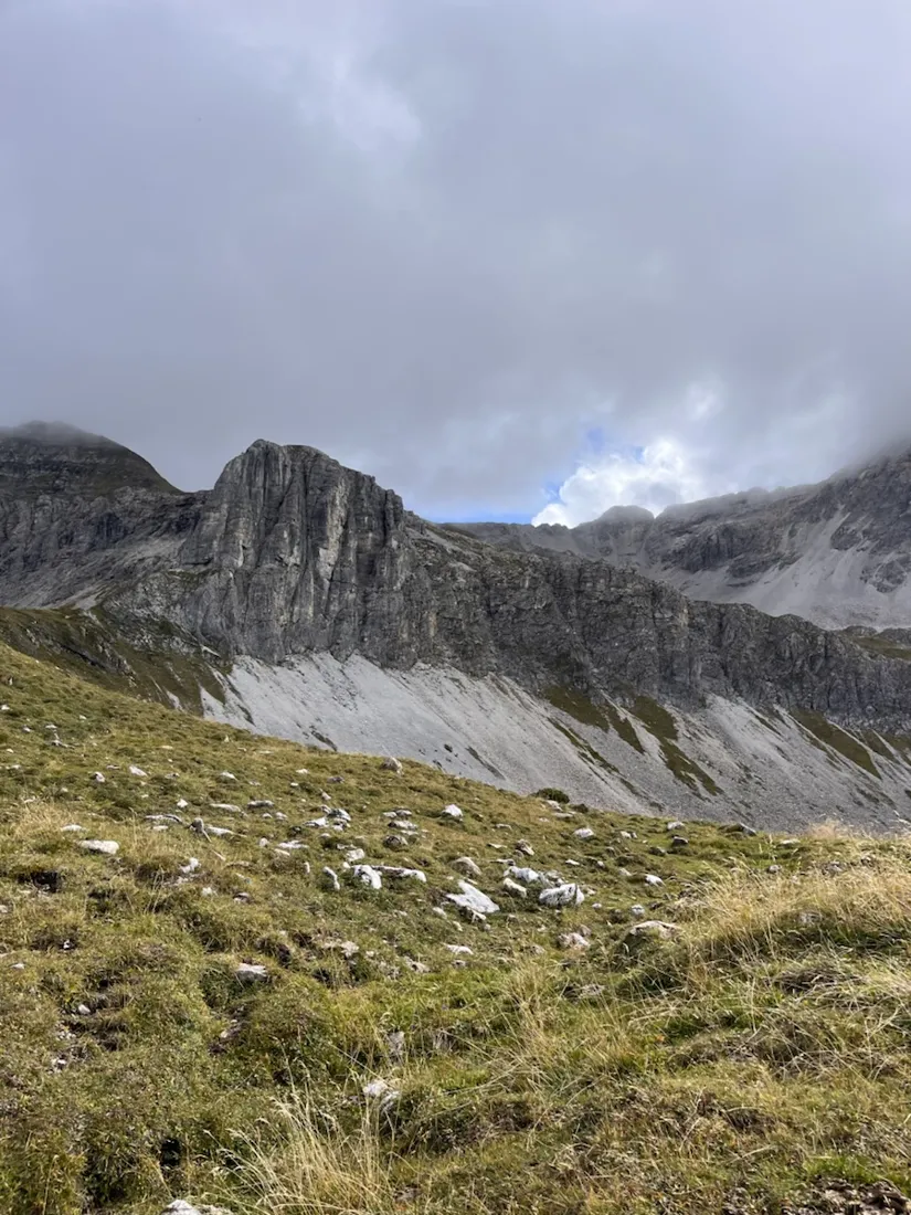
East of the Hengst the route stops climbing and starts contouring, and this is the best part of the day. The line holds a little over 2,000 metres for four kilometres, along the foot of the Pleißlingkeile and the Großwandspitzen — the Vordere at 2,380 metres, the Hintere at 2,437 — with scree fans running down from grey walls and the cloud pressing on the ridge. The elevation profile flattens into a long ragged plateau here, which is exactly what it felt like: small climbs and drops, no real summit, and the wall on your right the whole way.
The Wildsee
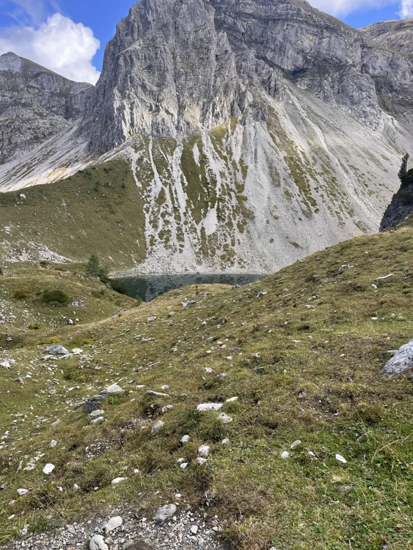
At the eastern end of the traverse the ground falls away into a cirque and the Wildsee sits in the bottom of it, dark green, with the wall of the Großwandspitze rising straight out of the scree behind. It is a little over 1,900 metres and it is the turning point of the loop: from here everything is downhill, 800 metres of it, on the Felseralm side of the valley.
Alpacas, then sixty metres of waterfall
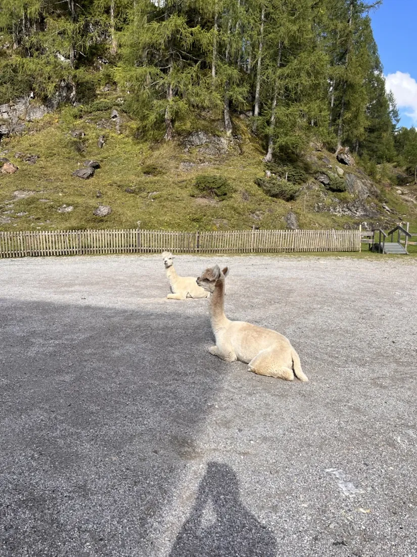
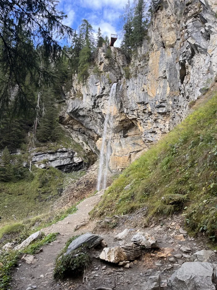
The descent passes the Felseralm at 1,633 metres, where two alpacas were lying on the gravel in the afternoon sun and showed no interest whatsoever in the traffic. Below that comes the Johanneswasserfall: sixty metres of water over a limestone step, with a viewing platform cantilevered out at the top and a secured path that takes you along behind the falling water. About two hundred steps connect the two. It is the one part of this loop that is on every family-walk list in the valley, and after five hours of empty ridge the handrails and the day visitors arrive as a slight shock.
What five and a half hours of recording is actually for
This is the kind of day a track earns its keep. The line holds the answer to how long the traverse really took, where the climbing was, and how much of the descent was still ahead at the Wildsee — the things you cannot reconstruct afterwards from photographs alone. It also holds one small correction to the map. The GPX below has coordinates, elevations and relative times for anyone who wants the same loop; read the note about the hut before you count on it for water.
About the place: Untertauern, Salzburg, Austria
The Radstädter Tauern are the western end of the Niedere Tauern, in the Salzburg Pongau between Radstadt and the Tauern pass. The Gnadenalm, at 1,278 metres on the old pass road above Untertauern, is the usual starting point: a flat alm basin at the head of the Taurach, with the Johanneswasserfall — sixty metres, with a viewing platform and a path running behind the water — twenty minutes above it. Southwards the valley climbs to the Südwiener Hütte at 1,802 metres, built by the Vienna Gebirgsverein and closed on 30 September 2024 when its hundred-year lease on the land expired; it was a stage on the Zentralalpenweg and demolition is under consideration. Above the hut the terrain turns to open grass on the Hengst, then to limestone: the Pleißlingkeile and the Großwandspitzen, 2,380 and 2,437 metres, whose walls carry the high traverse east to the Wildsee. The rock is what makes this corner of the Tauern look unlike the rest of the range — pale, broken and steep, with scree fans and cirque lakes, above pasture that is still grazed.
Get NomadTracks free — iOS & Android
More track stories
- Overlanding Namibia: 4,250 km from the Kalahari to the Kunene
- Mount Whitney in two days: 24 km to the roof of the Lower 48
- Grant Park, the Bean & the Museum Campus: a 10.5 km Chicago run
- A morning run through downtown Chicago: 9.7 km past Navy Pier and the lakefront
- Running Lincoln's Springfield: 8.8 km through the Illinois capital
- Camps Bay to Table Mountain: the steep way up Cape Town's icon
- Dürrensee to the Drei Zinnen: a Dolomites classic
- Baleal: a 5.6 km morning run out to Peniche's old whaling island
- Sagres: a 4.8 km morning loop around the Algarve’s last headland
- Maurer Wald loop: a 9.7 km trail run on the edge of Vienna
- Camping Šobec and the birth of the Sava: a 7 km morning run
- The Slow Trail around the Pressegger See: a 5.7 km reed-belt loop
- Vorderberg to the Dellacher Alm: a wild 13 km off-trail climb in the Carnic Alps
- Sailing the Šibenik archipelago: 69 nautical-style kilometers under sail
- Canoeing Caddo Lake: 9 km through a flooded cypress forest
- Mount Shasta mountain-bike loop: 28.6 km of volcano singletrack
- Lofoten lake hike: 9.6 km through Norway's green wilderness
- Cinder Cone, Lassen Volcanic NP: a 6 km climb up a perfect volcano
- Tugela Falls hike: Sentinel route, GPX and coordinates
- The Olive Trail, Namib-Naukluft: 10.9 km through a desert canyon
- Mount St. Helens: 16 km through the blast zone to the viewpoints
- Double O Arch via Devils Garden: 12 km through Arches' fin country
- The everyday loop: 12 km of redwoods and fog above Redwood City
- Lake Tahoe rim ride: 28 km of singletrack above the blue
- Dewey Point in winter: 12 km on snowshoes to Yosemite's quiet rim
- Pinnacles High Peaks loop: 12 km among the condor spires
- Golden Canyon to Zabriskie badlands: 6 km below sea level
- Hoh Rain Forest: a 4 km walk through the moss cathedral
- Oahu waterfall trail: 5 km of mud, roots and jungle
- Riding to Lake Helen: 17 km up a closed park road through the snow
- Phillips Cave: a 6.5 km walk to Namibia's White Elephant rock art
- Koiimasis: 9 km through the granite of the Tiras Mountains
- Cathedral Gorge: a short ride through Nevada's clay cathedral
- Riding Black Rock City: the GPS trace of a city that doesn't exist
- Peekaboo Loop, Bryce Canyon: 15 km among the hoodoos
- Steinhof and the golden dome: a 9.7 km evening run in Vienna
- Wilhelminenberg by evening: a 10.2 km run over Vienna’s western hills