Running · Vienna, Austria · recorded with NomadTracks
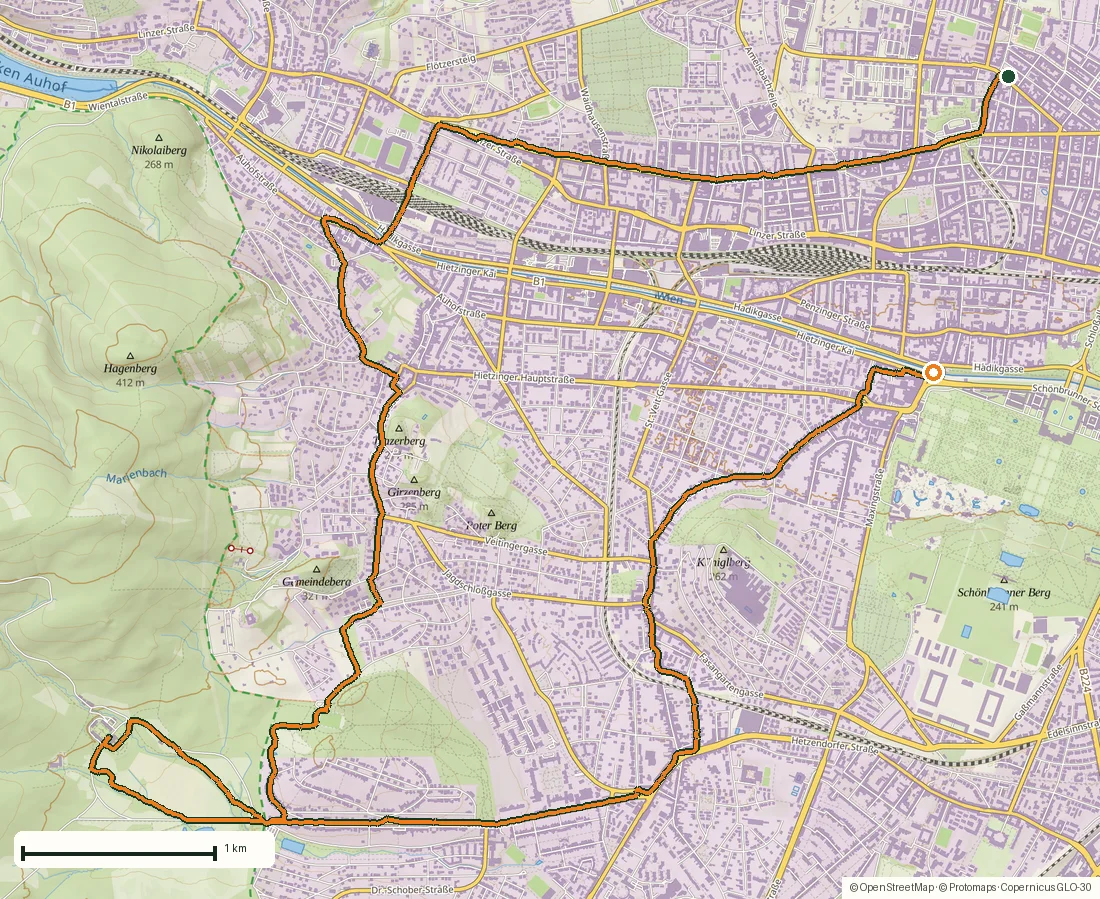
Hermesvilla: a 16.6 km run through Vienna’s western districts
A red-brick church in Breitensee, a wooded path under autumn leaves, then the elaborate ironwork and garden fountain of the Hermesvilla: this 16.6-kilometer run connects several very different corners of western Vienna. The recording starts at Laurentiusplatz, heads west through Hacking, visits the villa in the Lainzer Tiergarten and finishes in Hietzing.
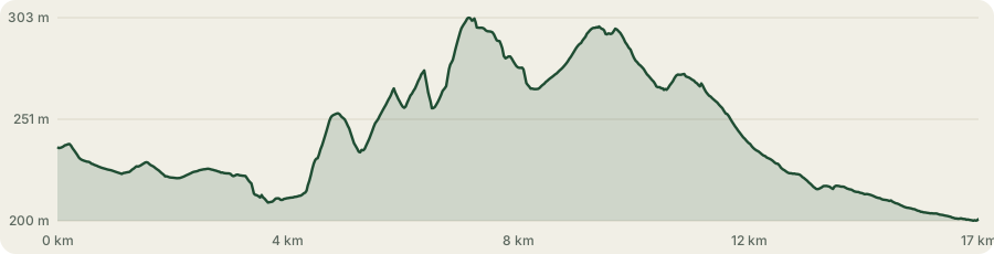
This is a point-to-point outing rather than a closed loop. The recording lasts 2 hours 7 minutes, with roughly 162 meters of ascent and elevations between 200 and 303 meters. The six photos show the transition from streets to woodland and the villa grounds.
About this data: this track and its photos were personally shared with us as samples by a NomadTracks user. NomadTracks never uploads, collects or shares your tracks or photos — your recordings stay on your devices and in your own cloud.
Download GPX Coordinates, elevation and relative times — recording dates are normalized out, photos not included.
From Breitensee to Hacking
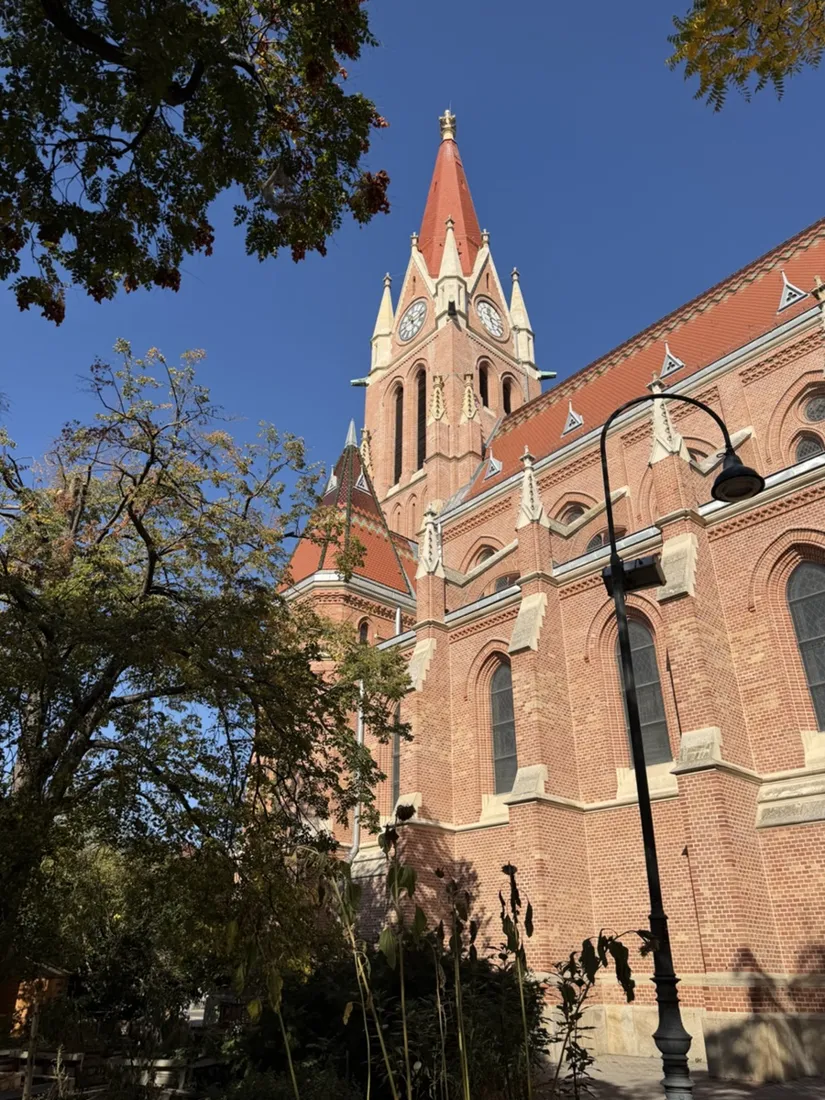
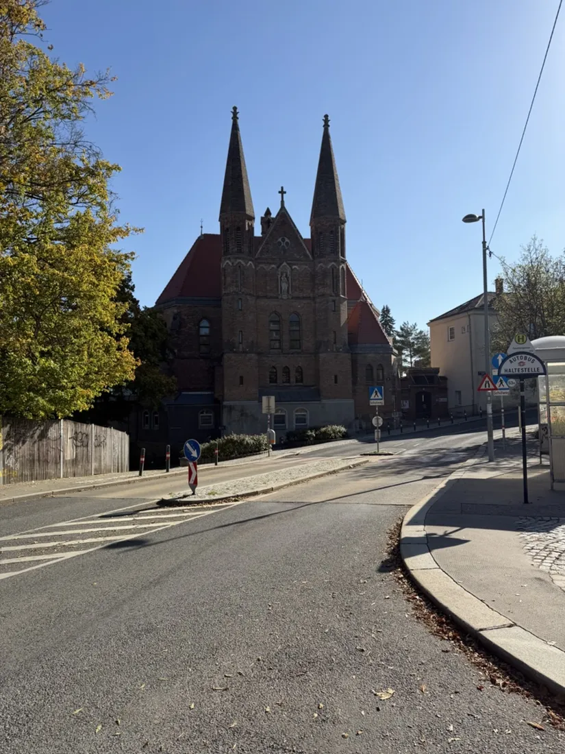
The opening photo shows St. Laurentius in Breitensee, its brick tower rising above Laurentiusplatz. The route then heads west through the city towards Hacking, where another church marks the way: the twin-spired church of the Dominican convent on Schlossberggasse, photographed from Seuttergasse. These are the urban miles before the run turns south towards the greener edge of Hietzing.
Woodland on the approach
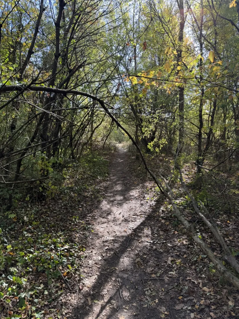
South of Hacking the recorded line continues towards Friedensstadt and the Lainzer Tiergarten. The Afritschweg photo catches a narrow earthen path under a canopy of branches, with fallen leaves and patches of sunlight on the ground. It is a marked change from the streets earlier in the run. The elevation profile rises gradually towards the villa, then falls away on the return towards Hietzing.
An imperial villa in the woods
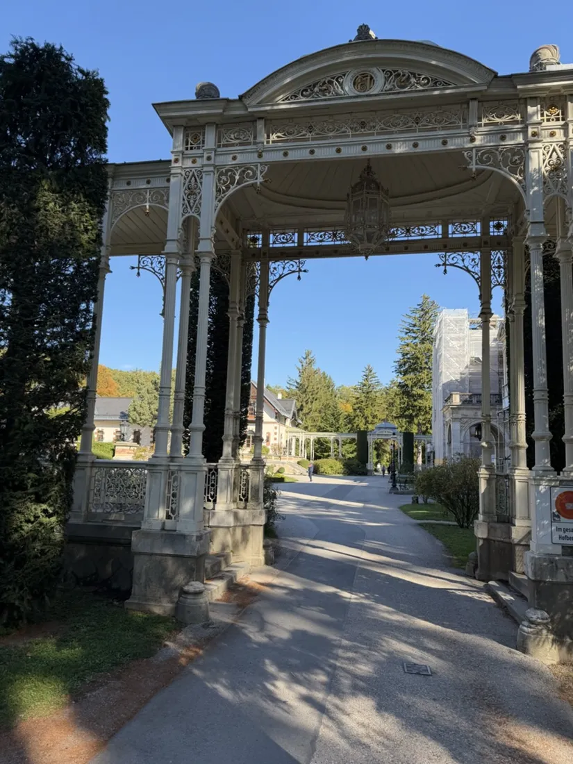
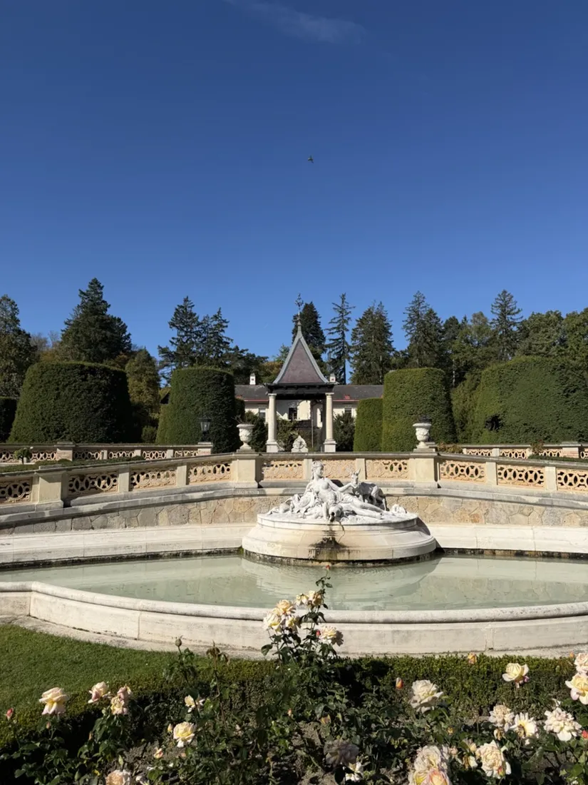
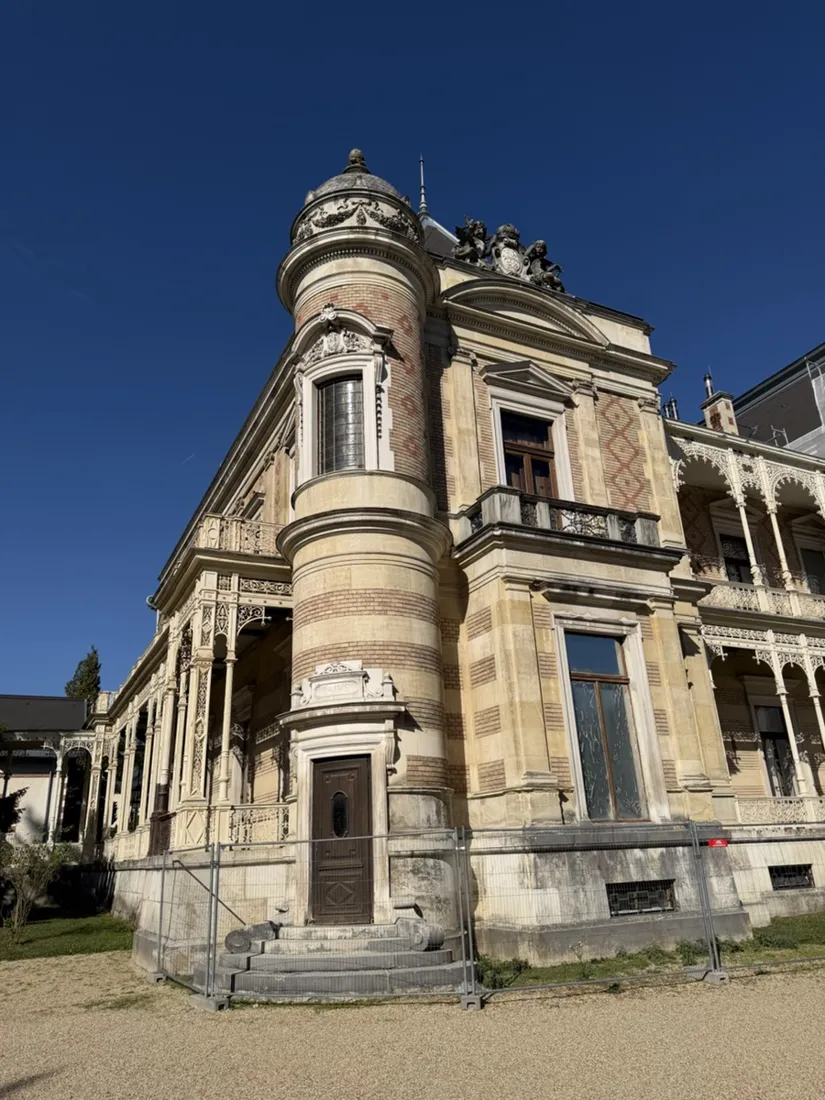
The Hermesvilla was built between 1882 and 1886 to plans by Carl von Hasenauer, as Emperor Franz Joseph’s gift to Empress Elisabeth. Its name comes from the statue of Hermes in the garden. The photos focus on what this run reached outside: ornate ironwork, the garden fountain, clipped hedges and the decorated corner tower. Scaffolding and temporary fencing are visible in the recording’s photos; the museum documents ongoing façade restoration.
On to Hietzing
After the villa, the track heads east through the southern part of Hietzing before turning north to finish near the Kennedybrücke. Start and finish are in different places, so the GPX describes the complete recorded outing, not a small circuit around the villa. Its 3,644 points preserve the streets, paths and turns across the full 16.6 kilometers.
Plan around the park gates
The city publishes the Lainzer Tiergarten’s current gate hours; they vary with the season, and entry and exit are not possible after closing. Park entry is free, while the Hermesvilla museum has separate opening times and admission. Download the GPX on this page and import it into NomadTracks to inspect the route before setting out.
About the place: Vienna, Austria
This route connects Breitensee in Vienna’s 14th district with Hacking and Hietzing in the 13th. Its western destination is the Hermesvilla in the Lainzer Tiergarten, where city streets give way to the wooded edge of the Wienerwald. The recording ends back in Hietzing rather than at its starting point.
Get NomadTracks free — iOS & Android
More track stories
- Dubrovnik: an 8.1 km run from Babin Kuk through Lapad
- Overlanding Namibia: 4,250 km from the Kalahari to the Kunene
- Mount Whitney in two days: 24 km to the roof of the Lower 48
- Grant Park, the Bean & the Museum Campus: a 10.5 km Chicago run
- A morning run through downtown Chicago: 9.7 km past Navy Pier and the lakefront
- Running Lincoln's Springfield: 8.8 km through the Illinois capital
- Camps Bay to Table Mountain: the steep way up Cape Town's icon
- Dürrensee to the Drei Zinnen: a Dolomites classic
- Baleal: a 5.6 km morning run out to Peniche's old whaling island
- Sagres: a 4.8 km morning loop around the Algarve’s last headland
- Maurer Wald loop: a 9.7 km trail run on the edge of Vienna
- Camping Šobec and the birth of the Sava: a 7 km morning run
- The Slow Trail around the Pressegger See: a 5.7 km reed-belt loop
- Vorderberg to the Dellacher Alm: a wild 13 km off-trail climb in the Carnic Alps
- Sailing the Šibenik archipelago: 69 nautical-style kilometers under sail
- Canoeing Caddo Lake: 9 km through a flooded cypress forest
- Mount Shasta mountain-bike loop: 28.6 km of volcano singletrack
- Lofoten lake hike: 9.6 km through Norway's green wilderness
- Cinder Cone, Lassen Volcanic NP: a 6 km climb up a perfect volcano
- Tugela Falls hike: Sentinel route, GPX and coordinates
- The Olive Trail, Namib-Naukluft: 10.9 km through a desert canyon
- Mount St. Helens: 16 km through the blast zone to the viewpoints
- Double O Arch via Devils Garden: 12 km through Arches' fin country
- The everyday loop: 12 km of redwoods and fog above Redwood City
- Lake Tahoe rim ride: 28 km of singletrack above the blue
- Dewey Point in winter: 12 km on snowshoes to Yosemite's quiet rim
- Pinnacles High Peaks loop: 12 km among the condor spires
- Golden Canyon to Zabriskie badlands: 6 km below sea level
- Hoh Rain Forest: a 4 km walk through the moss cathedral
- Oahu waterfall trail: 5 km of mud, roots and jungle
- Riding to Lake Helen: 17 km up a closed park road through the snow
- Phillips Cave: a 6.5 km walk to Namibia's White Elephant rock art
- Koiimasis: 9 km through the granite of the Tiras Mountains
- Cathedral Gorge: a short ride through Nevada's clay cathedral
- Riding Black Rock City: the GPS trace of a city that doesn't exist
- Peekaboo Loop, Bryce Canyon: 15 km among the hoodoos
- Steinhof and the golden dome: a 9.7 km evening run in Vienna
- Wilhelminenberg by evening: a 10.2 km run over Vienna’s western hills
- Over the Hengst to the Wildsee: 18.6 km in the Radstädter Tauern