Hiking · Famara, Lanzarote, Canary Islands, Spain · recorded with NomadTracks
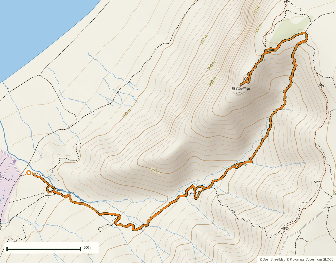
Up the Risco de Famara: 8.1 km to El Castillejo above Lanzarote’s north coast
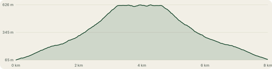
A short, steep half-day on Lanzarote: 8.1 kilometres, 576 metres of climbing, two hours and twenty-six minutes from the edge of the Urbanización Famara at 65 metres to 626 metres on the rim of the Risco de Famara and back. Recorded on a Thursday in November, under a sky that kept changing its mind.
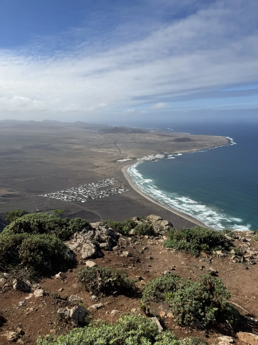
It is an out-and-back: the way down never strays more than fifty metres from the way up. All of the interest is in the vertical. You start among holiday houses behind a surf beach and an hour and a half later you are looking straight down on them from the top of the island’s north-western wall.
About this data: this track and its photos were personally shared with us as samples by a NomadTracks user. NomadTracks never uploads, collects or shares your tracks or photos — your recordings stay on your devices and in your own cloud.
Download GPX Coordinates, elevation and relative times — recording dates are normalized out, photos not included.
Out of the Urbanización, up a stony track
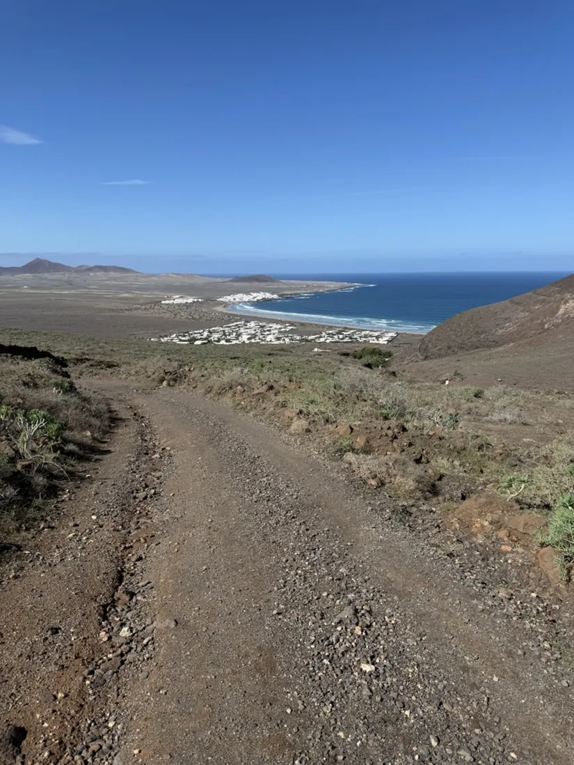
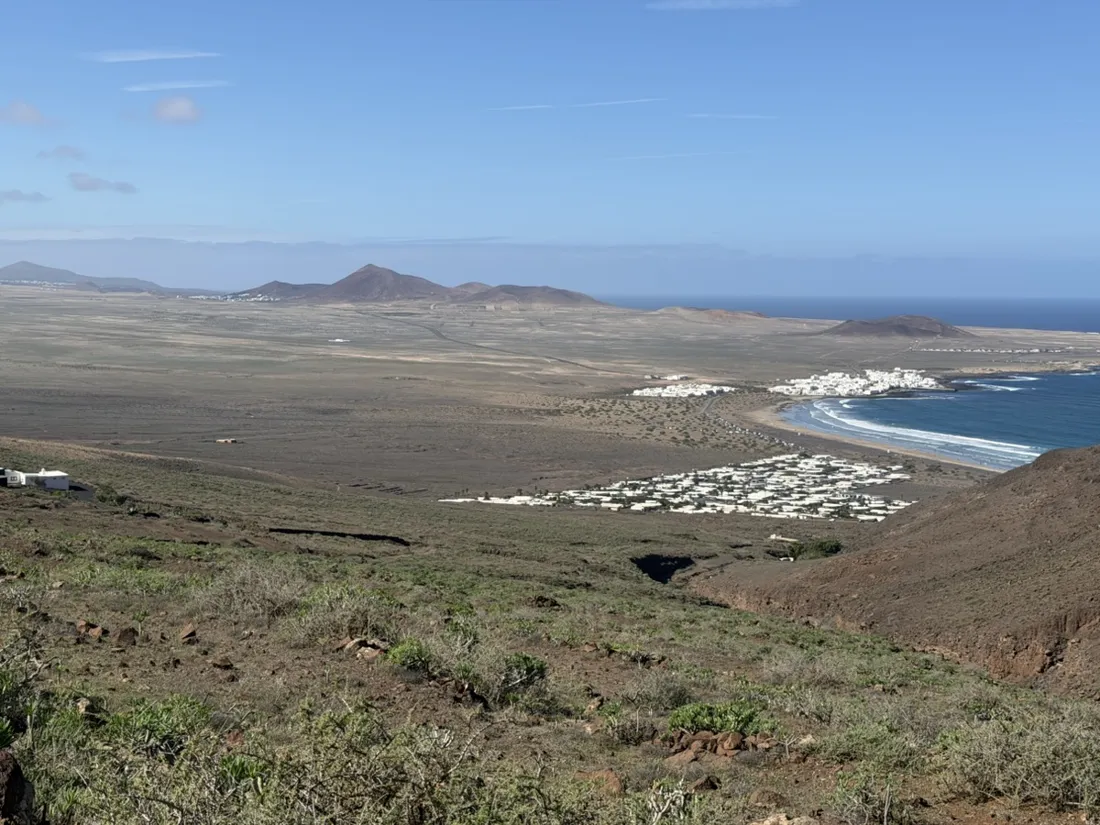
The start is the inland edge of the Urbanización Famara, a settlement of low white houses behind the southern end of Playa de Famara, at 65 metres. A dirt road leaves it uphill through low scrub, broad and loose, the kind of surface that is easy to walk up and easy to slide on coming down. Within twenty minutes the whole bay opens behind you: the beach, the Urbanización, and at the far end of the sand the fishing and surf village of Caleta de Famara.
Onto the Risco
The dirt road gives way to a path and the slope steepens into the Risco de Famara proper, the escarpment that runs along Lanzarote’s north-west coast. The cliff is a stack of old lava flows, layer on layer, and it is some of the oldest rock on the island. The scrub up here is noticeably greener than the dry plain below — spurges, succulent rosettes, the occasional lichen-covered boulder — and the path picks its way between them with a lot of loose stone underfoot.
Radar domes on the island’s highest point
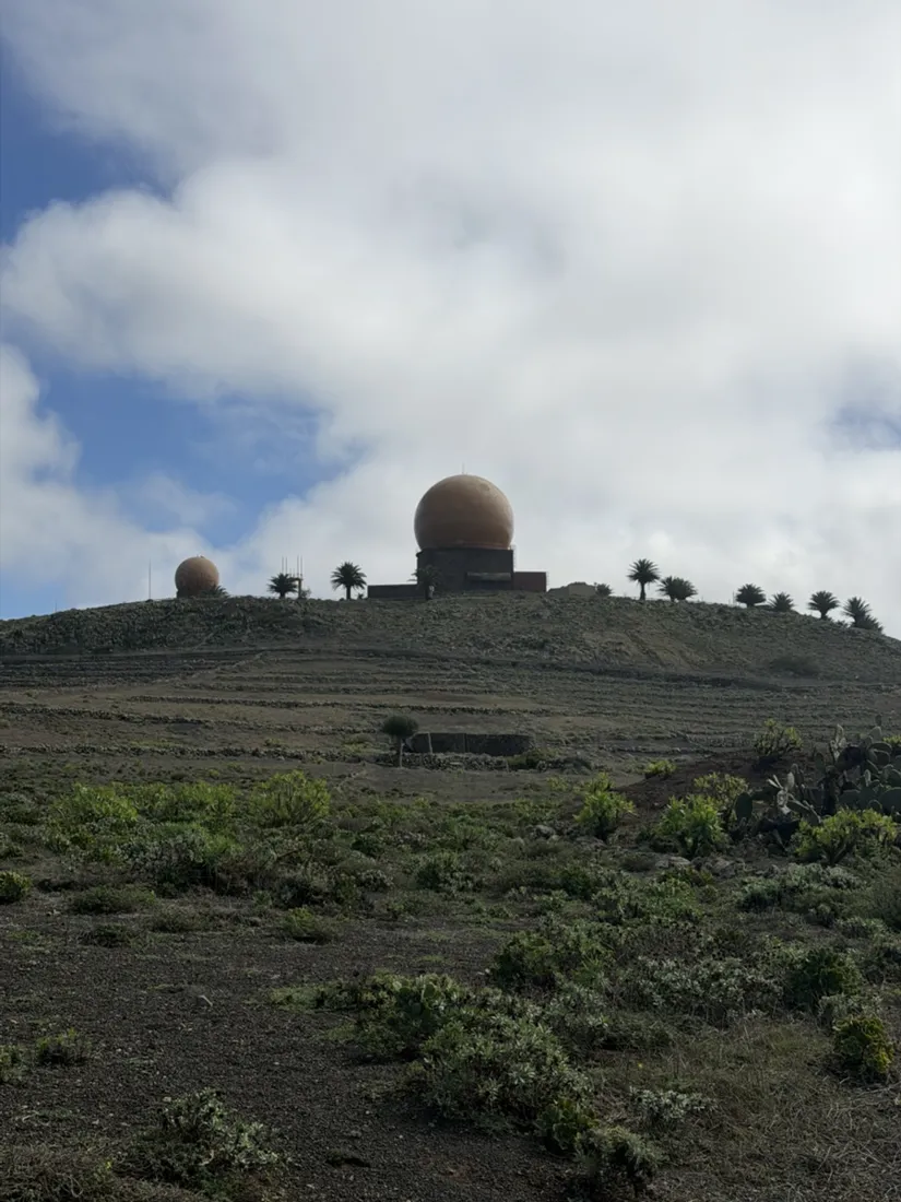
Near the top the track runs below Peñas del Chache, at about 670 metres the highest point of Lanzarote. You will not stand on it: the summit carries the radar domes of the Spanish Air Force’s air-surveillance station number 22, and it is military ground. From the path the two spheres sit on the skyline like something left over from a science-fiction set, and they are the easiest landmark on the whole ridge.
El Castillejo and the drop
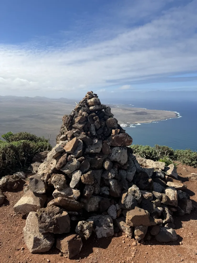
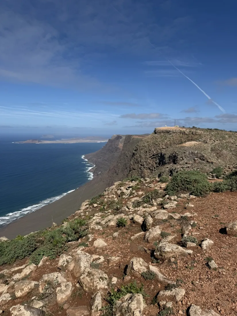
The goal is El Castillejo, a summit on the rim at 625 metres with a big cairn on top — and the reason to come is what happens a few steps past it. The ground simply stops. Six hundred metres below are Playa de Famara, the white grid of the Urbanización and the line of surf, and to the north the cliffs run on along the coast with the island of La Graciosa flat on the sea beyond them. The recording’s high point, 626 metres, is a little further north along the edge; the Mirador del Bosquecillo lies another half kilometre on.
Down the same way
The return is the same track, fifty-three minutes from the rim to the houses, and the loose surface is the only thing that demands attention. There is no railing anywhere along the edge, and this is a windy coast — the surf schools in Caleta de Famara exist for a reason — so the edge is a place to stand back from rather than lean over. The GPX below has coordinates, elevations and relative times for anyone who wants the same climb.
About the place: Famara, Lanzarote, Canary Islands, Spain
The Risco de Famara is the long escarpment along the north-west coast of Lanzarote, in the municipalities of Teguise and Haría, and its massif is among the oldest volcanic rock on the island. Its high point, Peñas del Chache at about 670 metres, is the highest point of Lanzarote and carries the radar domes of the Spanish Air Force’s air-surveillance station EVA 22, so it is military ground. Below the cliffs lie Playa de Famara, one of the island’s long surf beaches, the holiday settlement of the Urbanización Famara and the village of Caleta de Famara. Along the rim, viewpoints such as the Mirador del Bosquecillo look north to La Graciosa and the islets of the Chinijo Archipelago. Paths up the face are steep and loose, and the edge has no railings.

Get NomadTracks free — iOS & Android
More track stories
- Cavtat by boat: 20.9 km along the Konavle coast at sunset
- Vienna Woods: 21.9 km via Rieglerhütte and the Jubiläumswarte
- Hermesvilla: a 16.6 km run through Vienna’s western districts
- Dubrovnik: an 8.1 km run from Babin Kuk through Lapad
- Overlanding Namibia: 4,250 km from the Kalahari to the Kunene
- Mount Whitney in two days: 24 km to the roof of the Lower 48
- Grant Park, the Bean & the Museum Campus: a 10.5 km Chicago run
- A morning run through downtown Chicago: 9.7 km past Navy Pier and the lakefront
- Running Lincoln's Springfield: 8.8 km through the Illinois capital
- Camps Bay to Table Mountain: the steep way up Cape Town's icon
- Dürrensee to the Drei Zinnen: a Dolomites classic
- Baleal: a 5.6 km morning run out to Peniche's old whaling island
- Sagres: a 4.8 km morning loop around the Algarve’s last headland
- Maurer Wald loop: a 9.7 km trail run on the edge of Vienna
- Camping Šobec and the birth of the Sava: a 7 km morning run
- The Slow Trail around the Pressegger See: a 5.7 km reed-belt loop
- Vorderberg to the Dellacher Alm: a wild 13 km off-trail climb in the Carnic Alps
- Sailing the Šibenik archipelago: 69 nautical-style kilometers under sail
- Canoeing Caddo Lake: 9 km through a flooded cypress forest
- Mount Shasta mountain-bike loop: 28.6 km of volcano singletrack
- Lofoten lake hike: 9.6 km through Norway's green wilderness
- Cinder Cone, Lassen Volcanic NP: a 6 km climb up a perfect volcano
- Tugela Falls hike: Sentinel route, GPX and coordinates
- The Olive Trail, Namib-Naukluft: 10.9 km through a desert canyon
- Mount St. Helens: 16 km through the blast zone to the viewpoints
- Double O Arch via Devils Garden: 12 km through Arches' fin country
- The everyday loop: 12 km of redwoods and fog above Redwood City
- Lake Tahoe rim ride: 28 km of singletrack above the blue
- Dewey Point in winter: 12 km on snowshoes to Yosemite's quiet rim
- Pinnacles High Peaks loop: 12 km among the condor spires
- Golden Canyon to Zabriskie badlands: 6 km below sea level
- Hoh Rain Forest: a 4 km walk through the moss cathedral
- Oahu waterfall trail: 5 km of mud, roots and jungle
- Riding to Lake Helen: 17 km up a closed park road through the snow
- Phillips Cave: a 6.5 km walk to Namibia's White Elephant rock art
- Koiimasis: 9 km through the granite of the Tiras Mountains
- Cathedral Gorge: a short ride through Nevada's clay cathedral
- Riding Black Rock City: the GPS trace of a city that doesn't exist
- Peekaboo Loop, Bryce Canyon: 15 km among the hoodoos
- Steinhof and the golden dome: a 9.7 km evening run in Vienna
- Wilhelminenberg by evening: a 10.2 km run over Vienna’s western hills
- Over the Hengst to the Wildsee: 18.6 km in the Radstädter Tauern